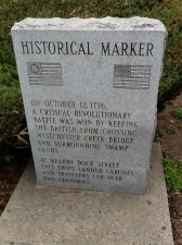
Though this was the first time in awhile, while writing Forgotten New York the past 15 years I have frequently found myself in Westchester Square in the Bronx. The neighborhood surrounds the triangle caused by the confluence of two major roads, Westchester Avenue and East Tremont Avenue at Westchester Creek, which here is buried underground but figured in a Revolutionary War battle.
What is now the Bronx used to be part of Westchester County and was ceded to the City of New York over time. West of the Bronx River (which bisects the borough) was annexed by NYC in 1874 while everything east of the river joined New York County by 1895. Until 1898, when NYC became an agglomeration of five boroughs, Manhattan and the Bronx were the same county: New York County. Finally, the Bronx became a county on its own in 1914. Today, the boroughs are coterminous as Manhattan occupies New York county, Brooklyn, Kings County, and so forth.
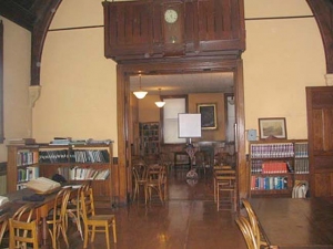
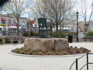
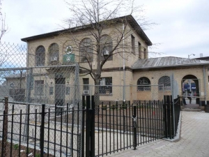
My first two-part Westchester Square series, describing the Huntington Free Library, and Revolutionary War battle marker, seen here.
ForgottenTour #26 visited Westchester Square and featured a lecture by Bronx historian Bill Twomey in the Free Library, as well as visits to St. Peter’s Cemetery and the adjacent, much smaller Ferris cemetery, The Seat sculpture, and a fun walk through Parkchester. (I was flying high that week because the tour was given the very same week the ForgottenBook first came out.)
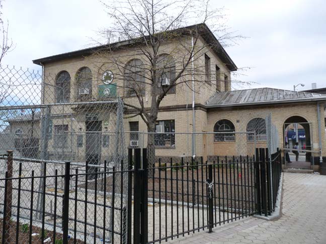
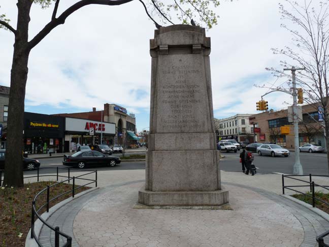
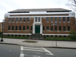
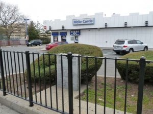
The triangle formed by Tremont, Westchester and Lane Avenues was renamed Owen Dolan Square, and the massive Spanish-style recreation center as well, after a local educator who had an unusual end. Dolan gave a spirited speech at the dedication of the memorial in 1925 and promptly dropped dead from a heart attack after returning to his seat. He died with his boots on. The park was named for him the following year.
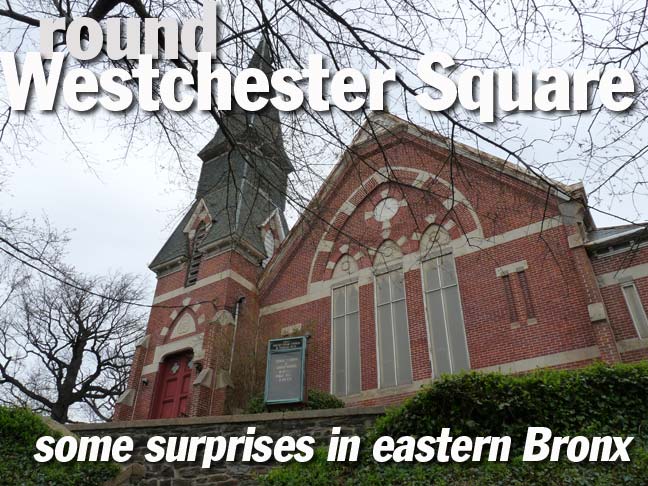
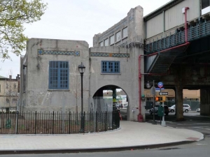
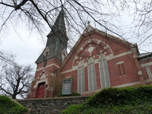
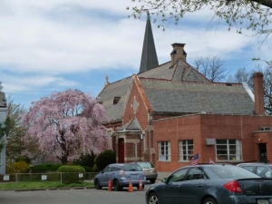
I struck off on East Tremont Avenue southeast from Westchester Square. Many years ago, the city “captured” Fort Schuyler Road, which runs from the Square southeast to the East River, and made it part of East Tremont Avenue and made it the only, or one of the few, avenues that run from the Harlem River to the East River. After making s sharp curve you come upon the First Presbyterian Church, and coming in sight of it is more impressive that it’s a surprise to non-densizens of these parts, because it’s hidden from the Square partly by the elevated train. Its steeple rises starkly as it is situated on a hill above the street. The steps required to access it are so numerous that church management now requires that you enter from around the corner, on Dudley Avenue.
Online information about the place is skimpy. The congregation has been here since the 1820s, but a fire burned down the original church and so this “new” church took its place in the mid-1880s.
There is a cemetery to the church’s rear on Ericson Place which I did not visit, but Emilio Guerra has a few images on his flickr page.
One G or Two?
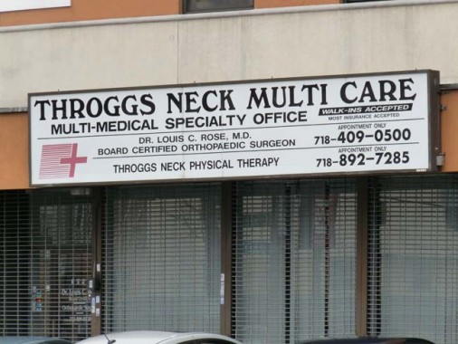
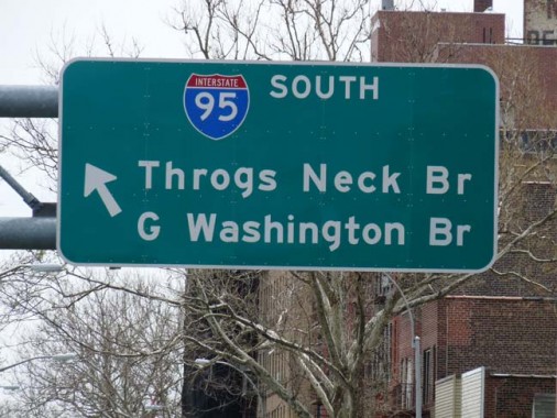
There is an ongoing battle in the Bronx that has been going on for decades, and shows no sign of ending. It’s about how Throg(g)s Neck should be spelled.
One of the quiet side streets in Throg(g)s Neck, which is a couple of miles southeast of Westchester Square, is called Throgmorton Avenue, so named in 1916 to honor the founder of the Throg(g)s Neck community, John Throckmorton, a Britisher given permission by the Dutch government then in charge to settle on the southeastern end of what would become the Bronx in 1642. The name became altered in spelling over the years (I’ve even seen “Frog’s Neck” on some documents) and though the name is spelled Throgs Neck on maps and highway signage, most residents add an extra G so it becomes Throggs Neck.
From what I gather from Mr. Twomey, the Bronx historian, is that area residents steadfastly use two G’s in the spelling, and fiercely defend that spelling as the correct one. Thus, all business signs in the area almost uniformly employ two G’s, while most Bronx maps, Department of Transportation signs and mapping services like Google almost uniformly use one G. The battle lines are drawn.
Despite that, the original progenitor of the name had no G’s in his name at all!
Every week, at least once, I try and walk down a street where I have never been before because, well, you never know when a discovery will be made and inspiration will strike. I struck off up Dudley Avenue from Tremont. It had been my aim to take Tremont, with a detour here or there, all the way to where it ends on Schurz Avenue and then wander around Throg(g)s Neck and maybe even Sunset Beach for awhile. But I was feeling a twinge in back of my knee and with a tour planned the next day, I didn’t want to blow out the knee. Thus I decided to cut the walk short and walk to the Bruckner and take the QBx 50 back to fab Flushing (there are two buses that go from Flushing to the eastern Bronx, mystifyingly).
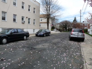
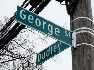
George Street, a dead end on Dudley between Mayflower and Edison, didn’t make most maps — it grudgingly shows up on latterday Hagstroms and Google, which is pretty comprehensive, lists it, but it was never in the Geographia little red books. There are a number of odd lanes like this in the northeast Bronx, known only to locals, like B Street, which is still there despite the disappearance of its pal, A Street.
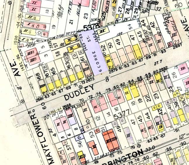
George Street does turn up on this 1927 Belcher Hyde plate, which is pretty much the gold standard. Notice the properties marked “II” (which means the buildings are two stories tall). Their continued presence has ensured that the dead-end has survived, as well.
As it turns out George Street may finally be “mapped” or recognized as an actual street.
North-south streets in Middletown, the neighborhood I have stumbled into, were given names associated with the Pilgrims who settled in New England beginning in 1620: Pilgrim, Puritan, Mayflower, Bradford, and so forth. However there are competing schemes of street naming here. Edison Avenue is named for the Wizard of Menlo Park, and other names in the area are named for terms associated with electricity: Ampere, Ohm, Watt, Radio. The land on which the neighborhood was laid out once belonged to Isaac Leopold Rice, the president of the Electric Storage Battery Company who was also a champion chess master.
Rice’s wife, Julia, was the founder of the Society for the Suppression of Unnecessary Noise, an institution I would like to revive. Mark Twain approved.
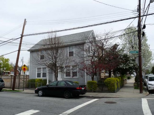
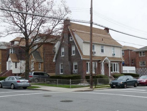
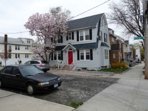
Here are a couple of houses at the intersection of Dudley and Edison Avenues. They seem to be a bit older than the surrounding homes, especially the salt box, so I suspect Edison Avenue may have been laid out before its parallel avenues.
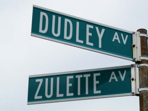
Zulette Avenue, which meets Dudley Avenue at Crosby, was named after an early settler, is the penultimate street in NYC if you rate them in alphabetical order. The last street would be Zwicky Avenue, a one block street in Midland Beach, which possibly has something to do with Fritz Zwicky, the Swiss astronomer who pioneered the study of dark matter in the universe.
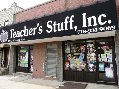
I wandered down Crosby and saw this huge awning sign featuring the Souvenir font, which was heavily used in the 1980s. The font lends a certain amount of kitsch and is looked at now as something of a period piece. I think it does work well as a display font but I wish they had used a real apostrophe instead of the computer-generated default. Why do computers do this, anyway?
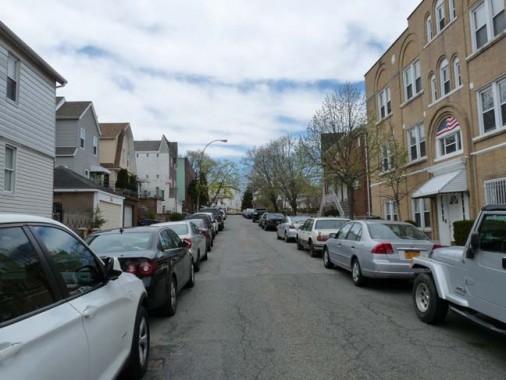
Daniel Street, between Plymouth and Crosby near Middletown Road, is another one of those dead ends or one-block streets that were plopped in decades ago. Along with Buhre Avenue it is named for Daniel Buhre, whose farm was subdivided into lots to created a new neighborhood around what used to be the small town of Middletown, so called because it was midway between Westchester Bridge (destroyed by patriots to delay a British advance in 1776) and Pelham Bridge, which had been at the entrance to the present Pelham Bay Park.
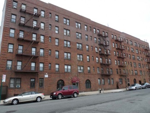
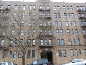
At Buhre and Jarvis Avenues, a block of apartments presents a stolid, unwavering mien. I have often called the Bronx the Borough of Apartment Buildings (though Brooklyn seems to have as many if not more). They just seem more obvious here, with occasionally complete streetscapes and vista presenting row after row of apartments built during the great initial boom of the Roaring Twenties.
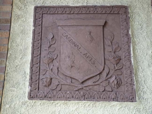
3120 Buhre, at Parkview, is impressive in its own right but I uncovered a secret from its early days by wandering into one of the arched entrances, which serves as a tunnel to the courtyard. (You will often find secret artwork by doing this, incidentally.) There are little terra cotta medallions proclaiming it to be the Cardinal Apartments. Just a little detail that only building residents know, and how many of them actually check these out?
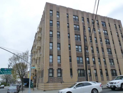
This streamlined Moderne apartment building at Bruckner Boulevard and Buhre was likely built before the accompanying Bruckner Expressway was rammed through and the roadway was still known as Eastern Boulevard.
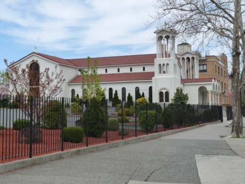
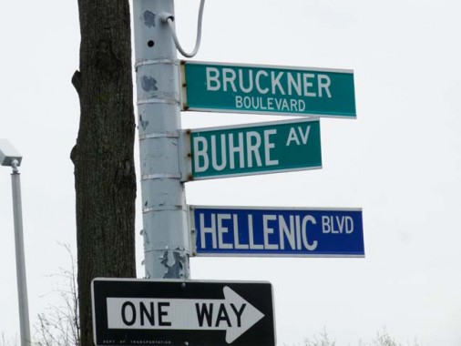
It was time to get the bus and rest the knee. (Which turned out to heal nicely, evidenced by a 5-mile hike in Staten Island I was able to do the following week). Before it came, though, I noticed the massive Greek Orthodox Church of the Virgin Mary of Zoodohos Peghe (Life-Giving Fountain), the congregation in existence since 1912; this building was built in 1995 and consecrated in 2007.
“Hellenic Boulevard” was appended to this part of Bruckner Boulevard in late 1993, when the church was under construction, to honor the new church and the Bronx’ Greek-American community.
4/28/13


26 comments
Great article Kevin!
Another fine job Kevin, thanks. Interesting how the DOT slightly raises the lowercase “g” on the I-95 highway sign. You can see how the “g” is slightly higher than the other lowercase letters in Throgs Neck and the word Washington. I assume they raise it up a bit so it doesn’t interfere with any letters below it, even though there is more than enough room to do so.
i am pretty sure i am more interesting then kevin. check out my article about the battle of westchester creek historical marker! c:
I loved the article, reading about street names and area history! I grew up in Pelham Bay, moving to Spencer Estates/Country Club area, and ending in Throggs Neck 🙂 Would enjoy reading more of more about these hidden Bronx gems (buildings, streets, area layout). Thank you!
Thanks to you I am learning about the Bronx!
Gee,ya think Bruckner blvd. has enough names?
I think it could stand at least 5,6 more easy,no problem
http://bronx.news12.com/news/owen-dolan-park-reopens-in-westchester-square-1.5414610
Owen Dolen Park has been completely redesigned and just re-opened last month. There are events there every Saturday in the summer.
Owen Dolen park has been completely redesigned and reopened last month. There are events there every Saturday in the summer.
I was very lucky to grow up in Pelham bay in the 1950. My mother kept a horse in a barn on Middletown in the 1920s , her uncles build two homes on Plymouth ave in the 1900s. We lived on Buckner. Most of the streets are named after engineers civil war soldiers of 1800s. Roe bling,Griiswold. I miss it. John
We lived on Bruckner Blvd and by the way mom’s horse was in Pelham Bay Park the house’s were on Pilgrim Avenue. The mine is the first to go… This part of the Bronx has not lost it’s zest. You miss it that’s why your in Fla.
I love this article. My husband was born in the Bronx. His great Grandparents were married at St. Peters Rectory located at Westchester Square on June 6 1906. These articles are very helpful for ancestry purposes and helped me envision the homes that my husband’s ancestors lived in and the places they visited. Its nice to match the addresses I see on the Federal Census’s with the pictures that are published here.
Thanks!
Melissa
I was born in Weatchetsr Square Hospital in 1946. Went to Manhattan College in Riverdale and met my wife while working in the A&P (now gone) in Westchester Square. Have lots of great memories such as Summer “Sunday’s” at Ferri Point Park while the whole family which included aunt’s,uncles neighbors,friends etc, had a day in the ‘country’. Lived on Lyvere Street and then moved to Hollywood Ave before finally moving to Putnam County. The Bronx will always hold a special place in my memories.
all is so clear i lived on westchester square 1937-1950
Do you have any information on James T Lane (1842-1908). Lane Ave was named after him. James had a grocery store and owned a large building on the south side of Westchester Square. James was also owner and editor of “the Westchester Independent” newspaper, which he founded in 1885 and was still been published at the time of his death in 1908. James was heavily involved in Democrat party and Tammany society. James also supposedly raised a regiment during the Civil war and was made colonel of the regiment
John, I am also researching James T Lane! I am a descendant of his daughter Mary Jane, who married my great-great grandfather Owen Clinton. The Clintons lived in the Bronx for a long time. Would love to compare notes sometime! I had never heard that Lane Ave was named after him….
Thank you so much for these articles. I grew up on Dudley Avenue near East Tremont, and lived there during the 50s and 60s until I graduated from Fordham and moved out to go to grad school. Sadly my home was torn down and replaced by an ugly multi-family some time in the past, but a lot of the rest of the street near where the home was remains pretty similar to what I remember from childhood. I love your articles!
ok George street was named after the first transvestite operation recipient. i hung out with his/her nephews where miss Georgansans lived back in the 50s The home i lived in is probably the oldest home in the neighborhood built in 1900 on Maitland ave #2829 ….its still there minus the picket fence and the porch with the pillars
Thanks for the memories, grew up in Westchester Sq., Halperin Ave, attended St .Raymonds school and church. parents were married there, and we were. My husband was in the Coast Guard, we then moved to the C.G. Lighthouse, at Fort Schuyler, then we transferred to Jacksonville, Fl. My heart still belongs there!
I also lived in westchester Sq, grew upon williamsbridge rd,two of my best friends grew up on halprin ave, Ronald Flanagan and Bill Walker
sadly both gone now.
I lived on1450 edwards ave across the river. I .lived there from 1944 to 1958 than moved to 2707 latting street a block away got marryed 1966 in 19 72 moved
I also went to PS12 weschester square
did you have a sister that also went to PS 12.
I also went to PS12 weschester square
I would greatly appreciate any information on the naming of LYVERE STREET. Some of my ancestors are buried at St. Peter’s Episcopal Church Cemetery, and I am at a dead end on finding out where they were from, since the earliest mention is Federal Census of 1800, The naming of the street may lead me to further information that could help my search.
Kevin- I am someone in search of information on the Mile Square which was located in what is now the Bronx. At its formation it was in the then Westchester environ. Do you or anyone you know have any information on life in Mile Square, the cemeteries that were there, any maps of the locale, or anything else that may be available. My 7th, 8th and 9th great grandfathers lived there from @1660 to @1750, and I am trying to discover anything I can on them. The internet has little information on the area at that time, though I have seen the wording of two wills which my ancestors made out. If this is not in your realm, no need to reply. I enjoyed your article, and being a history buff from youth, found both enlightening and entertaining. Godspeed.
Quentin, the Mile Square was located around the current-day Woodlawn area. This map (https://collections.leventhalmap.org/search/commonwealth:wd3768515) and this post by the Bronx River alliance would be useful (https://bronxriver.org/post/story/themilesquare#:~:text=One%20of%20the%20more%20unusual%2C%20and%20today%20nearly,just%20a%20few%20blocks%20north%20of%20Muskrat%20Cove.) The map illustrates also the “Kings Highway” which today goes through Mount Vernon on its way up to New Rochelle.