
I had an interregnum of work this past spring (2018), the better part of two months for a financial printer in Midtown. The hours were overnights from 12 to 8, though, and it played havoc with my sleep schedule — I could not really sleep that much during the day and would make up for it on weekends and overnights. During that time, though, I was able to get out for a monster walk, 8-10 miles, from Manhattanville east to Hunts Point in the Bronx, where I had not been for nearly a decade. The two coordinates are fairly easily attained on foot by using East 145th and Westchester Avenues, and I stuck to those routes, veering off when there was something nearby of interest. And, the cool clear weather was prime for photography; the summer that followed has been a humid, murky mess.
GOOGLE MAP: MANHATTANVILLE TO HUNTS POINT
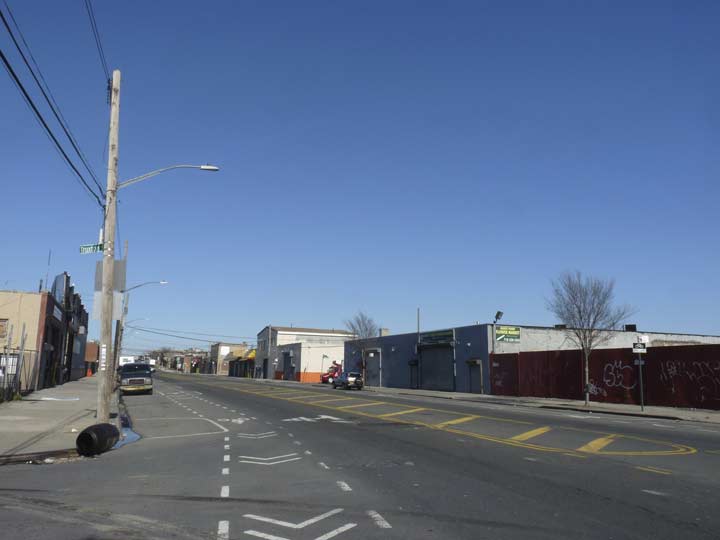
So where I left off in Part 2, I was heading east on East 149th from The Hub, the shopping and business area at 149th and Melrose and Third Avenues. However, I jogged a bit north to Westchester Avenue to see the elevated train supporting the #2 and 5 trains come above ground.
It’snot unusual that the Bronx has a Westchester Avenue. Prior to 1873, all of the Bronx was part of Westchester County, but that year, New York City annexed the portion west of the Bronx River as part of New York county, joining Manhattan. By 1895, the portion east of the Bronx River also became part of New York County and New York City. In 1898 the Bronx became a borough, one of the five making up Greater NYC, and finally in 1914, the Bronx became New York State’s newest county.
Westchester Avenue is a very old road; according to the late great Bronx historian John McNamara in History in Asphalt, it was first traced in the colonial era as a path from the Morris family estate to the town of Westchester, whose seat is now called Westchester Square. Westchester Avenue was graded from Coles’ Boston Road (now Third Avenue) to the town of Westchester in 1867, when it was known as the Southern Westchester Turnpike (to differentiate it from Westchester Turnpike proper, now followed in great part by US Route 1). Sometime before the turn of the century, as the area gradually urbanized, the name was changed to Westchester Avenue.
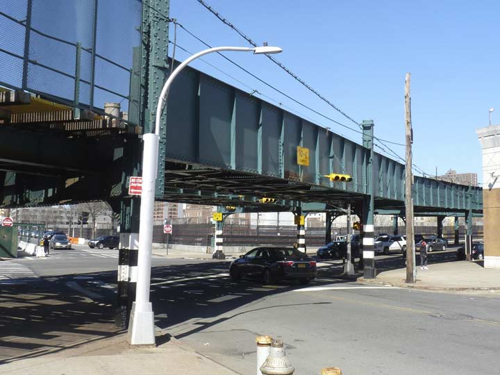
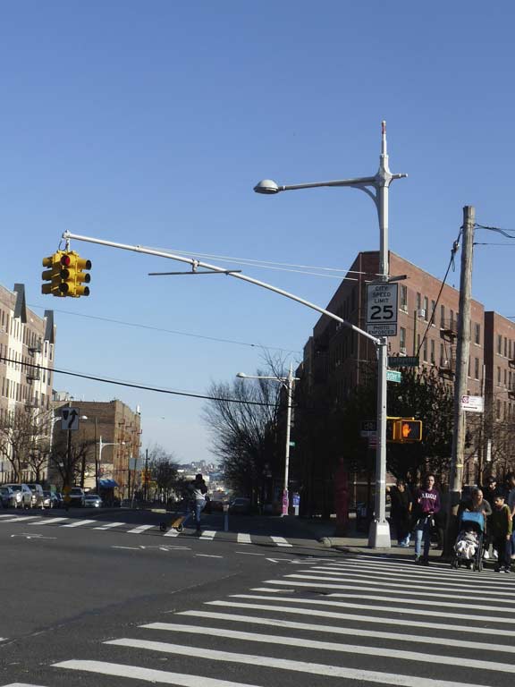
I headed up Brook Avenue, which overlays an actual brook called Mill Brook that was diverted into the sewer system when the south Bronx became urbanized and its streets laid out. I was attracted to this dwarf Deskey post at Westchester Avenue which looks as new as the day it was placed here sometime between 1962 and about 1975, when production on these posts was ended by SLECO. “Dwarf” Deskeys with shorter shafts were produced for uses under elevated trains and in airport flight paths. They could be made a lot smaller than this, though!
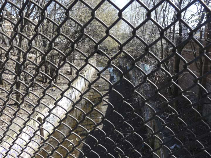
East of Brook Avenue, Westchester Avenue passes over a long-abandoned railroad cut. The cut runs from the Port Morris Yards at the East River northwest, passing under St. Mary’s Park, joining the Metro-North Harlem Line tracks at Webster Avenue; the line was always used as freight. This old line is virtually unnoticeable by most area residents who are likely unaware that a freight cut is there, since it is bridged over in most cases and the line is overrun by vegetation. Still, some miscreants and junkies use the old cut to shoot up in privacy.
The ever-intrepid Nathan Kensinger braved the cut for Curbed magazine in 2016. It has potential as a High Line-style linear park, but it would need to be heavily secured. In a future age the area may be “gentrified” and those of modest means pushed out, and then it could be developed as an enclave for the one percent.


A street that doesn’t make most paper maps, Hegney Place, runs along the cut for a block or so. When first laid out in the mid-1800s Hegney Place bordered the now-vanished Bensonia Cemetery, a small cemetery founded by the Benson family. It became known as German Place for the prominent neighborhood nationality, When the USA entered World War I, primarily opposing Germany, it was renamed for the first Bronx soldier killed in France, Arthur Vincent Hegney.


PS 27, St. Ann’s and East 147-148 Sts. facing the park, was constructed between 1895-1898 and designed by prolific schools architect C.B. J. Snyder.
The AIA Guide to NYC describes it thus:
“Built 5 stories tall for children with good legs and good lungs. The carved limestone escutcheon over the main entrance is an effulgent work of sculpture.”
There’s a lot going on there…eagles, ships, windmills, sunrises, harps, cornucopeas (-i?) globes, scales, hammers, and more I’m probably not even noticing.


St. Mary’s Park in Mott Haven is located in roughly 35 acres between St. Ann’s Avenue, St. Mary’s Street, Jackson Avenue and East 149th Street. It was the locale of Jonas Bronck’s farm; Bronck was the 1600s Swedish settler for whom the borough and the river that runs through it take their name. The land was later held by Gouverneur Morris and Janes and Kirtland Iron Works, which helped create the massive Capitol Dome in Washington, DC. The park was home to The Bronx’ first playground in 1914. It takes its name from a long-demolished church in the area, St. Mary’s Street, the park’s southern border, as well. The park is home to a number of glacial rock outcroppings.


The St. Mary’s Park Houses consist of 6 high rise units, opened in 1959, from East 149th to East 156th east of Cauldwell Avenue. The Houses run on the east side of a slight incline known as Janes Hill, after Adrian Janes (1798-1869) co-founder of the Janes, Kirtland Foundry, which created the iron work for the Capitol Dome in Washington, DC. Jaynes Hill, with an extra “y,” the highest hill on Long Island in West Hills, Suffolk County (348 feet), is also named for Janes.
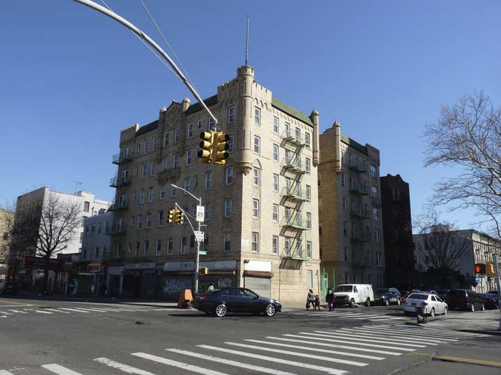
Castle-like apartment building at East 149th and Jackson Avenue. its old flagpole is still intact.


Turning onto Southern Boulevard at the east end of East 149th, the former Ace Theater, with its terra cotta tragedy masks on the roof, comes into view. Southern Boulevard in Longwood is a former Theater Row of sorts, with the intact Ace, Boulevard, Art and Spooner Theaters all intact and serving other business purposes. The Ace opened as the Congress Theater in the 1930s and closed for good in 1961.
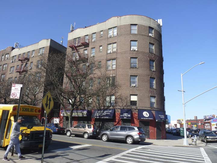
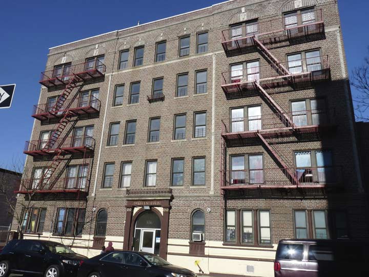
At Southern Boulevard and Leggett Avenue, the first apartment building sporting what I call the Bronx Curve comes into view. The Bronx seems unique among boroughs in that many apartment buildings were designed with sweeping curves where corners would be in other boroughs.
Leggett Avenue runs beneath the Bruckner Expressway and is bridged over the Amtrak RR cut, so it was my entry into the final leg of my walk, Hunt’s Point.


The Leggett Avenue is an aggressively blue truss bridge, one of a number of bridges that connect the neighborhoods of Longwood and Hunt’s Point (with or without an asterisk; I know I am being inconsistent) over the RR cut. The Leggett Avenue bridge is one of the few stretches of road I have encountered in NYC that’s not illuminated by streetlamps at all. The scrolled masts that held incandescent bulbs that lit the sidewalks are still there; on the 149th Street Bridge south of here, these still hold sodium yellow lamps.
Hunt’s Point
There are some NYC neighborhoods I’m in all the time, and some I only visit perhaps once per decade. I last entered Hunts Point way back in March 2009, and made a somewhat comprehensive survey back then. Today, I made a quick pass through, seeking out some of the landmarks I encountered the first time.
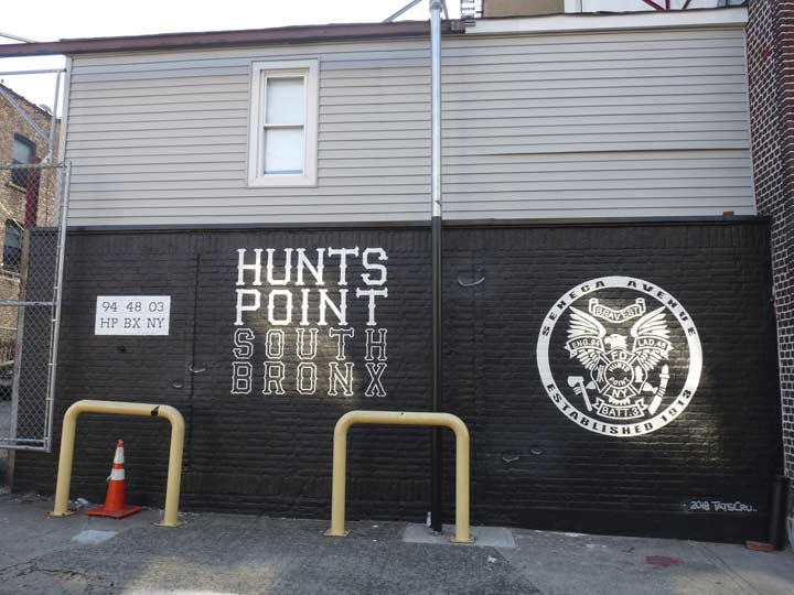
Hunt’s Point, not to be confused with Queens’ Hunters Point, is easily definable as it is cut off from the rest of the Bronx by pedal-to-the metal Bruckner Expressway, the East River, and the Bronx River, which divides it from Soundview and Harding Park. It was settled as early as the 1690s by the Leggett and Hunt colonial families, and for many years it was a rural enclave dotted with opulent mansions owned by Edward Faille, Paul Spofford, Cuban patriot Innocencio Casanova and Benjamin Whitlock. The only trace of them now, and other colonial-era names, are words on street signs.
In recent years Hunt’s Point has gained in importance because much of the food and comestibles NYC imports comes through the Hunt’s Point Produce Market. For example, fish that found their way to the tables of haute cuisine entered NYC through the Fulton Fish Market in the Seaport area for over 100 years until 2005, when it was relocated here.
The neighborhood was home to a couple of grand mansions, one still intact, one forever lost.
The super-wide Randall Avenue begins unheralded here at Leggett Avenue and Truxton Street, but it soldiers on in several different pieces, in Hunt’s Point, picks up again in Castle Hill, and peters out at Eastchester Bay in Schuylerville. The separate pieces are divided by the Bronx River and Westchester Creek.
Hunt’s Point has distinct residential and industrial sectors. On Sundays, things are quiet indeed and I was one of the few people around, on foot, bike or accelerator pedal.
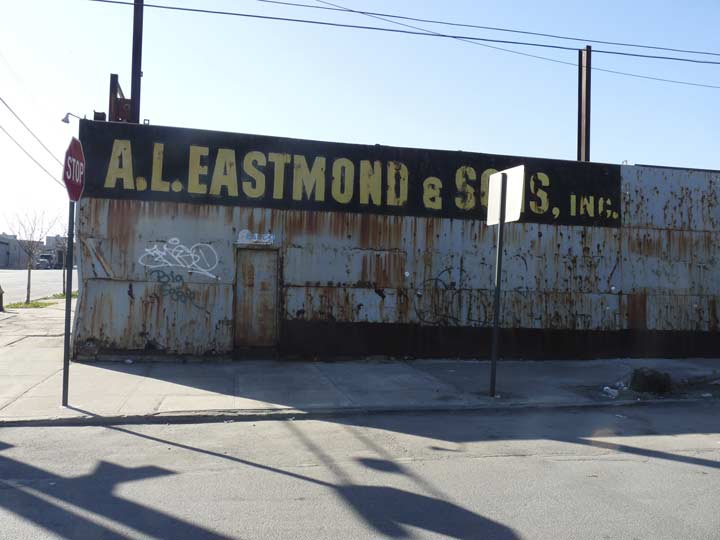
A.L. Eastmond and Sons on Truxton Street, does boiler repair. The painted sign is easily visible by trucks roaring down Randall Avenue toward the Liggett Avenue Bridge.
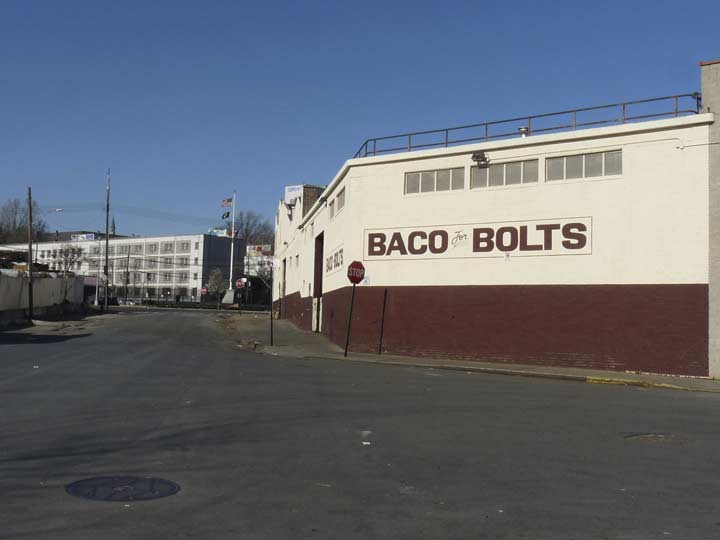
BACO for Bolts, Truxton and Worthen Streets. Good to come across a NYC enclave where manufacturing is still done.
We are a distributor of fasteners, a threaded rod and anchor bolt manufacturer, a steel service center, and a miscellaneous steel fabricator. To our knowledge, no other company has attempted to put these four companies together, but our valued customers understand. Not only are we the only supplier of steel and fasteners under one roof, but we are based in NYC. The city that never sleeps because you can be sure men and women are working to build and restore New York City 24/7. Like the city we have grown with, we are innovative and evolving into a full service manufacturer & supplier.
Some of the products we make in NYC are hex bolts, round head bolts, timber bolts, hex nuts, coupling nuts, jam nuts, slotted nuts, dock washers, plate washers, shims, custom wedges, anchor bolts, threaded rod, and much more. [BACO]


A triangle is formed by the confluence of Longwood and Spofford Avenues and Tiffany Street, and here is a 1955 war memorial for Hunts Point casualties.


For me the signature building of Hunts Point is the huge, brick American Bank Note Building on Lafayette, just east of Tiffany.
From the ForgottenBook: This fortress-like building at Lafayette Avenue and Tiffany Street has produced Mexican, Brazilian, Costa Rican, Ecuadorian and Haitian stock certificates, travelers’ checks and stock certificates, as well as paper money. The company later to become American Bank Note was founded in the 1790s by engraver Joseph Perkins, a Massachusetts native from Newburyport; the company was incorporated in 1858. American Bank Note did produce US currency from 1858 to 1879, and for a short time in 1861 produced Confederate money. The company also entered into printing stock and bond certificates in association with the New York Stock Exchange in the later 19th Century. Its Bronx factory was built in 1911 and it was designated as a NYC Landmark in 2008.
Later, the American Bank Note Building was home to artists’ studios and Wildcat High School, established for troubled students by the Wildcat Service Organization. Developed in 1972 by Mayor John Lindsay as a “program of last resort” for the chronically unemployed, the organization provides job skills and training for the economically disadvantaged. It is also being refurbished and new apartments and new retail constructed.
By 2012 it had gone the luxury condo route, as The Banknote.
For many years the ABNC employed an engraver named Joseph Ford, who was a legal counterfeiter! He duplicated various currencies produced here; his successes in counterfeiting banknotes prompted changes in their manufacture. His son, William, became the world’s most successful portrait engraver (the type that appear in the Wall Street Journal).


Directly across Lafayette Avenue from the Bank Note building is Corpus Christi Monastery, home to a flock of cloistered Dominican nuns. It is thickly walled on its Tiffany and Manida Streets and Spofford Avenue sides; it was designed in 1890 by architect William Schickel. The monastery was founded by Julia Crooks in 1889. In Latin, corpus Christi means “body of Christ.” According to Catholic doctrine, bread and wine are converted to the literal body and blood of Christ during the ceremony of the Mass, matching the dictates of Jesus at the Last Supper before His crucifixion in the Gospels.
I call the Bronx the Borough of Apartments and Hunts Point is no slacker in that regard. Here’s a monumental sample at the corner of Lafayette and Hunts Point Avenues. The latter street is the spine of the neighborhood, running from Southern Boulevard and East 163rd Street to the Hunts Point Produce Market.
In 2017, Hunts Point Avenue received a new set of Triborough Bridge-style lampposts. The design first appeared on the T-Bone in the 1930s, and the Department of Transportation began installing knockoff versions in Queens (Broadway, Jamaica Avenue, Ditmars Boulevard) and Bronx (Elton Avenue, Hunts Point Avenue) in the 2000s and 2010s.


When I’m in Hunts Point I always check on its remaining grand estate, the former Sunnyslope on Lafayette Avenue and Faile Street.
What is now Bright Temple African Methodist Episcopal Church was constructed in the 1860s on the Peter Hoe estate, when Hunt’s Point was part of the town of West Farms in the county of Westchester. According to Barbaralee Diamonstein’s Landmarks of New York, the building was designed in the Picturesque Gothic tradition, and resembles several of the homes mentioned in Calvert Vaux’ s book Villas and Cottages, though there is no known connection between Sunnyslope, as the building was named, and the co-architect of Central and Prospect Parks. The Hoe family business was printing; Peter’s brother, Colonel Richard Hoe, invented the rotary printing press.
After Hoe sold the estate in 1864, Sunnyslope passed through many hands, in 1919 becoming the Temple Beth Elohim. It has been owned and occupied since 1966 by the Bright Temple AME. It is one of the very few of the country houses from wealthy estates still standing in the five boroughs.
Crescent Court, an apartment building on Faile Street at Gilbert Place, named for late 1800s area businessman W.W. Gilbert, an owner of Sunnyslope.
Pride of place in Hunts Point. The insignia is rendered here on a shed behind the Engine 94/Ladder 48 firehouse at Faile Street and Seneca Avenue.


The Hunts Point station house of the former New York, New Haven and Hartford Railroad sits moribund at Hunts Point Avenue and the Bruckner Expressway. It is a relic of a period when local service was offered on high-speed rail lines in the southern and eastern Bronx, and additionally a relic of the days when grand buildings were constructed even on local stops in areas that were not necessarily in the center city. It was designed by Cass Gilbert — the architect of the Woolworth Building — in 1908. This is one of a series of deteriorating rail stations in the Bronx along the old NY, NH & H.
The station has been home to a variety of businesses; lawyers, travel agencies, pizza, fried chicken, groceries, topless. Periodically an idea is floated about reopening these ancient stations for local service, but the millions of $$ it would take says otherwise.
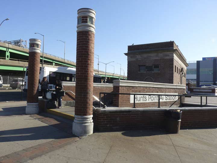
The Hunts Point #6 train station at Hunts Point Avenue and Southern Boulevard at Monsignor Raul Del Valle Square. Del Valle (1926-1998) fled Fidel Castro’s Cuba in 1961, arriving in the Bronx, and rehabilitated and revitalized local parishes St. Anselm and St. Athenasius. He became a beloved local activist, setting up homeless shelters and food stations. Upon learning he had cancer, he wished to see his native land once again; John Cardinal O’Connor interceded with Castro, and the prelate saw Cuba before returning home, where he died a few months later.
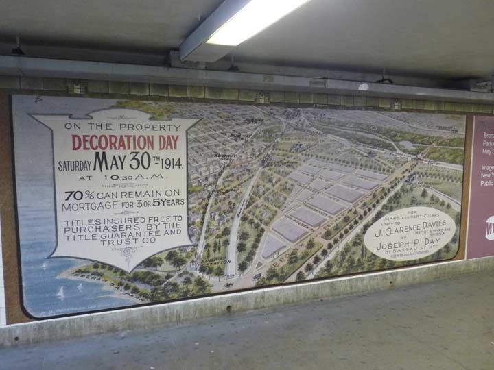
This unusual map advertising available properties in 1914 is just inside the station down the entrance staircase. On the map, Morris Park, to the northeast of here, is on the bottom and Longwood, where we are, is on the top. “Decoration Day” is an old name for Memorial Day. Graves of war veterans were “decorated” with wreaths and flowers.
Please help contribute to a new Forgotten NY website
Check out the ForgottenBook, take a look at the gift shop, and as always, “comment…as you see fit.”
9/17/18
11 comments
Just a slight correction(that I reluctantly submit on this, of Many enjoyable and Informative reports). The Logo pictured for the Firehouse on Seneca Ave. is for the Fire Companies that are stationed there;
Engine Co. 94
Ladder Co. 48
Battalion 3
This particular Firehouse is unique in that the front portion of the top(3rd Floor) is an Open Portico. I believe some pretty extensive renovations have been performed on the Firehouse in the last 10 +/- years.
Thanks again for all of your reporting
I worked in The Hub, 1972-74. The S. Bronx resembled post WW 2 Berlin in those years & I was glad to move on. Here’s a link to a book written about the 41st Precinct, a/k/a Ft. Apache:
http://www.nypress.com/fort-apache-tom-walker-fourth-generation-bronx-cop/
Just to add to your Banknote portion. My company bid on work in that building back in 2012 and a portion of it may be condos not but back them a significant portion we bid on was for the DCAS HRA (Human Resources Admin) for the the city who still occupy the space.
My father used to work on Barretto St. in Hunts Point at Ferrara and Korb sheet metal which later became Brakewell Steel Fabricators and has subsequently moved to Westchester. I remember helping at the Christmas parties (1950’s). All the local cops came in for a steak hero and a shot.
We got the hero’s from DiNotos Bakery down the street.
Kevin has tastefully and thoughtfully omitted the fact that for a long time in the 1980’s and 1990’s, Hunts Point was synonymous with prostitution and drug pushers. Because it was a largely commercial area that was empty nights and weekends, it was a virtual haven for hookers, junkies and the like. I had a friend who owned businesses in the Bronx and he had to visit some of the sheetmetal and junk outlets in the area and he always told me that the hooker business there was brisk, even during the day. It was a dirty, dangerous place. Rudy Giuliani went a long way toward cleaning the place up. Moving the Fulton Fish Market up there really bolstered the neighborhood.
Regarding “Corpus Christi”: should not “bread and water” be “bread and wine”?
yes-fixed
My father worked at Hunts Point for years. Before the days of paper transfers and then Metro Card, he paid one fare for the bus from the West Side to the East Side to catch the 6 train, another fare to the Hunts Point stop, and then another fare into the market. And this was at oh-dark thirty. How he never got mugged in SoBro is still a miracle. His days often ran 12+ hours, waiting for the last truck of the day to get across the GWB and the Cross Bronx and arrive at Hunts Point. And then he took the same route home. Why? Because he couldn’t drive to save his life.
hector and mom lives in house on 504 concord avenue since from builing on boston road since 1971 and leaving to florida in 2013.
When I was 15 years old in 1970 my parents bought a house in the hunts point area 815 Bryant Ave we lived there until January 2000. I don’t have any complainst about the neighborhood. Yes there was lots of hookers drugs but nobody bothered anybody, I have 2 daughters that were practilly bought up there we have very good memories I always pass by to relive my youth. still the same neighbors we had live there.
WE lived on Fox Street, 627 and 634, just off Avenue St. John, I was 10 in 1947 when we moved to Mohegan Avenue and 180th Street. Such great memories of The Bronx (only Borough with a The in the front of it), just great times, went to PS 62 there, where are all my friends now from those days. Loved the Ace Movie Theater, my mom used to take us there. We will never see those times again, and our children and grandchildren will never experience what we did. Thanks for listening….