On a late winter Sunday in February 2015, cabin-fevered from weeks of cold and ice (I complain equally bitterly about summers when they are hot and humid for weeks on end) I took the LIRR to Flushing Main Street, exited the train and walked the length of Kissena Boulevard, which runs from Main Street just south of the railroad overpass to Parsons Boulevard and 75th Avenue. A tidy little 2 to 3-hour adventure.
I also consulted old photos and maps, since I knew that the boulevard evolved from a rural route that connected Queens’ two largest towns, Flushing and Jamaica Avenue, but ran through rural farms and fields to do so. Presently, the route runs past flocks of high-rise apartment houses but also the open fields of Kissena Park and the fairly expansive Queens College campus, which still contains a number of buildings left over from when it was the grounds of the Parental Home.
My route today was prosaically simple, but it’s always nice to have a map, anyway.
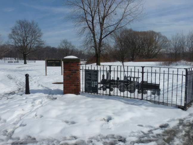
Where was I? I was on Kissena Boulevard at the entrance to Kissena Park at Rose Avenue. But why is there a wrought-iron rendering of a locomotive on the fence? There’s a reason it’s there.
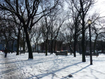
A lengthy gash of green known as the Kissena Corridor can be seen on Queens maps, running from Flushing Meadows-Corona Park at its western end all the way east to Cunningham Park at Francis Lewis Boulevard on the east. The Queens Botanical Garden between College Point Boulevard and Main Street forms its western end, while a narrow patch is slotted between Colden Street and 56th Avenue/56th Road, seen in the above photo on a recent February afternoon.
The gash “widens” into Kissena Park proper, which is divided into a “parklike” northern section and a more “natural” southern section, between Kissena Boulevard, Rose Avenue, Oak Avenue, Booth Memorial Avenue and 164th Street. East of that, the Kissena Corridor’s narrowest sector runs from Fresh Meadow lane to the Long Island Expressway, after several blocks’ interruption by the Kissena Golf Course between 164th and Fresh Meadow Lane.
The Kissena Corridor is there because it is the ancient right-of-way for a long-vanished railroad. In the early 1870s, Scottish immigrant and department store magnate Alexander T. Stewart purchased plots of land from local farmers and built the Central Railroad of Long Island as a means to connect western Queens with a new development of his, Garden City.
The railroad was a financial failure and survived for just a few years, yet the railroad, built over 140 years ago, still survives…after a fashion… as a park, which matches its fate with that of the High Line on the west side of Manhattan.
Just as we’re speculating about what would happen if the Long Island Rail Road Bay Ridge freight line through the heart of Brooklyn and into Ridgewood, Queens, could be fitted for mass transit, or perhaps the old Ozone Park to Rockaways LIRR branch, abandoned since 1962, could be used again for rail, it’s fun to speculate what would have occurred if Stewart’s line was a success. It would mean a direct connection from the LIRR Port Washington Branch to Garden City, serving the Queens communities of Fresh Meadows, Hollis Hills, Bellerose and Floral Park; the street grid in those areas, after over 140 years, still allows for a a railroad right-of-way! Oh well… the full second Avenue Subway will be built before any transit initiatives favoring Queens are even discussed!
Read much more on the Central Railroad of Long Island here at Art Huneke’s Arrchives.
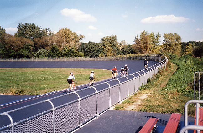
Kissena Park itself lies on the former plant nursery grounds of Samuel Bowne Parsons, and does, in fact, contain the last remnants of their plant businesses. As stated in Part One, Parsons Boulevard is the road built in the 1870s that connected Parsons’ farm with that of Robert Bowne. A natural body of water fed by springs connecting to the Flushing River was named Kissena by Parsons, and is likely the only Chippewa (a Michigan tribe) place name in New York State. Parsons, a native American enthusiast, used the Chippewa term for “cool water” or simply “it is cold.” After Samuel Parsons died in 1906 the family sold the part of the plant nursery to NYC, which then developed Kissena Park, and the other part to developers Paris-MacDougal, which set about developing the area north of the park. Kissena Park attained its present size in 1927. Much of its southern end remains wilderness, with bridle paths running through it.
It’s also the home of New York City’s only outdoor velodrome, where pro, semi-pro and proficient bicyclists can race or practice on a raised track. It was in fact used in 1962 for Olympic Games bicycling trials. The velodrome had slipped into obscurity and deterioration until about ten years ago when it was restored to glory. Coincidentally, or perhaps not so coincidentally, NYC was preparing its bid for the 2012 Summer Olympics, which were ultimately awarded to London, England.
Full FNY coverage of Kissena Park
Full FNY coverage of the Kissena Park Corridor
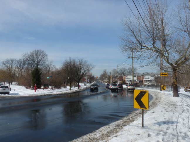
At the park, Kissena Boulevard, originally the main road between Flushing and Jamaica (and named Jamaica Road) takes a turn directly south, it had run southeast from Main Street in Flushing. No stoplights control the flow here, so reflective signs have been installed to avoid crashes into the park…

… at Peck Avenue, a single guy wire mounted blinking Cyclops signal warns traffic about the bend.
Peck Avenue runs along the south end of the Queens Botanical Garden for a couple of blocks. It’s one of the more unusual avenues in eastern Queens, as it runs through Flushing, Fresh Meadows, and Hollis Hills in five different sections; in its longest section, it runs south of Corridor Park, while Underhill Avenue runs along the north. At one time, Peck and Underhill were mapped out to the Nassau County line along the route of the Motor Parkway, but were never built that far.
Peck Avenue is named in honor of longtime Flushing resident and property owner Isaac Peck (1824-1894). He owned a department store in College Point for many years. Members of the Peck family are buried in St. George Churchyard on Main Street in downtown Flushing.
Kissena Boulevard passes by the southern, “wilder” section of Kissena Park, which boasts is bridle trails, serviced by the Western Riding Club on Pidgeon Meadow Road and 169th Street in Auburndale, which has been in danger of immediate closure for a couple of years.
The “twin towers” of the Electchester housing project can be seen looking south on Kissena Boulevard.
Electchester, a cooperative housing project located between Jewel/HVA Avenue, Parsons Blvd., 164th Street and 65th Avenue, was established by Van Arsdale and the Joint Industry Board of the Electrical Industry in 1949 on the grounds of the old Pomonok Country Club. Originally housing mostly electrical workers and their families (hence its name), Electchester is no longer exclusive to them:
The meat cutters had Concourse Village in the Bronx. The garment workers had Seward Park Houses in Manhattan. The printers had Big Six Towers in [Woodside], Queens. Decades ago, local unions sponsored more than a dozen cooperatives that provided almost 50,000 decent and affordable apartments to working-class families. As the power of labor waned and real estate values skyrocketed, though, most of these co-ops either lost their direct union connection or allowed their shareholders to sell their units on the open market. New York Times, March 15, 2004
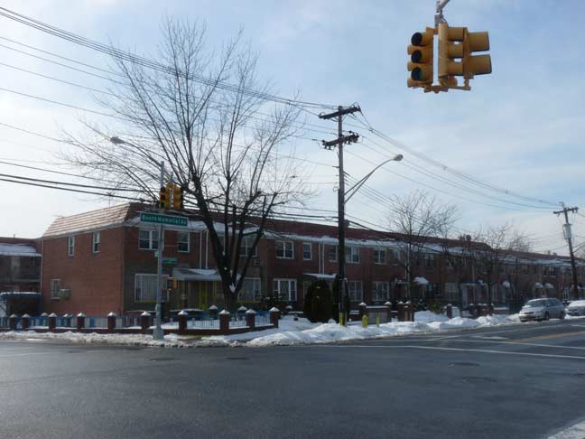
The intersection of Kissena Boulevard and Booth Memorial Avenue is an old one, and has existed for over a century; it was formerly where two country roads called Jamaica Road and North Hempstead Turnpike met. The Turnpike, named for the former name of New York Hospital at its intersection of Main Street, once went as far east as Queens Avenue, now Hollis Court Boulevard, and not as far as the westernmost town in Nassau County for which it is named. (That intersection has been eliminated by the joint creations of Cunningham Park and the Long Island Expressway.)
Several of Hempstead’s original fifty patentees in the 1640s were Dutch, suggesting that Hempstead was named after the Dutch town and/or castle Heemstede, which are near the cities of Haarlem and Amsterdam. However, it is possible that the authorities had Dutchified a name given by co-founder John Carman, who was born in 1606 in Hemel Hempstead, Hertfordshire, England, on ancestral land owned by his ancestors since the 13th century. wikipedia
It’s still a puzzler why this old trace, which before it was called North Hempstead Turnpike was called Ireland Mill Road since on its western end it led to a now-vanished tributary of the Flushing River, received its old name. On its original eastern end, Queens Avenue could get you to the Hempstead & Jamaica Turnpike, now prosaically called Jamaica Avenue, which is the likely story.
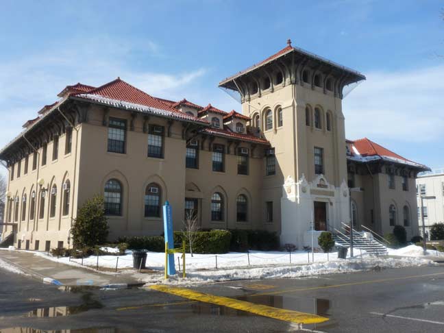
Just past the Long Island (Horace Harding) Expressway, Kissena Boulevard forms the eastern end of the main campus of Queens College, established in 1937 at the former grounds of the Parental Home, a home for “troubled boys.” The Parental Home, in turn, was established in place of the Jamaica Academy, established in the early 1820s. Long Islander journalist/poet Walt Whitman had served as a schoolteacher at the Academy briefly. The schoolhouse remained a part of the campus until 1935.
Six of the campus’s original nine Spanish Mission-style buildings have been retained till the present, including Thomas Jefferson Hall, above. They had been constructed for the Parental Home campus in the first decade of the 20th Century.
Jefferson Hall, like other buildings built for the Parental Home, was constructed by the prolific schools architect C.B.J. Snyder. The Hall, originally the H Building (campus buildings were simply alphabetized at the beginning) was designed with terra cotta ornamentation above the entrance, including six owls and two laughing schoolboys at the front and side entrances.
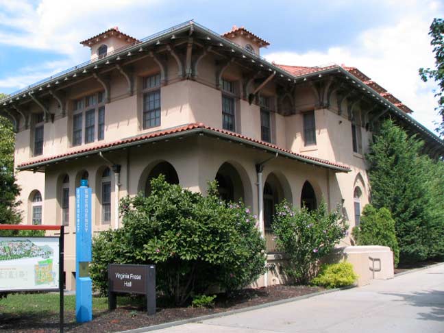
Another original QC building, Virginia Frese Hall, serves as the school’s Counseling, Health and Wellness Center.
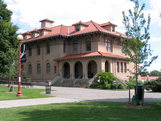
Delany Hall is named after Dr. Lloyd T. Delany, who was a professor in the Psychology Department and was appointed the first African-American Director of the SEEK Program at Queens College. Established in 1966, the program was designed to reach qualified high school students who may not have the wherewithal to attend college.
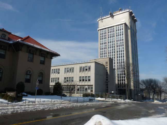
The 11,400-square foot Margaret Kiely Hall, seen prominently from Kissena Boulevard, is the QC Administration Building.
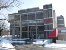
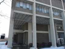
At first I was put off by the Queens College Student Union Building; I dislike most Brutalist architecture of the Paul Rudolph sort, but I looked at the building more carefully and it grew on me, with its straight up and down lines. (I’m no architectural scholar or critic, but I know what I like and don’t like.) The recessed concrete panels reminded me of the Washington DC Metro subway system, where all the underground stations feature them.
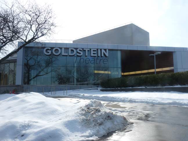
The primary host for productions of the Drama, Theatre and Dance Department, Goldstein Theatre is located on the northeast corner of campus, at the intersection of Kissena Boulevard and the Horace Harding Expressway (L.I.E.). The theater is named in honor of QC alums Irving Goldstein, ’60, CEO of INTELSTAT, and his actress wife, Susan Wallack Goldstein, ’62. It is a 450 seat proscenium theatre with a 40 foot wide by 18 foot high proscenium arch. This theatre is equipped with an automated orchestra pit which can be lowered to 7’6″ below stage height, a fully computerized lighting system installed in 2006, and ample wing space on both sides. –Queens College

Big names in music and theater appear at the The Kupferberg and Colden Centers in the campus’s northeast corner at Kissena Boulevard and the LIE.
One of these weeks I’ll have to do a more thorough survey of Queens College’s architecture, since it ranges from the mission-style campus buildings left over from the home for wayward boys all the way through to the 21st Century’s streamlined, computer-age facilities. Since the school is built on a hill, it also has a fine view of the distant Manhattan skyline.
A pair of lampposts on one of the campus roads near the KIssena Boulevard entrance look like mini-versions of the finned Whitestone Bridge lamps, which until the 1960s were standard issue on NYC parkways (they were the successors to the wooden posts). A few of the originals can still be seen around town, especially at either side of the Brooklyn Bridge.
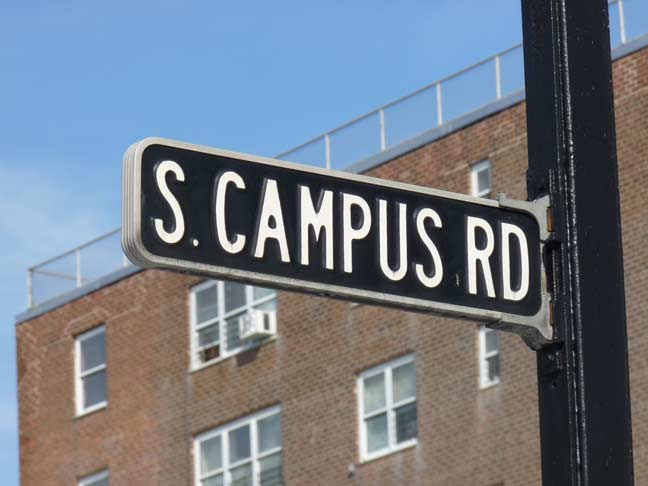
Also at the same entrance gate is a very well preserved specimen of metal and enamel Brooklyn street sign typically seen in the 1950s and 1960s before vinyl versions overcame them. This one was likely produced by the same firm. The signs feature a black background with raised white letters in a Highway Gothic condensed font.
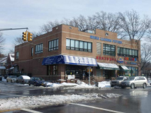
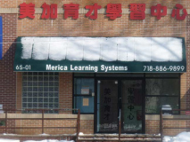
When I saw the name at the roofline of this brick building at Kissena Boulevard and 65th Avenue, Merica Learning Systems, I was stumped. Surely the initial “A” had fallen off? Then I saw the name again, on the awning over the front door. Perhaps it always was Merica, but perhaps, just perhaps, the letter fell off long ago and it was decided to make the mistake permanent. The building also contains a pizzeria poplar with the QC lunch crowd and a day care center.
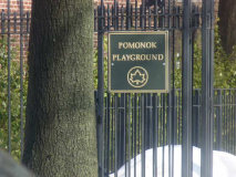
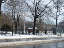
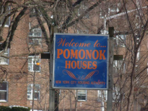
“Pomonok” is a prominent name in these parts, enough so that the immediate neighborhood is sometimes called by the name, as well as a playground and a nearby housing project. It can also have a variety of spellings such as Paumanok or Pomanok, since it was a Native American name and the English alphabet was not originally used to spell it: it was an Algonquin name for Long Island. William Wallace Tooker, a 19th-century expert on the subject, thought that it meant “land of tribute.” Other translations have included “fish-shaped” and “land where there is traveling by water.” The word was favored by Walt Whitman in his works, and since Whitman was a former neighborhood resident and educator, the name has been liberally applied in the neighborhood.
From the Pomonok neighborhood page by Christina Wilkinson:
Jaynes Hill, the tallest hill in Long Island, is a short distance from Walt Whitman’s birthplace in Huntington, Suffolk County. Both the Long Island Sound and Atlantic Ocean are visible from its 400-foot summit. Though Whitman and his parents moved when he was just four, Whitman was drawn to this part of the island and wrote about it often. A passage from Leaves of Grass appears on a plaque affixed to a large boulder, deposited by a glacier, at the summit of Jaynes Hill.
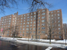
The Pomonok Houses are located in 35 buildings 3, 7 and 8-stories high on 51.98-acres with 2,070 apartments housing an estimated 4,204 people. Completed June 30, 1952, the complex is bordered by 65th And 71st Avenues, Parsons and Kissena Boulevards.
Both playground and housing project stand on the grounds of the Pomonok Country Club:
The course was built by members of the Flushing Athletic Club, which began in 1886 as one of the first golf clubs on Long Island. They leased 83 acres of land along Northern Boulevard in Flushing. When their lease was set to expire in 1919, some members favored finding a new, larger site that had room for an 18-hole course. Others favored renewing the lease at the original site and gradually expanding their 9-hole course. The membership ended up splitting, with the bolting members forming the Pomonok Country Club along Kissena Boulevard in 1921.
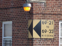
An interesting feature that has been retained is the presence of several original vinyl directorial signs in my favorite color combination, gold and black.
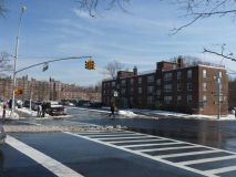
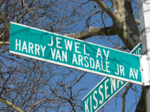
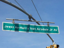
The art of sign-cramming was perfected by the Department of Transportation here at Jewel Avenue, which crosses Kissena Boulevard south of the Pomonok Houses. Instead of installing a separate sign, the DOT puts both of the street’s names on the same sign, and that was carried forth to the newer one-line signs hung on traffic signal mastarms, making for an incredibly lengthy piece of metal.
Harry Van Arsdale, Jr., president of Local 3 of the International Brotherhood of Electrical Workers, was instrumental in the construction of the nearby Electchester Houses east of Parsons Boulevard north of Jewel Avenue/Harry Van Arsdale, Jr. Avenue one block away.
Jewel Avenue has a curious history, and I’m not sure why it wasn’t just given a number when it was laid out. Presently, west of 147th Street, it runs between 69th Road and 70th Avenue and I imagine Queens Topographical didn’t want to call a lengthy avenue “69th Drive” which it would oridinarily be.
Also, curiously, “Jewel Avenue” is the last remnant of Forest Hills’ alphabetical nomenclature system (it once was in a sequence that included Fife, Gown, Harvest, Ibis, etc. as seen on this 1908 atlas plate). When Jewel Avenue was given an eastern extension through Flushing Meadows and beyond, it retained its name, until the labor leader’s name was slapped onto Jewel Avenue signs in the 1980s.
And lastly curiously, Harry Van Arsdale, Jr.’s name on the street signs was also extended west as far as Queens Boulevard; however, it wasn’t extended along Jewel Avenue west of Flushing Meadows. In Forest Hills, 69th Road carried the Harry Van Arsdale, Jr. signs!
Kissena Boulevard ends at Parsons Boulevard and 75th Avenue (there’s something behind that, but I’ll get to it) but before that it makes another jog to the southeast, creating a traffic triangle and green space at 72nd Road. The small park is called Abe Wolfson Triangle, named for one of the founders of the Queens Historical Society at the young age of nineteen. Wolfson (1949-1971) was the organization’s first president and, as an environmental activist, also founded the Flushing Meadows Park Action Committee and fought for the cleanups of the Flushing River and Meadow Lake. Wolfson perished in October 21st at age 21 while learning to fly in a single-engine Cessna in Great Falls, MN.
Meanwhile, Flushing Meadows is again in need of a major overhaul to its parklands, bodies of water and general facilities both modern and historic.
Aguilar Avenue and the end of Kissena Boulevard
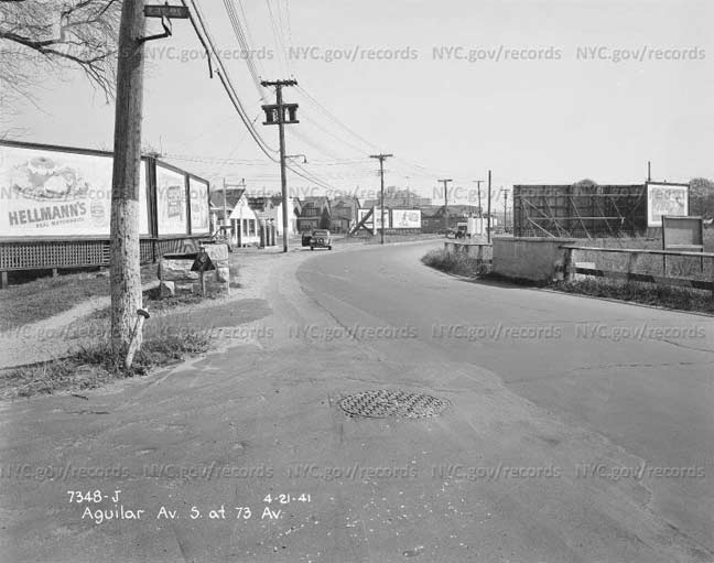
Here’s a photo from 1941 showing the curving Aguilar Avenue at 73rd Avenue, an intersection that no longer exists. Stay with me and I’ll discuss its relevance with Kissena Boulevard…
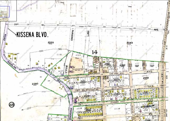
Here’s map from earlier in the century showing the south end of Kissena Boulevard, formerly Jamaica Road. As you can see, traveling south, it made a dipsy-do on the twisting Aguilar Avenue before continuing south on Parsons Boulevard, named for the horticulturist mentioned earlier. Some parts of the road were built before others, but with various interruptions, Parsons Boulevard now runs from the East River in Malba all the way south to Jamaica Boulevard in the heart of Jamiaca (it’s actually the east end of the E and J subway lines).
Over time, though, the western end of Aguilar Avenue was renamed as a southern extension of Kissena Boulevard and the east end became parts of Parsons Boulevard (in the 1941 photo we’re actually looking at Parsons) and only a short middle section bordering the Pomonok Crest Apartments remains.
The whole S-shaped road was likely the original trace, perhaps going back to Native American days. The trace likely curved to avoid a swamp or a hill.
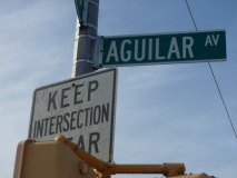
Aguilar Avenue today, in the one-block section connecting Kissena and Parsons Boulevards. The origin of the name is a puzzler. The name resembles the Spanish word for “eagle,” and is also a relatively common Spanish surname. Perhaps there were Spanish settlers in the area in the early 20th Century.
2017: Sergey Kadinsky has likely ferreted out the origin of the name.

You do wish that some of the original names of local roads could have been retained, at least for separate street signs. 73rd Road was formerly Blackstump Road, so named because local farmers would burn down trees and mark their property by the blackened stumps.

They say good fences make good neighbors. A short section of the present 71st Avenue once carried this name. I’ve rendered each in 1960s-style Queens signs they would carry if the names still existed.
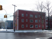
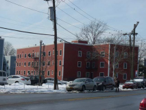
I’ve always been fascinated by the Kew Gardens Hills Apartments, a collection of buildings found between 150th Street, Kissena Boulevard, and 72nd and 75th Roads. They look like no other housing project I’ve ever encountered, with their vinyl sides made to resemble clapboard in shades of brick red and light blue. Anyone have any documentation about these buildings, their history and planning?
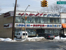
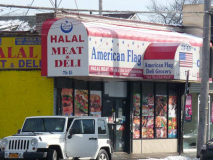
Kew Gardens Hills boasts some immigrants form Afghanistan, who have kept shops along Parsons Boulevard for several years; look carefully and you can see an outline map of Afghanistan on the Kouchi supermarket sign. A neighboring market has (cannily?) called his shop American Flag, perhaps to assuage the fears of neighbors.
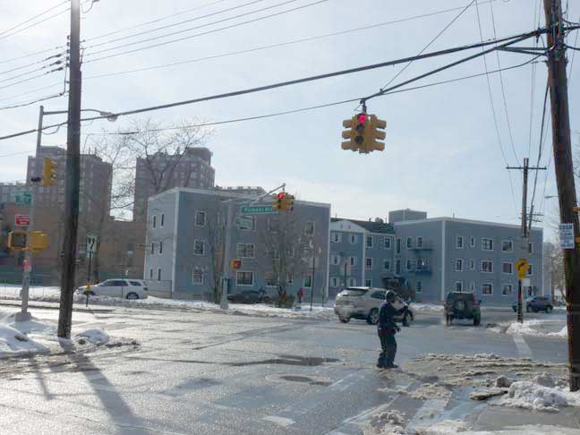
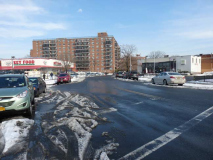
Kissena Boulevard ends here, at Parsons Boulevard and 75th Avenue, and a section of the Kew Gardens Hills Apartments.
3/8/15

33 comments
You asked about the Kew Gardens Hills Apartments. They are a dump, residents complain of no hot water, unresponsive management and other complaints. Its one clam to fame, or rather infamy, is its the former home of Alice Crimmins, who was tried and convicted of her son and daughters murder. Their bodies were later found in flushing meadow near the lake and on the grounds that would later house the 107th Pct
Investigation Discovery did a very good documentary of this as part of it’s “A Crime To Remember” series:
http://www.imdb.com/title/tt3058158/?ref_=ttep_ep1
You can watch it here – https://www.dailymotion.com/video/x3ht29y
Take a close look at the 1941 photo of Aguilar Avenue. On either side of the road are stone walls. This was a bridge crossing over a brook that originated in the swamps to the south of Aguilar Avenue’s curve. That swamp remained undeveloped for many decades until Touro College’s Lander college for Men developed it nearly a decade ago.
The bridge also appears in the Bromley map above at the point where Aguilar Avenue merges into Parsons Boulevard. This brook flowed east towards Fresh Meadows and then north into Kissena Lake. It was known as Mill Creek and Kissena Creek.
http://www.mazeartist.com/kissenacreek.htm
Serguey, when in the late 50’s and early 60’s, we neighborhood kids called that area “the 150th St. swamp”, and we caught frogs in small ponds among the rushes, as dragonflies hovered overhead. When I went back to visit the area in the 70’s, the land had become dry and scrubby. I suppose the water table dropped and eventually made it possible to develop the area into Touro College.
While I’m here — just want to thank you for all your previous contributions. I feel fortunate to have grown up in an area that was densely populated but still had lots of wetlands; probably helped lead me to a career in the biosciences. I am fascinated with what the area must have been like before the 39 World’s Fair boom, and am so pleased to come across a “time machine” like the one accompanying your link.
I have to agree with Geoff about the apartments, but I don’t believe Kew Gardens Hills Apartments is the proper name for the development. The buildings in the development were spruced up some years back by the placement of colored siding on its walls, to give the area a little splash of color. Otherwise its pretty grim. When I was a kid in the early 1970’s, that part of KGH was really bad; you wouldn’t want to walk through there even during the day. Its gotten better since then, and now its populated primarily by Afghanis and Russian immigrants. Its safe to walk there now.
Mitch, you’re absolutely correct about the name of the apartment complex. In the 1960’s, I lived on the corner of 75th Avenue and 153rd Street, and that section was known as Carlton Gardens. Across the street was a big lot, on which the Opal Building now sits, where us kids used to play and have dirt-bomb fights.
Regarding Kew Gardens Hills Apartments —
I lived nearby as a kid, 1955-1964, in a row house at 73rd and 147th. I had several friends who lived in those apartments, which were known in the neighborhood simply as “the garden apartments”. They were constructed of plain red brick. When I visited the neighborhood for the first time in 25 years, in 2001, I was shocked their appearance. It’s the same buildings, with an added vinyl cladding. I think the white framing around the windows makes the most difference, making the buildings look very modern and rather cheap.
I assume these apartments were built between 1928 and 1940, during the surge of pre-Fair development on the old Queens Valley Golf Course and surrounding area.
I had a friend who lived in them in the early 70s. I think they were red brick back then. Her apartment was the most run down place I’d ever seen. Paint was flaking off in palm sized pieces.
Great article Kevin. I especially enjoyed the old photos of Flushing, when it was still a rural suburban village. If only the residents of Flushing of a century ago, would be able to see Flushing today, I would think
that they would have a difficult time believing it was the same place. It is only for the landmarked buildings such as St. George’s Episcopal Church, the Quaker Meeting House, the Armory and the Bowne house, that would assure them that this is the same Flushing they knew and loved.
I lived in Kew Gardens Hills during the 1970’s and 1980’s on 150 th st. Those builing had a lot of broken windows . I was told never to walk up 150th st pass them on my way to school. It is better now as the neighboorhood has changed a lot.
This was a great article, as I grew up on 72 Dr. between 147th St. and 150th St., (1977-1995) and went to Queens College (1996-1999). Up until the 90s, the KGH Apartments were brick; the colored siding was put on them in the late 80s or early 90s. We called them the “Apartments” (the “Garden Apartments” was how we referred to the better development located on 150th St as one approached Melbourne Avenue). When I was growing up, KGH was increasingly Orthodox Jewish (as was my family and nearly every family on our block). My block had attached, single-family homes until you reached the corner at 150th St, where you hit the first set of Apartments. It was like crossing into another world, and while it was generally considered safe, we were instructed to be very careful when walking in that area.
The “Harry Van Arsdale Ave.” name was originally applied in an even more complex manner.
West of Queens Blvd., it was carried both by Jewel Ave. and by 69th Rd.; so both of those one-way streets became sub-sets of the grand two-way Harry Van Arsdale Ave.
But, because this proved to be too confusing, the “Harry Van Arsdale Ave.” name west of Queens Blvd. was cut back to 69th Rd. only.
[…] record [TRD] · “Art-adviser” Jessica Chestman buys in 20 East End Ave [NYP] · Exploring Kissena Boulevard, Queens [FNY] · …read more Via:: Curbed New […]
the building in the very first photo looks almost Tibetan.
Probably where the Dai Lama stays whenever hes in NY
Actually, it’s Harry Van Arsdale JR. Avenue.
Interestingly, one of the new format street signs, at 112th Street and 69th Avenue, omits the Jr. from the man’s name. Also, considering how one of the reasons the signs are supposed to be changed is because the powers that be say it’s easier to read upper/lower case than all caps, the replacement sign has the lettering in all capital letters. Maybe they didn’t have lettering for the smaller size?
The apartment buildings by Aguilar ave and kissena blvd in the 90’s were called the Smurf houses because most of the buildings had a light blue siding.
Thank you – great article! Do you, by any chance, recall the name of the small department store that was on Kissena Blvd. between Jewel Avenue and Parsons Blvd.? I’m almost certain that the name started with a “W” but I can’t remember the name. Any information you could give me would be most appreciated. Thank you.
Wainwright’s?
The American Deli is owned by a Yemeni guy not Afghan I attend prayers at the mosque there in Kew Gardens and yes the area is filled by Afghans but most of the Afghans there are family related as many of them came after the Soviet invasion of 1979 so there are like families who know each other but they are good productive citizens many work at the 107th pct NYPD in the area
Actually, Merica was always called Merica! I took classes there the first year it opened up. It’s actually a second location owned by the same people the run Mega Learning Systems right off Main St on 41st Avenue. I don’t know why they didn’t just call this place Mega as well. The Chinese names are exactly the same.
Also, who is being memorialized by Booth Memorial Avenue?
The founder of the Salvation Army, for whom Booth Memorial Hospital (now NYH) was named
Wow, I grew up in Flushing, queens. Pomonok Houses. I moved there at the tender age of 7, when Backstreet Boys, Britney Spears, Spice Girls etc were very popular. Nostalgic memories but also bitter sweet to think of. The neighborhood has changed. Very decrepit looking buildings…I went to P.S.200Q. WOW the place looks so different, the businesses are closing, Baby Blue has closed down… BTW great article. Takes me back in time.
I lived across from the soccer grounds off Peck, off Kissena Boulevard in the early 70s. There was a rough greenspace between us and Kissena, which had a single, mature apple tree. I often wondered if it had been part of an orchard once, or if it grew wild. Roma people camped in that area for a few months, which fascinated me, though I had to walk around the area to get to my bus stop. I didn’t want to encroach on their space.
I grew up in Kew Garden Hills at 75-06 153rd Street in the 1960’s. We called our area of KGH, Carlton Gardens! The buildings were red brick and for the most part, it was a nice area until around 1969. I used to play in a big lot with my friends where the Opal complex now sits. I went to PS154 and afterwards I would hang around playing handball with my friends in the alley on the side of Wainwright’s Department Store. Food Fair Supermarket was on the corner of Aguilar and Kissena Blvd right before it hit Parsons. I really miss those days and I have many fond memories of Flushing!
I lived in campus hall till I was 9 in 1967. Great memories of Wainwrights store when a new Beatle record went on sale it was a madhouse. Often ate lunch at the Jewish deli or the luncheonette. I went to PS 164. I also remember the building of Electchester. Steve Strauss, an electrician who lived there perished in the twin towers 9/11. A I can also remember the Alice Crimmins murders it changed the whole area. It went from totally safe to never being able to be outside alone as a kid. People would sit on their lounge chairs and argue her guilt or innocence. I have always wondered how well that neighborhood held up.
I grew up on 150th off jewel. In the garden apartments. I went to ps 165. It was primarily an orthodox area. By the time the 90s came around it had gotten worse. My dad still lives in the same apartment 55 years later.
I lived in Campus Hall as a child, from 3 years old to seven years old. 1958-1962. I went to P.S. 165 then St. Nicklaus of Talentines Catholic School. So many great memories of Wainwright’s, the library, pizza! …. it was very safe, we would walk to school or going to St. Nicks take the city bus. We moved to Northwest NJ when I was going on 7 years old but I’ll never forget those childhood years in Queens.
I lived in Campus Hall from 1958 to 1969 when I went to college. I attended P. S. 165 and then Parsons Junior High School. I remember it being mostly Conservative Jewish, changing to more Orthodox in the 70s and 80s. I was wondering if it was built by Fred Trump. I know that it was always a white area, racially, and CORE tried to integrate it in 1969, unsuccessfully. I feel troubled that my parents helped to fund the Trump dynasty. Anyone know if I’m right?
i grew up in Pomonok Housing, right across the street from the main entrance to Queen’s College. It was a wonderful, integrated environment with people of many creeds and backgrounds, living in peace and harmony at the time. Attended PS 201 right down the block. Again, a wonderful school because the principal, Edward Moses, hand picked all the teachers from the teacher’s college at Queens. This was from 1951 – 1963 when we moved to Far Rockaway. I have detailed, fond memories of the entire area, as it was safe to roam as a child with many, many friends of the same age. Brown paper bags from the grocery stores would easily be filled and refilled on any Halloween due to so many apartments in Pomonok. Thanks for this site. Just discovered it and will have to take the time to study it more.
What was the name of the drug store in between the Butterflake & the corner candy store? I think it started with a “P”?
I have read in a few places that the band Kiss took its name from Kissena Blvd…Stanley Eisner (Paul Stanley) grew up in this neighborhood…
I know Kew Garden Hill in the early 1980 but does anyone remember the stores in Kissena Blvd?
Wainwright is one of them but at the alley is where the Barber shop next to the parking and the Landrymat is. ( There’s two which is across the street ) Next to the laundromat is some Jewish owned store I don’t know what’s it for. Next to it is a men’s clothing store which is somewhat expensive. Next is a pet store, which they moved across the street until they closed down two years ago. And next to it is a smaller version of Wainwright called McCrory. Next to it is The Valentino’s pizza store ( which, like McDonald’s, they’re still around.) Next door to it was a coffee shop that me and my friend love to hang out until they closed down and Valentino took over as their own restaurant. Next to it was a pharmacy which is also cool to hang out. Between the second alley is a bakery shop. Why they shut down I have no idea. Next to it were three mini stores ( Four cause the Kissena Farm supermarket is the last one until Aron’s supermarket took over ) One is like a health store, I think it’s name GMS or something. Next is a fish store and the last is a candy store. But between 1980 – 1979 there was another store that split the fish and health. And that was a…’ comic book store? ‘ Does anyone remember the name or has a photo of that place? It should be cause that’s where my brother bought a Fangoria magazine in there, with an Italian cover version of Godzilla.
( It even came with a poster. Sweet )
Across the street on Kissena is the Astoria bank. ( Now a 24hr laundromat ) but next to it, where Rite Aid is, was The Pathmark pharmacy. ( used to work there since high school in 1989/91. ) next to it, a Hallmark store. ( Switch their location in Electchester until they were closed ) next, Domino Pizza. ( very small ) Next, Radio Shack. ( Yup, we had Radio Shack until they moved in Continental Ave. Forest Hills, now closed ) and at the corner of where the restaurant is today was another candy store with arcade coin games. Two or three of them. I don’t know the rest of the other stores across the street except the laundromat but there were not one but TWO gas stations between the corner of 70s road.
Across the Aron’s supermarket is another one with the same name as the pharmacy, Pathmark. But then Walbaums took over and made everything expensive. Until Key Food brought back the cheap. Before the tiny mosque, the Afghan pizza store, a little market, a lens shop, laundromat and a pharmacy next to the McDonalds, it was nothing but two fast food chains: a tall Chinese take out and a Jack in the Box. McDonalds has the same recognizable building but a playground OUTSIDE the restuarant until a tragedy struck when a van mauled through the playground. I don’t know what happen or who got killed but McDonalds redesign the playground inside until the building got a makeover and killed the look of the franchise. And last where Walgreens stands is Wendy’s. ( What’s with the added ‘ s ‘ that all franchise use? )
I’m asking this if anyone has any old photos of what I describe those places? Especially the comic book store? Does anyone know? I would love to see them again. It’s been a childhood of mine for years… Thank you so much.