

I don’t have the time or inclination to research it right now, but it can’t be a complete coincidence. Both Manhattan and Brooklyn’s Fulton Streets scythe through the downtown sections of both boroughs, at least the original downtowns. Both were founded early in the 18th century if not earlier, with Brooklyn’s Fulton Street the route of the original Kings Highway that now connects Bensonhurst and Brownsville and ran from the waterfront to Flatbush and then turned west.

Meanwhile, as mentioned in FNY’s Lower Manhattan Street Necrology, Fulton Street in Manhattan was originally named Partition Street west of Broadway; east of Broadway, Fulton was called Fair Street. Both were renamed for the popularizer and pioneer of the steamship, Robert Fulton, sometime in the early 1800s.

Can it be a pure twist of fate that these two titan Fulton Streets face each other across the East River, and that for a couple of centuries, a ferry connected the two? Somehow I doubt it.
I first walked Fulton Street (Manhattan) in its entirety in 2003. I have also walked Fulton Street in Brooklyn for its 10-mile length in stages, also and have documented it on a number of pages; use the handy FNY Search feature, marked by a magnifying glass, at the top of the page. In Manhattan, so much has changed since then, but much is the same. Unfortunately a number of items have fallen victim to Manhattan’s mania to scaffold everything in sight, but they’re underneath, waiting to be uncovered…some day.


Whereas previously I walked Fulton Street east to west, today I began at West Street and walked east. I couldn’t do this in 2003; then, where I stood was still a huge hole in the ground left by the terrorist destruction of the original World Trade Center on 9/11/2001. The reconstruction of the site is largely complete (with exceptions; see below).
From the 1800s to 1970, Fulton Street was the sole Manhattan street south of Houston Street that runs “river to river,” Hudson to East. Beginning in the late 2000s the section between West and Church Streets was restored: but it does not go to the Hudson River as its route there is blocked by Brookfield Place, the high-end shopping district in Battery Park City.
As you can see the restored section is mostly for pedestrians and official vehicles, which need a checkpoint charlie complete with roadblocks to gain egress. The north side of Fulton here faces the ground floor of One World Trade Center, which even though it’s NYC’s tallest building, does not even appear in the top ten worldwide, with most of the tallest found in the UAE and China. One World Trade is in the same spot where downtown’s premier wholesale and retail produce shopping, Washington Market, stood from 1813 to 1957; the wholesale market, like the Fulton Fish Market on the East River. moved to Hunts Point in the Bronx decades ago.


The Perelman Performing Arts Center, seen here on Fulton facing Greenwich Street (itself newly restored in the new WTC complex) was named for billionaire Ron Perelman, who donated $75M to its construction. Though plans were announced in 2004 the building, designed by architects Joshua Ramus, Davis Brody Bond and Magnusson Klemencic Associates (MKA), didn’t open until late 2023.
Though it’s a class apart from the usual blue glass towers, I liken PAC NYC to to the Borg Cube, the spaceships used by the robotic would-be conquerors of the galaxy in Star Trek.

Looking southeast from Fulton and Greenwich, we see lined up in a row #3 World Trade Center (2018), #4 World Trade Center (2013), The Greenwich (#125 Greenwich), W New York Downtown Hotel and Residences (#8 Albany Street), and #50 West Street at the Brooklyn Battery (Hugh Carey) Tunnel entrance.
I’m happy about the revival of the WTC area; but the sameness of the glassy towers is ennui-promoting, to me at least.


And now, the ridiculous. This object, an entrance to the PATH tracks below has been plopped in the middle of the revived WTC complex since 2013. That’s how long it has taken the last piece in the puzzle, #2 World Trade Center, to bear fruit; since it was proposed in 2003 and has outlived its original developer Larry Silverstein; its original architect, Daniel Liebskind (whose renderings I liked) was replaced years ago. A new design (one of many over the years) was announced in May 2025; it didn’t make the news, as people are assuming nothing will appear for years.


There are actually two downtown buildings called “The Oculus” but this one, by Spanish architect Sergio Santiago Calatrava, is properly named the Westfield World Trade Center. Initially, I made fun of it and called it a fish skeleton (instead of the dove’s wings it’s supposed to look like); I have warmed to it over the years, though I wish they hadn’t made it into Brookfield Place II, especially since I just got laid off after 4 years and can’t afford anything (I can browse the Apple store and dream, though).
It’s a train terminal for the PATH with direct connections to Jersey City and Newark, transferring in JC to Hoboken. I remember, though, in the days after the terrorist attack there were whisperings about making it a downtown LIRR terminal by digging a tunnel from the Flatbush Avenue LIRR terminal; but if they started it in 2002, they’d probably be only half finished by now.
Here’s some details on the edifice from the horse’s mouth, Santiago Calatrava’s website.

At left, at Fulton and Church, is another black glass wall, the Millennium Downtown New York, built by developer Peter Kalikow in 1992. Note the misspelling “Millenium” which was actually intentional. At right is the the aggressively Art Moderne Century 21 store at 22-26 Cortlandt Street, constructed in 1933 [Walker & Gillette, architects] for the East River Savings Bank, established by attorney John Leveridge in 1848. The ERSB lasted over a century and a half before merging with Marine Midland Bank in 1995.
Century 21 soldiered on in the building for a few years before moving into a bigger space next door on Cortlandt, with Mercer Labs, actually a museum, taking over its original location.
[See Comments for a correction regarding Century 21]


In the mid-1760s, NYC had sufficiently grown that the Episcopalian parish of Trinity Church began to expand uptown, and built St. Paul’s Chapel in 1766. When a giant fire broke out in lower Manhattan in 1776, most buildings in the area were destroyed, but a dedicated group of bucket brigaders kept St. Paul’s from burning down. Today, the new #1 WTC provides a 21st Century contrast to one of the few 18th Century buildings remaining in lower Manhattan. Following the events of 9/11/01, it became a focal point of mourning for the victims of the terrorist attack. The church provided a round-the-clock relief ministry to Ground Zero rescue and recovery workers.
Following the September 11th attacks, it was a miracle that St. Paul’s hadn’t suffered any physical damage. Not even one window had been shattered. The building sat directly across the street from the World Trade Center yet survived unscathed. People started referring to it as “the little chapel that could.”
The church gave credit to a giant sycamore for saving it from damage. The tree stood in the corner of the property, taking the brunt of the debris. Only the church’s organ suffered serious damage, but it was quickly refurbished and put back to use. [911groundzero]
I didn’t tarry at the church or its yard, which is found between Fulton, Vesey, Church Streets and Broadway. The cemetery lacks the star power of Trinity further downtown, but it still has 300+ year old gravesites of interest.


Does the Fulton Transit Center at Broadway and Fulton Street offer entrance to the greatest number of subway lines in the city? The BMT, IND and IRT are all represented, including the Broadway BMT, 7th Avenue IRT, Lexington Avenue IRT, 8th Avenue IND and Nassau Street BMT, with 12 different lettered trains, though the Z is a rush hour skip stop version of the J, while the W is a mini-N train that connects Whitehall Street with Ditmars Boulevard. Trains accessed here go all the way to Van Cortlandt Park, the Rockaway peninsula, and the northern end of the Bronx near Mount Vernon. Only the 6th Avenue and Queens Boulevard IND and, of course, the crosstown G, L and 7 don’t join the conclave.
The building itself is a squarish black box; the cylinder on top is a skylight, giving the building its nickname “The Oculus.” There are shops within that are bit more downscale than the other Oculus. The whole thing to me resembles the killer robot Kronos, from the 1950s movie.
This stanchion is also unique as it isn’t the more ornate IND station indicator station, but a cylindrical version only used here at the FTC. Every line that converges here is listed on the pole. The complex opened in 2014 in order to simplify the connections between five separate trunk lines, but simple geography dictated that the free transfers couldn’t really be simplified all that much and considerable stairway and corridor walking still has to be done to transfer between trunks. The green indicator at the apex means the entrance is always open.

Originally the Doric-columned, 29-story American Telephone & Telegraph Building at 195 Broadway at Fulton, also known as 15 Dey. The first trans-Atlantic phone call was placed from this building, as well as the first Picturephone call, both in 1927.
After AT&T moved out in the 1980s, other tenants moved in – including my Forgotten New York (The Book) publisher Harper Collins, which relocated here from its longtime HQ at 10 East 53rd Street off 5th Avenue. Nobu, the iconic (and expensive) Japanese-Peruvian seafood joint, also relocated here from Tribeca awhile back.


I was taken aback by this gorgeous Beaux-Arts building (likely built around 1900) at #124 Fulton at Nassau Street. There’s no online documentation I can immediately find as it’s not in a Landmarked district. I was also surprised to find a line around the block for Joe’s Pizza; some research uncovered it’s a downtown branch of a longstanding Greenwich Village pizzeria founded by Joe Pozzuoli in 1975. Never been, but lines usually mean it’s got to be good.

On the southwest corner of Fulton/Nassau is the Fulton Building (1891) classified as a Renaissance Revival building with brick, limestone and terra cotta. It was designed by the same architectural firm that later built the Macy’s flagship store at Herald Square. Great curved glass corner windows.


The Keuffel & Esser Building at #127 Fulton Street just west of the Seaport area. For years it was the home office and retail center of K&E, which sold drafting instruments and drawing materials beginning in 1876. This building is nearly perpetually covered in scaffolding, which is is in mid-2025, so I’ll use these shots from 2015, when it had been recently rehabbed. I hope the present work isn’t stripping off the mighty exterior.
Representations of drafting tools were incorporated as friezes onto the exterior of the building, surrounding the second-story arched windows, along with an interlocking digraph with the company’s initials. Shields, decorative corbels and ornate window guards are also part of the design.
Keuffel & Esser Co., Hoboken, New York, sold and manufactured slide rules, drawing instruments and other technical supplies. Established in 1884, sold rules from 1886, began manufacturing their own rules in 1891 and continued until 1976. Over the course of their history Keuffel & Esser became the largest manufacturer of slide rules in the US. In 1967, Keuffel & Esser, commissioned a study of the future. The report predicted that, by the year 2067, Americans would live in domed cities (possibly influenced by Issac Asimov’s robot novel Caves of Steel) and watch three-dimensional television. Unfortunately for the company, the report failed to predict that slide rules would be obsolete in less than ten years, replaced by the pocket calculator. By 1976, Keuffel & Esser mothballed its slide rule manufacturing equipment and sent it to the Smithsonian Institution. They transitioned into CAD equipment in the 1980’s. [Slide Rule Museum]
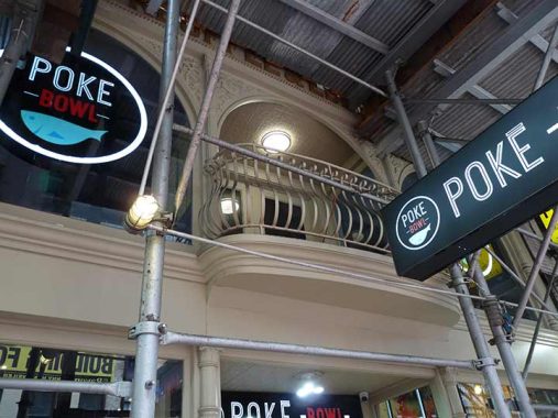
Some of the K&E Building detail can be seen here, in spite of the encasing and impregnable-by-camera scaffolds. The ground floor is currently occupied by Poke Bowl, which is apparently a Hawaiian version of sushi. The only “poke” I knew about in a culinary context is the edible weed Tony Joe White sang about in “Poke Salad Annie.”

American Stamp Manufacturing Inc. is apparently still in business upstairs at #121 Fulton, featuring rubber stamps and “numbering and dating machines.” The distinctive red and yellow sign has been in place for decades.
The sign is a true wonder of old-school delights. In addition to rubber stamps, the sign promotes its buttons, numbers and dating machines (electrical and manual) engraved signs and seals. You can even get your diplomas laminated. All this can be gleaned from this very effective sign. [The Retrologist]


19 Dutch is a 63-story, 758-foot residential skyscraper, with the typical dark glass exterior found on modern “supertalls.” It’s named for the short street it abuts, which is usually fully or partly covered by construction sheds. I did find Dutch Street briefly uncovered in 2019. 19 Dutch is more interesting at the bottom than the skyscraper section.


In 1942, the Fidelity and Deposit Company of Maryland succeeded in building a 7-story center at Fulton and William Streets that looked 20 years older than it actually was. Today the building hosts Pace university and other offices. The “FD” digraph can still be seen on the pediment above the Ionic columns.


#100 Fulton, on the SW corner of William, is not landmarked and so is relatively unchronicled at least in what is readily available to me. It was constructed in the first decade of the 20th Century, and has a subway entrance to the #2 and 3 trains on the William Street side. It too has some interlocking identifying letters above the entrance: RIC, for Royal Insurance Company: the 14-story building originally built for its offices fronts on Fulton Street between William and Gold Streets.


While both its William and Fulton Street entrances also connect to the subway, only the Fulton Street entrance has an old school subway indicator that I’m surprised the MTA hasn’t yet found out about and removed. Do younger riders know what “IRT” means?


John DeLury Square at Fulton and GoldStreet was formed in 2010 when the city made some alterations to the intersection, brought in some large rocks and converted an already-existing public plaza to what you see today. The plaza was formed when preexisting buildings and streets were paved over and eliminated to create the affordable housing called the Southbridge Towers between 1961 and 1971.
The United Sanitationmen’s Association’ union headquarters are around the corner on a surviving section of Cliff Street and in 1968 the Sanitation Workers struck when negotiations for better pay and conditions broke down, creating the second serious strike during the John V. Lindsey administration. The day he took office in 1966, the transit workers closed down the subways and buses for twelve days. Conditions in the streets got so bad that Governor Rockefeller threatened to have the National Guard pick up trash, which prompted other unions to threaten to strike in solidarity. Eventually of course a settlement was negotiated. John De Lury was the longtime union head, from 1956 to 1978.

Old school hardware store sign, #74 Fulton near Gold Street.

I don’t know much about #64 Fulton, corner of Ryders Alley, but I can talk about its beveled-off corner, known as a “chamfer.” It gives residents a better angle looking west on Fulton that a window directly facing the street or the alley have.


All but a short once-block stretch of Cliff Street between John and Fulton Street was eliminated in stages in the 1950s and 1960s. The stretch seen here has been replaced by the Southbridge Towers houses. Cliff Street ran to just north of the Brooklyn Bridge, where it dead-ended north of a short street called Hague. See more of these lost streets on this FNY page.
The section of Cliff Street just north of Fulton likely survived because of this Art Moderne electrical substation. You can tell immediately it was built in the 1930s. Squire’s Diner served as the postgame spread after a Forgotten NY tour of the Seaport area a few years ago.

New York City has formal, informal and completely accidental homages to those who died in the sinking of the HMS Titanic on April 15, 1912. On the corner of Fulton and Water Streets stands a reminder of one of the world’s most infamous naval disasters. The Titanic Memorial Lighthouse was dedicated exactly one year after the sinking and was originally placed atop the Seamen’s Church Institute, a 14-story building at South Street and Coenties Slip downtown. In 1967 the Seamen’s Institute moved and the building was later demolished; the lighthouse, fortunately, was preserved and by 1976, had been installed at its present location. The tall pole at the apex originally had a metal ball that, when signalled by a telegraph at the National Observatory in Washington, DC, would drop at noon daily.
The lighthouse is under some much needed repair and is currently invisible (mid-2025). Here’s what it looks like, from a FNY tour in 2012.


South Street at Fulton is dominated by Schermerhorn Row, which stretches along Fulton all the way to Front Street. The Schermerhorns were a well-established merchant family in NYC in the colonial era. Peter Schermerhorn owned the land here as early as 1792 and began building the Row in 1810, completing it in 1812. It’s been altered considerably over the years; the mansard roof on the South Street corner building, for example, was added in 1868. Today various restaurants and commercial establishments as well as the Seaport Museum are located in the Row.
If I had taken these photos in 1992 the storefront at South and Fulton would have boasted two old-time Seaport establishments, Sloppy Louie’s and Sweet’s seafood restaurants. Sweet’s, which had been founded in 1842, was lost to a vicious nor’easter in December 1992 and 6 years later, Joe Merino, nephew of original proprietor Louis Merino, closed Sloppy Louie’s. Joseph Mitchell explored the then-mysterious upper floors of the building in 1952; his article published that year in The New Yorker became the subject of a collection of his work, Up in the Old Hotel.

A few years ago I noticed that the Seaport area’s retro-19th Century lampposts resembling gaslamps had had a number dealt to them by Hurricane Sandy. I noticed that finally, replacements in the form of these narrow, shorter LED lamps had been installed.
Beside it is one of the few fat high pressure fire hydrants remaining in Manhattan.

I won’t dwell on the Seaport today as FNY has often covered it; I took a number of photos that will make their way to other pages. This building, though, is venerable.
Manhattan’s Tin Building, which has primarily been used as a seafood market, has made several moves during its long life as a commercial building. The Fulton Fishmongers Association first built a wooden market south of the current site along the East River in 1869, then another around the present location near the Brooklyn Bridge in 1894. The current Tin Building was constructed in 1907 and was directly modeled on the 1869 version. In its latest incarnation, it has been reconstructed six feet higher and 32 feet east of that original site.
|
Time was not exactly kind to the structure. There was a massive fire in 1995, and government refrigeration requirements eventually forced the market to move north to the Bronx in 2005, leaving the Tin Building empty and in shambles. Flooding from Hurricane Sandy in 2012 further damaged the facility. However, after nearly a decade of planning and work, it has been transformed into a high-end destination for dining and drink, as well as a consumer-oriented gourmet seafood and grocery market. At 53,000 square feet, it’s the largest enterprise launched by celebrity chef Jean-Georges Vongerichten. It opened in late September [2022], the product of $194.6 million in investment. [NAIOP]
Check out the ForgottenBook, take a look at the gift shop. As always, “comment…as you see fit.” I earn a small payment when you click on any ad on the site.
7/13/25
6 comments
Fish bones, totally. Dove wings, no way.
The daily “Noon Ball Drop” at the Seamen’s Church Institute also took place at the Post Office that once stood south of City Hall where the fountain is currently located in City Hall Park. In those days of spring-wound pocket watches, men would gather on the nearby sidewalks and adjust their watches to match the “official” time as the ball dropped. It is likely a modification of this practice which inspired the New Years Eve ball drop at the New York Times Building at 42nd Street and Broadway.
Kevin, I want to correct something you said regarding the Century 21 Department store. The C21 store originally had a smaller store around the corner on on Broadway (and an entrance on Cortland St for the shoe department) between Dey and Cortlandt Sts. It was so popular that it eventually moved into the store that was vacated by F.W. Woolworth. At one point it further expanded into the vacant space occupied by the East River Savings bank using the Church St entrance. The entrance in the old ESB side faces the WTC site and was heavily affected as a result of the events of 9/11. The entire store was closed and remained so for a number of years until the owners decided to reopen (to the delight of fans across NYC – myself included)). However after many years the company that owns C21 could not keep all of its stores open (Manhattan (2 of them), Queens, Brooklyn (the main store where it all started) and one in NJ and on LI) and closed them all while filing for bankruptcy. It was December a few years ago when the stores closed. Apparently somethings were able to be turned around for them but only the Manhattan store across from the WTC was reopened although the old ESB space was given up and the 4th floor in the old Woolworth space was returned to the building’s owner. It remains a favorite of locals and tourists alike.
Just a historical note – I worked in that area on and off for almost 20 of my 34 year career with one company so I saw this changes happen. I still stop in C21 when I go down to lower Manhattan b
I think the Oculus wings were “inspired” by the General Motors Pavilion at the NY World’s Fair 1964-65.
Have a look.
https://digitalcollections.nypl.org/items/449a9670-c5cf-012f-a056-58d385a7bc34#/?uuid=510d47e2-0756-a3d9-e040-e00a18064a99
Alas! I dropped by #121, and that stamp firm is no longer there. They’re listed on one of the boards in the tiny lobby, but what appears to have been their door sign is lying derelict in the stairwell. Too bad. I have a Bates stamp or two that needs supplies and servicing.
I have always thought that the Oculus “wings” looked more like a whale’s tail.