

HUNTERS POINT, at the extreme west end of Queens abutting the East River north of Newtown Creek, has been visited often by the Forgotten NY camera. In the last 25 years it has undergone a complete transformation, from a mixed use industrial/residential region to a wealthy region dominated by high rises, especially along Center Boulevard (I do not know why this relatively new road was called “Center Boulevard”; logically it would be “West Boulevard.”) This transformation has added public amenities such as Gantry State Park and a new avant-garde library, which I will touch on. I last walked Hunters Point Avenue, the road connecting Hunters Point with Blissville, back in 2012. In June 2026, the light bulb in my head went off and I thought I would walk the road in its entirety, including its western end, 49th Avenue. The contrast in architecture and infrastructure is striking. I began at the Vernon-Jackson #7 station, headed west to Gantry, then east on 49th/Hunters Point Ave., and then Greenpoint Avenue back to the 46th Street station. The Hunters Point/49th Avenue photos alone total over 200, so I’ll be splitting things up: two pages for 49th/Hunters Point, and separate pages down the road for Hunters Point and Gantry state and for the Blissville/Sunnyside stretch of Greenpoint Avenue.
Some of the images are somewhat dull, as an overcast dominated the first leg of my walk.
GOOGLE MAP: 49th/HUNTERS POINT AVENUES
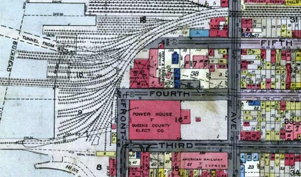


Hunters Point’s (I’ll leave out the apostrophe for expediency; I have seen the word with and without) railroading past has almost completely been eradicated. Compare this 1919 map excerpt to the parkland and high rise apartments that have replaced all of the freight railroad tracks. a pair of barge transfer gantries have been preserved at the water’s edge. Goods were floated across the river on barges, and transferred to a spur of the Long Island Rail Road at water’s edge in Hunters Point. When the park was built, the designers placed railroad tracks in the same spot where they used to run to the waters’ edge. Over time, Gantry Plaza State Park was gradually expanded so it now runs along the East River from the Gotham Point complex at 57th Avenue north to Anable Basin. The park incorporates Hunters Point’s famed Pepsi Cola neon billboard. Years ago, in the 1990s when the park was smaller, I was shooed off my bicycle here by a park ranger. Parks advocates are much friendlier toward bicyclists now.
Until relatively recently a narrow rail spur, a far cry from its heyday, traveled west to the waterfront north of 48th Avenue. Today, that open cut has been filled in and the spur track ends below Jackson Avenue. That is visible at the top of the map excerpt.
Eliphalet Nott, inventor of the anthracite coal stove and founder of upstate (Schenectady) Union College, along with Neziah Bliss, purchased the estate of the Hunter family, which owned much of Hunters Point’s territory, in 1835. Bliss set about founding Hunters Point, Greenpoint, Brooklyn, and a small eastern hamlet called Blissville, and laid out the street grids of both Greenpoint and Hunter’s Point, which mirror the grid of Manhattan across the river. Until the Queens Topographical Bureau determined a street and house numbering plan for all of Queens in the 1910s and gradually implemented it for the next two decades, Hunters Point had its own street numbers; 49th Avenue used to be Fifth Street.


The new Hunters Point Library sits at the west end of 49th Avenue at Center Boulevard. When it was first built, I poked fun at the design, but I have to say that I’m more openminded about interesting and intriguing building designs, especially with all the boring glass towers popping up all over town. (Hunters Point has mostly been spared these, but neighboring Queens Plaza hasn’t.) The library is a gray box with seemingly random window “cutouts.” The library, designed by Steven Holl Architects, opened in 2019. A word with a security guard in the foyer vouchsafed me an interior photo. American Institute of Architects (I wish they’d publish a new guide to NYC; the latest was 2010) has some more interior views.
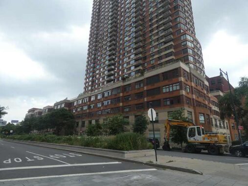
48th Avenue has a center median between Vernon and Center Boulevards, and the Queens West high rise sits atop the right of way of the former rail spur.
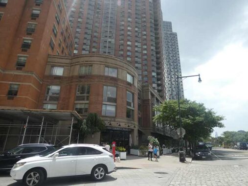
A rare low-rise Hunters Point building at 49th Ave. and Center Blvd. amid the Queens West development, hosing the American Brass restaurant. It was built in the 1990s, but looks older than that. Note the retro-Belgian blocks in the roadbed.


Some excellent residential design that combines high density with handsome esthetics such as brick exteriors and large, square windows. The ground floor is punctuated with artwork by South African muralist Keya Tama. This is part of Jasper, a mixed use complex fronting on #49-20 5th Street (where its glass front can be forgiven). It’s so new, neither Google Street View or Open Street Map show it (as of July 2026).
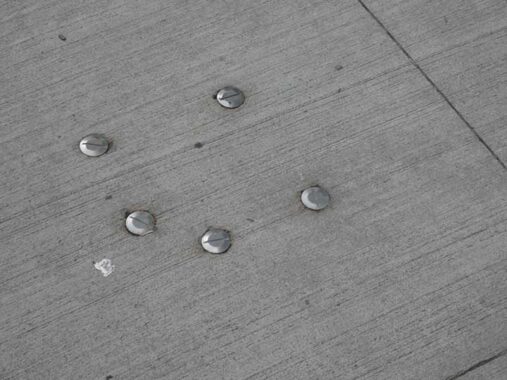
The large screws embedded in the sidewalk baffle me, though. If anyone can explain, Comments are open.
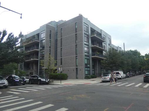
“Developed by Milestone 49th Avenue LLC and designed by Gerner Kronick + Valcarel Architects, [The Gantry] was completed in 2006. It features a gray façade with deep balconies and metallic siding, inspired by its namesake riverfront sign. The building is also known as 5-15 49th Avenue.” One of a number of structures in Hunters Point named for the waterfront gantries, this building is something of an intermediate design between glass fronted, narrow-windowed residences adn newer designs featuring very wide, squarish windows.
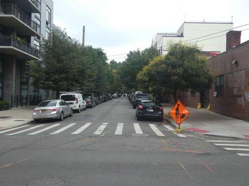
East of 5th Street, 49th Avenue gains a verdant canopy, which dominates it until its junction with Jackson Avenue at the Pulaski Bridge to Brooklyn.
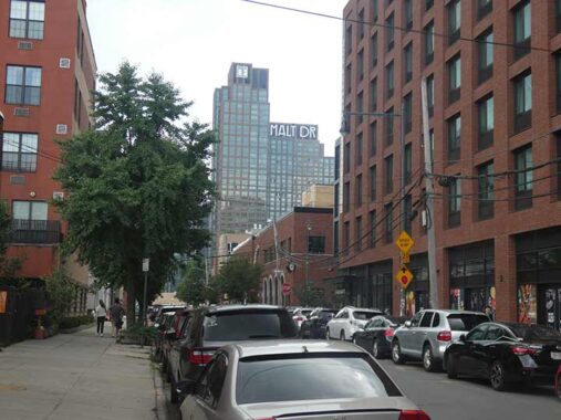
Malt Drive is the name of a new luxury tower, street and park at the south end of Hunters Point, in this view south on 5th Street. Sergey featured it here in December 2024.
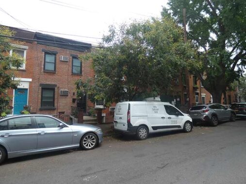
East of 5th Street, 49th Avenue settles down somewhat. Here we see simple attached tw-story brick residences, similar to those seen in Brooklyn’s Gowanus region (where some have three floors).
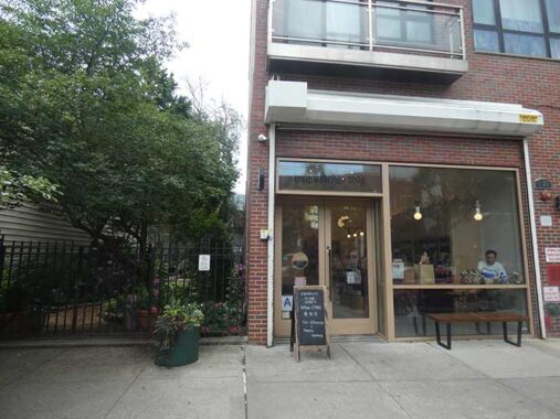
I don’t have much culinary range, so I had to look up what “banchan” is, as in the Little Banchan Shop, #5-28 49th Avenue. The Google AI robot: “small, shared side dishes served alongside cooked rice in Korean cuisine. Meant to be eaten in alternating bites with rice, soup, and main courses, they range from fresh and pickled vegetables to braised meats and savory pancakes.”


Next door is the Long Island City Community Garden, one of the few green spots in the area before Gantry State Park was expanded. Urbanists, increasingly influential in urban planning, now consider these small vest pocket parks as wasted space, and would rather build large multifamily dwellings to replace them.


Mutual Hardware, in business since 1935, has moved north to Vernon Blvd. and 36th Avenue, but this is its former office, as indicated by black plastic lettering on the white facade. I wish I knew more about this building on 49th west of Vernon Boulevard, which stands out with its arched entrance, Corinthian pilasters and pure white paint job.
Vernon Boulevard
Vernon Boulevard was not named for George Washington’s Virginia mansion, Mount Vernon, but for Revolutionary War figures Samuel and William Vernon:
“Ebenezer Stevens, born on August 11, 1751 in Roxbury, Massachusetts, died on September 2, 1823, in Rockaway, New York and is buried in Astoria. He was a lieutenant colonel in the Continental Army during the American Revolution, a major general in the New York state militia in the War of 1812, and a New York City merchant.
|
His training as an officer in the artillery gave him an unparalleled opportunity to be at more pivotal points of the Revolution than anyone, excepting perhaps only George Washington. His distinguished record included Bunker Hill, the British surrender at Saratoga, and war’s end at the Siege of Yorktown. He served with distinction under Nathanael Greene, Marquis de Lafayette, and George Washington.
|
It was after fleeing from the Boston Tea Party that he found shelter with his friends, Samuel and William Vernon, merchant bankers of Newport, Rhode Island, and leaders in the resistance to the taxation policy of Britain. He would never forget their kindness.
|
At war’s end Stevens moved to Astoria purchasing much of the Hallett Farm they lost as a penalty for supporting the British. He was also one of the first to see the Treaty of Paris (ending the War of Independence) as it was delivered to New York, then the seat of government, by neighbor John Delafield.” — Bob Singleton, Greater Astoria Historical Society


Built in 1887 by pre-eminent church architect Patrick Keeley, St. Mary’s Church, Vernon Boulevard at 49th Avenue, with its distinctive clock steeple, was the tallest structure in Hunters Point, other than the Pennsylvania RR powerhouse smokestacks (removed in 2005), for over a century until the Queens West development of the 1990s. The church is built from brick and brownstone in a simple Gothic design, featuring multiple pointed arches across the façade on Vernon Boulevard, and a tall steeple that rises several stories. Clad in gray slate, the steeple houses clocks on each side, and marks the skyline as it rises over Vernon Boulevard.
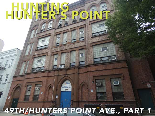
The church’s old grade school (now Long Island City Early Childhood Center) and Lyceum (now the St. Joseph Center) can be found on 49th Avenue adjacent to the church.
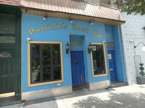
Dominie’s Hoek (Hook), originally the western end of the town of Newtown, was originally settled when a tract of land was awarded to Everard Bogardus, a Dutch Reformed minister (dominie), in 1643. The land was later owned by British sea captain George Hunter and by 1825 had become known as Hunter’s Point. It began the transition from rural farmland in the 1860s when the Long Island Rail Road built a terminal that would be its primary connection with Manhattan until the East River tunnels and Pennsylvania Station were built in 1910.


On Vernon Boulevard you can find some interesting business signage. The Vernon Grille sign is rendred in Times Roman, but note the “V” formed by a knife and fork.


I was tipped about this ancient sign at 49-10 Vernon Boulevard in the recent book by Bill Helmreich, The Queens Nobody Knows (sadly, Helmreich, who I met by serendipity on a tour in Fordham in 2018, passed away in 2020). The family of Italian immigrant Antonio Mora marks the spot at #69 Vernon Avenue, now 49-10 Vernon Boulevard, where Mora maintained his coal and ice business after immigrating from Italy in 1897. How long this sign has been here, I have no idea, but I never noticed it on previous trips down Vernon Boulevard, which have been often.
Notice the telephone exchange, HUnterpoint 0677. By 1940, the Monas were operating a clothes cleaning business at 49-10. Terri Mona Adams was a Navy veteran and a lifelong Hunters Point civic advocate.


49th Avenue encounters Jackson Avenue at the ramp to the Pulaski Bridge spanning the noxious and noisome Newtown Creek. Jackson Avenue is the western end of Northern Boulevard, or, more properly, Northern Boulevard is the east end of Jackson Avenue. It was built in the 1850s as a toll road from the waterfront to the Flushing River and was named for its engineer, John Jackson. By 1920 the section east of Queens Plaza was renamed Northern Boulevard, which also incorporates routes east of Flushing as NYS Route 25A.
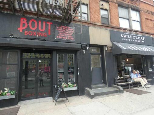
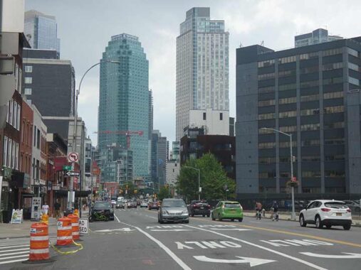
I really should re-walk Jackson Avenue since my last in depth look came in 2010. Especially in its east end near Queens Plaza, multiple glassy high rises have sprung up, which contrast with these older buildings from the late 19th century.
Bout Boxing replaced the Creek and the Cave (now in Austin, TX), a popular venue as a comedy club and Mexican restaurant where I gave a powerpoint show donkey’s years ago. Sweetleaf, which is where I fueled with hot chocolate before some Hunter’s Point Forgotten NY tours, remains in place.
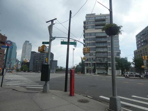
I don’t have a detailed map of Queens streetcar lines but this abandoned iron trolley pole, Jackson Avenue at 11th Street, once supported power lines for either the Steinway Railway’s Steinway Street Line or 31st Street Line, both of which ran along Jackson Avenue. Both lines were abandoned in 1939.
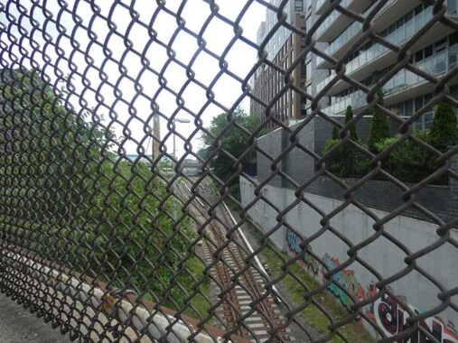
A Long Island Rail Road spur from Sunnyside Yards originally connected to gantries on the East River. Most of the right of way has been made into a playgrounds and parks. Vernon Boulevard was formerly carried by a trestle bridge over this railroad spur; the trestle survived until 1993. The spur now ends beneath Jackson Avenue.


Once again, apologies for the dull photos on a lead gray day. I have used the Pulaski Bridge a number of times to get from Hunters Point to Greenpoint (and in reverse), and likely on bicycle a few times. About a decade ago, a protected bicycle lane (by a jersey barrier) was vouchsafed, so bikes and walkers don’t have to compete for space.
I have never seen the bridge identified by a small green street sign before. The bridge is connected to local streets without parkway or expressway ramps.
Next: Hunters Point Avenue, which isn’t in Hunters Point
Check out the ForgottenBook. As always, “comment…as you see fit.” I earn a small payment when you click on any ad on the site.
7/10/26
5 comments
We moved to Hunters Point in 2000. Vernon Blvd had maybe 3 old school restaurants. You could have bowled down it any night, it was so empty. It was an eclectic mix of industrial, residential and a couple of artists. 5 Points was initially Fun Factory (sp) graffiti. Dominie’s Hoak was the first “new” bar to open.
Similar to the sort of development in what’s called “West Loop” in Chicago, and for pretty much the same reasons.
Good lord, “The Gantry” apt. building is one of the ugliest things I’ve seen. Modern Brutalist? Or Retro Soviet revival? Definitely looks like East Germany.
I remember Hunters Point from the late 1950’s and lived thorugh all the changes/evolutions to now. The rail car floats were in use until somewhere in the 1970’s. It was always intersting to watch the process. My father related to me that, as a boy, he was fascinated by the activity at the floats and small rail yard. In particular, he recalled a small building, slightly larger than a telephone booth, at 5th Street where it crossed the railroad tracks. It housed a mam who would come out and swing a lantern to stop vehicular traffic whenever a train would roll across from the rail yard to the spur, juset like in Lionel train set. The bridge that carried Vernon Boulevard over the LIRR tracks had not been painted for as long as anyone could remember and was a terrible eyesore. I was on the Board of the Long Island City Busiess Developent Corporation, and we pushed for a long time to gete it painted. While I do not recall who did it, the bridge was finally painted. It looked really good, but withinn a year it was dismantled and the railroad cut was filled in!
If I rememember correctly, a massive part of the waterfront, from Newtown Creek northward, was accumulateds by the Port Authority of New York and New Jersey for future commercial development. Over time, it was determined that the Port Authority was not going to pursue it, and it fell to New York State, which favored creating a new residential area. At the beginning, it was a “hard sell” to convince anyone to invest in residential development in that area. To make it more attractive, Governor Mario Cuomo created Gantry State Park, to offer a green space for the pioneers who moved into the first buildings. The park proved its value and has grown considerably, as has the residential population.
I also remember the remains of the bridge that ran from Vernon Boulevard across the train yard, and Newtown Creek, and connected with Manhattan Avenue, in Greenpoint. After the Pulaski Briege was opened in 1954, the old Vernon Avenue/Manhattan Avenue Bridge was torn down……almost completely. For some reason (possibly because it was immediately above the Queens Midtown Tunnel and demolition was tricky) the approach ramp at 50th Avenue to Borden Avenue was left standing, with a fence across the cut-off end. This two block oddity was used as a parking lot for years, until it was eventually torn down. It was replaced by the small park and parking area that is there today.
As a kid taking the 7 train from Flushing in the 70s/80s, mostly on weekends for various jaunts to “the City”, I remember Hunters Point and Vernon-Jackson stations as the ghostly stops where seemingly no one ever got on or off the train. Am guessing that’s not exactly the case anymore….