

HERE’S the Richmond Hill LIRR elevated station on the Long Island Rail Road Lower Montauk Branch in 1997. When in the next year I heard this line would be mostly closed to passenger service in 1998, I resolved to catch one of the last runs with MP72 cars from Jamaica to LIC that stopped at every intermediate station. By that time the line had only a handful of paying customers in the few morning and evening runs.
Richmond Hill was the only station marked by a sign and had a platform. The Glendale, Fresh Pond and Haberman stations were mere clearings by the tracks. On my ride it reminded me of a run in the country as people stood by the tracks and waved. The ride cost over $4, which was expensive in 1998. After March 1998 the Montauk tracks were used for a couple of daily express runs from LIC to Jamaica, but those were ended in 2010, after which all LIC service went through Hunters Point Avenue and the Sunnyside yards. Photo: Julia Sanchez in the Only Classic NYCTA Subways, Buses, LIRR, Metro North and PATH Facebook group.
Inspired by the photo, I resolved to dip into my own FNY archives as well as Google Street View and cover the Lower Montauk from Jamaica west to its terminal in Long Island City.
First, a bit of history. Trains have run on the Lower Montauk route from Jamaica to LIC since 1867; the route was incorporated in 1862, the year the Civil War began, as the South Side Railroad of Long Island. Following its lease to the LIRR in 1876, it became the LIRR’s Southern Division and was reorganized as the Brooklyn and Montauk Railroad and then the LIRR Montauk Division, becoming officially part of the LIRR in 1889. My guess is that trains that ran the route to Jamaica then continued east the 100 miles to Montauk Point: hence the name West of Jamaica, the line came to be called the Lower Montauk Division. Unlike every other LIRR branch running through Queens, it was never electrified with a third rail and has employed diesel-powered engines. The reason why passenger service was discontinued was given as poor patronage (by 1998, few used its morning and evening runs) but also, when new double-deck diesel-powered engines were purchased, they required high-level platforms, and the LIRR had neither the inclination nor the cash to build them for the little-used branch.
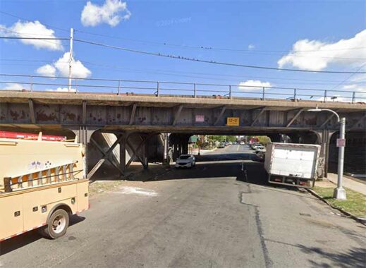
The Lower Montauk Branch diverges from the Jamaica Yards at the Morris Park Engine Shop west of 130th Street and proceeds west on an elevated trestle as far as Forest Park. Here, it crosses 89th Avenue east of 121st Street.
The entrance to the elevated Richmond Hill station was a staircase catercorner to the intersection of Lefferts Boulevard and Jamaica Avenue. The steps have since been removed, preventing anyone scuttling about with a camera from possibly attaining the platform; in any case, the steps have been removed as well. This is an unusual intersection as the tracks of the Jamaica El (J train) raised to a relative high position, taking them above the Lower Montauk structure. I still feel this has potential as a transit hub in case the LIRR here is ever restored to passenger service.

The last time a large group of people were milling about on the elevated station was during the LIRR fantrip in September 1999. The MP-72 unit was typical of the train cars that would stop at this station in its final days. I always mourn the end of local train service; I feel it’s a lot of potential wasted and if the MTA wanted to upgrade the tracks and build real stations, not only here but on the Rockaway and Bay Ridge branches, those routes could make money. But I am a railfan.
For you Facebook people, here’s a short video depicting Richmond Hill platform in 2025. If service ever returns, a lot of rehab is necessary. It won’t embed, so simply copy and paste the URL into another window.
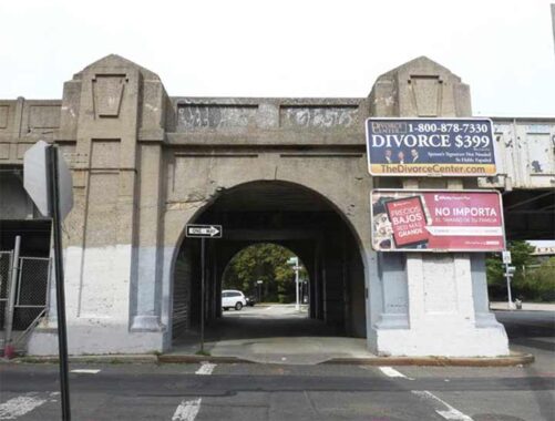
At Hillside Avenue, a major route to the middle of Nassau County, the trestle was given a grand concrete bridge, and inscribed on each side is a keystone symbol. The LIRR was run under the auspices of the Pennsylvania Railroad from 1900 to 1949, and in those years, the LIRR signage adopted the “Pennsy” keystone symbol, since Pennsylvania is called the Keystone State. Until 1955, the LIRR’s chuffing steam engines all carried a keystone plate on their noses, when the last steam engine was retired from active service. One of their complement, Steam Engine #39, is exhibited, Pennsy plate included, at the Railroad Museum of Long Island in Riverhead.
Surprisingly, few Pennsylvania Railroad relics, aside from the name of the main terminal in New York City, remain from the LIRR’s Pennsy days; this is one of the few.
A pair of streets named Babbage and Bessemer accompany the elevated Lower Montauk in Richmond Hill. They’re discussed on this FNY page.
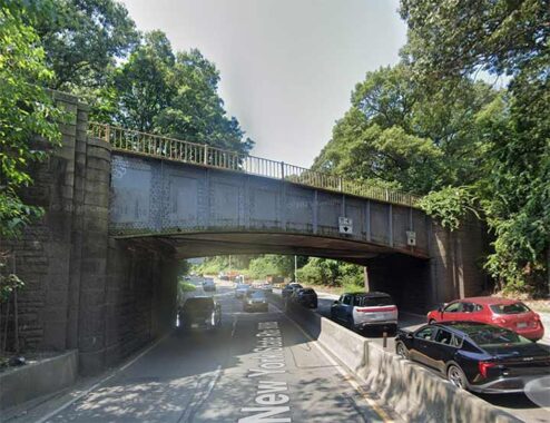
It’s unusual for an active railroad to go right through a park but that’s what the Lower Montauk does, running through Forest Park and bridging over the Jackie Robinson Parkway, built in 1932 as the Interborough Parkway from East New York to Forest Hills.
Forest Park was actually created by the city of Brooklyn in 1895, with the city’s Parks Department buying up acres of forested, pretty much unused property, hence the name. It’s among the more ‘natural’ of our big parks, with about 165 acres left as woodland, interspersed with marked trails. The park was surveyed by Frederick Law Olmsted, the co-developer of Central and Prospect Parks and much like the parks and natural reserves of Staten Island, Forest Park contains several nature trails ‘blazed’ or marked for the ease of hikers, and also boasts a bridle path.
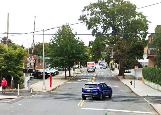
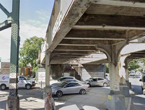
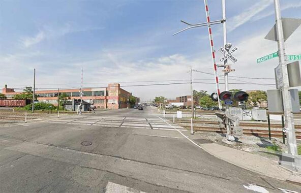
88th Street (formerly Van Dine Avenue) also has a grade crossing at the Montauk branch, between 76th and 77th Avenues, one block west of Woodhaven Boulevard (which is bridged over the tracks). This is the furthest east grade crossing on a public street on this line. Neighborhood residents have called for it to be eliminated, citing potential increased freight traffic here, but it hasn’t materialized, and the tracks still cross at grade. The line continues mostly at grade west to Long Island City, and has the lion’s share of grade crossings in NYC, though mostly not on major roads. There is a crossunder or two, as we’ll see.
Like Grand Street and Grand Avenue, which run from Williamsburg to Maspeth, Cooper Avenue is called a “Street” in Brooklyn, but once reaching the (undefended) Brooklyn-Queens borough line at Irving Avenue, it becomes an Avenue. It widens gradually and runs in a northeast route through Ridgewood and Glendale and eventually knocks on the door of Forest Hills as it ends at Woodhaven Boulevard. It is a very old road…it takes exactly the same route as the Road from Bushwick to Newtown as shown on this 1852 Dripps map of Brooklyn and Queens.
The origin of the name isn’t mentioned in any of my sources, but my guess is industrialist/philanthropist Peter Cooper, whose name loomed large in 19th-Century Brooklyn and Manhattan. He had a glue factory on Newtown Creek.
The Lower Montauk branch passes busy Cooper Avenue just east of the Glendale station, but long ago Cooper Avenue, like Flushing Avenue (see below) was depressed under the tracks, and becomes something of a speedway here. The road and underpass were treated to a reconstruction early in the 2010s. According to railroad historian Art Huneke, this underpass was built in 1935. There’s a staircase to the dead end section of Cooper on the surface, and another staircase that currently leads nowhere. See this FNY page for more scenes from Cooper Avenue and Glendale.


I have discussed the Glendale station rather often in Forgotten NY, as it’s relatively isolated and anyone passing here would find it odd that a LIRR station was ever located here, at Edsall Avenue and 73rd Street, at the south entrance of Lutheran/All Faiths Cemetery. The two buildings shown here on Edsall Avenue were at one time hotels serving travellers exiting at Glendale: The former Woods Inn, or Kirschmann’s saloon (1906), on the left and the even older George Gundolff’s Hotel (1830s) on the right. Now they are private homes and the residents may have no idea of the buildings’ former use. Both have been resurfaced and no longer look very much as they were when built.
The station was a mere clearing by the east and westbound tracks. I do seem to recall a standard issue black and white LIRR platform sign when I rode the line in 1998, but it has of course been since removed. What hasn’t been removed is a very old matallic sign saying it’s dangerous to cross; the sign appears to be many decades old.
It can be said now, as the statute of limitations is long past, that back in 1999 or 2000 I broke the law by walking the Lower Montauk tracks between Glendale and Fresh Pond. The line had been closed by then, it was on a Saturday and the exit at Fresh Pond had not yet been sealed off (see below). I was taking a chance, as I could have been spotted by cops or even encountered a fast moving freight which may have necessitated some fancy footwork. I did get a couple of valuable photos of the line I still consult today, perhaps 25+ years later.
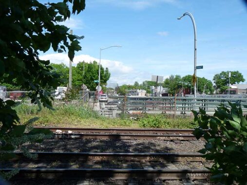
West of here, the Lower Montauk traverses the Fresh Pond Junction, where the NY & Atlantic Bay Ridge Branch becomes the NY Connecting RR. This is the site of the proposed IBX light rail that would connect Bay Ridge and Jackson Heights, with planned transfers to many subway routes. Many in the area question the necessity of the line and believe bus transfers to subway lines work fine.
Mafera Park in Ridgewood has a fine (and legally located) view of the truss bridge that takes the Bay Ridge branch above the Lower Montauk.
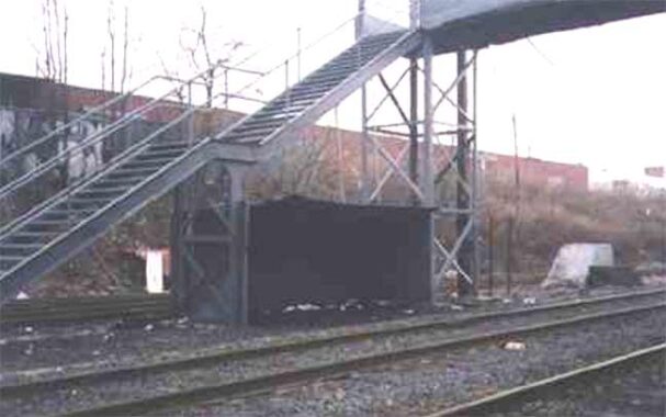


This batch of photos was obtained in 2005 (hence their small size), when the very obscure entrance to the former Fresh Pond station was still open. The sign, installed in 1998 announcing that the station had closed, was in place until 2012, along with the one at Richmond Hill! The station was attained via a narrow opening on Metropolitan Avenue east of Fresh Pond Road and then along a garbage-strewn walkway until a rickety iron pedestrian bridge leading down to the tracks. On the eastbound side there was an equally rickety metal shack to protect against the elements.
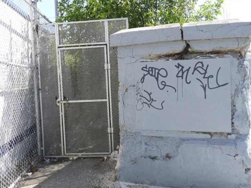
Most recently, the former entrance looks like this, protected by a locked iron gate.
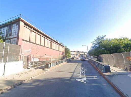
West of the Fresh Pond station, the Lower Montauk enters southern Maspeth in a region where most of the streets are numbered 60 (if not 60, then 59). There is a small grouping of streets around Metropolitan Avenue where there are named streets. One of these, Andrews Avenue, crosses the Lower Montauk in a relatively new (about 25 years) bridge.
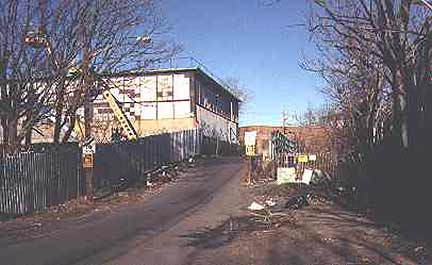
I remember, though, the mid-1990s when the Andrews Avenue Bridge was a trash-strewn rattletrap (left).
|
|
Also at the Andrews Avenue Bridge, the LIRR Bushwick Branch, freight-only now but actually a former passenger line, branches off and runs west to Bushwick Place.
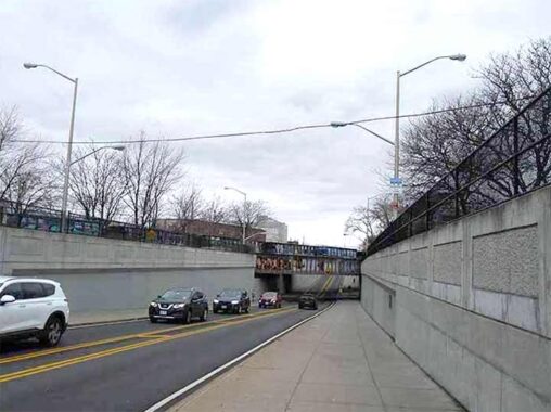
Flushing Avenue is crossed by two sets of railroad tracks, the Lower Montauk and Bushwick Long Island Rail Road lines. While traffic was controlled by a simple set of crossing gates and a diamond-shaped warning sign in the early 20th Century, the crossing in 2010 is a little more complicated than that. In the 1960s Flushing Avenue was depressed in a traffic underpass to allow Lower Montauk Line train traffic. Here we see the tracks from the surface dead ends of Flushing Avenue; the road continues through in an underpass. Note the now-rare extended two-mast Deskey lamppost; a few can be found on Flushing Avenue in the area.
The freight Bushwick LIRR branch, meanwhile, runs over the depressed roadway on an iron bridge and local Flushing Avenue traffic must stop if a train is crossing at this point. In 2009, the Bushwick was somewhat upgraded with new signals, and its (usually garbage-strewn) right of way was cleaned up.
The Lower Montauk line has yet another grade crossing at Maspeth Avenue. Over the years, so many landmarks in the general vicinity have been lost: in 1933, DeWitt Clinton’s house, which faced Newtown Creek before its industrialization and when it was a fresh waterway, burned down (its location was marked with a sign placed by the Newtown Historical Society); St. Saviour’s Church; and the venerable Clinton Diner (seen on this FNY page), renamed the Goodfellas Diner before it suffered two devastating fires and now is a deteriorating hulk that has the Blur of Anonymity on Google Street View.
Here, the Lower Montauk tracks share space with railroad tracks that served local businesses in western Maspeth south of 56th Road and north of Grand Avenue. Most of these tracks are now inactive. There used to be a passenger station at Maspeth Avenue, many decades ago, but I can’t find a photographic trace on any map or photo.


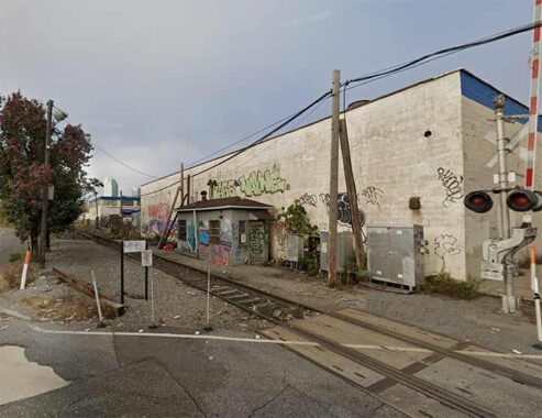
Proceeding west along the Lower Montauk tracks on 56th Road, the next stop was the oddly named Haberman. As with Glendale and Fresh Pond, this is all that remains of what was once the Haberman LIRR station at 56th Road and 49th Street (formerly known as Debevoise Avenue). According to the late LIRR historian Vincent Seyfried the station originally opened in 1892 and was named for the Haberman Steel Enamel Works in Berlin Village, a name formerly applied to this section of town, which featured a number of German immigrants.
In 1893, trains from Rockaway Beach ran on the LIRR Southern Division to the Long Island City terminal, where a ferry could be accessed to Manhattan, then as now. Near the Haberman station, Berlin Village, occurred one of the worst train crash disasters in the railroad’s history.
The crash had occurred near the Haberman Manufacturing Company. Mr. Haberman and his staff arrived at the scene, and volunteered the factory as a makeshift hospital and morgue. A call went out to all of the doctors in Long Island City, and as doctors and ambulances began arriving at the scene, so too did officials from the railroad. Relief trains arrived, and began loading the most severely wounded up for transport to local hospitals. Chaplains and priests also began arriving, some had been on the trains, and began offering spiritual help to the dying and wounded. [Brownstoner]
A monument on Green-Wood Cemetery in Brooklyn commemorates Oscar and Maggie Dietzel, who perished in the crash. The monument features limestone sculptures, sadly deteriorating from the elements, depicting the crash. Oddly enough, the Dietzels are (apparently) not interred at the monument, but instead in All Faiths/Lutheran Cemetery.


A pair of views of the Lower Montauk line from the New Kosziuszko Bridge walkway, which opened in mid-2019. Naturally, FNY was on top (sorry) of things. Here, the line parallels the noxious and noisome Newtown Creek. Calvary Cemetery can be seen on the right side of the photo.


A trio of views from various decades of the Penny Bridge station, at Review Avenue and Laurel Hill Boulevard across from the southern Calvary Cemetery entrance. The station had been named for a series of bridges that crossed Newtown Creek, connecting Review and Meeker Avenues; according to legend, toll takers collected a penny to cross it at least through part of its history. The bridge was removed after the first Kosciuszko Bridge was built across the creek in 1939. At best, the “station house” was a shack by the side of the tracks. Like its namesake bridge, it served cemetery-goers on the Queens side of Newtown Creek. It was open off and on from 1857-1880, and then continuously from 1883-1998. LIRR historian Art Huneke shows multiple vintage maps showing the station and others along the Lower Montauk.
Though Greenpoint Avenue travels over the nasty Newtown Creek on the J.J. Byrne Bridge, it does have a local section that runs down to the creek and is duly grade-crossed over the Montauk tracks. Here, the Lower Montauk, single-tracked here (which prohibited greater passenger service) passes through a small Queens neighborhood called Blissville. The shack for RR personnel hasn’t been used in many a year.
Blissville is the small wedge of Queens positioned between Newtown Creek, Calvary Cemetery and the Queens-Midtown Expressway; it takes its name from Neziah Bliss, inventor, shipbuilder and industrialist who owned most of the land in the 1830s and 1840s. Bliss, a protégé of Robert Fulton, was an early steamboat pioneer and owned companies in Philadelphia and Cincinnati. Settling in Manhattan in 1827, his Novelty Iron Works supplied steamboat engines for area vessels. By 1832 he had acquired acreage on both sides of Newtown Creek, in Greenpoint and what would become the southern edge of Long Island City. Bliss laid out streets in Greenpoint to facilitate the riverside shipbuilding concern and built a turnpike connecting it with Astoria; he also instituted ferry service with Manhattan. Though most of Bliss’ activities were in Greenpoint, he is remembered chiefly by Blissville and by a stop on the Flushing Line subway (#7) that bears his family name; 46th Street was originally known as Bliss Street.
On this page, FNY discusses NYC’s handful of grade crossings, including those on the west end of the Lower Montauk. For many, I went forth on a snowy day in January.
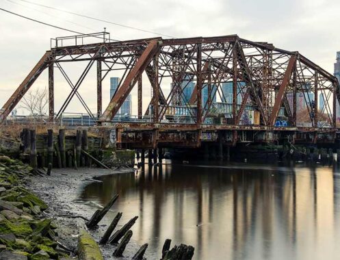
The Lower Montauk line is bridged over just one body of water along its route, Dutch Kills, on a swing bridge constructed in 1893 known as the DB Cabin Bridge or the Dutch Kills Swing Bridge. For the past several decades, the bridge has been stuck in its present position but in the past, it could swing perpendicularly to permit shipping into Dutch Kills. Art Huneke has some photos of the bridge in an open position, as well as vintage photos of steam powered trains and the former trainyard that adjoined the bridge. “DB Cabin” was just that, a small cabin for train personnel, marked with the letters “DB.”
Two RR bridges cross Dutch Kills. The other one is the Cabin M Bridge that carries Montauk Cutoff tracks north, connecting the Lower Montauk with Sunnyside Yards. It has actually been posited as an elevated park, but so far no concrete plans have been engaged.
In addition, photographer/historian Mitch Waxman has written extensively on both bridges in the Newtown Pentacle.


The LM crosses one more grade crossing before its terminal at Long Island City, on 11th Street beneath the Pulaski Bridge connecting Hunters Point and Greenpoint.
Dominie’s Hoek (Hook), originally the western end of the town of Newtown, was originally settled when a tract of land was awarded to Everard Bogardus, a Dutch Reformed minister (dominie), in 1643. The land was later owned by British sea captain George Hunter and by 1825 had become known as Hunter’s Point. It began the transition from rural farmland in the 1860s when the Long Island Rail Road built a terminal that would be its primary connection with Manhattan until the East River tunnels and Pennsylvania Station were built in 1910.
Between 1853 and 1861, substantial progress was made in creating the town of Hunter’s Point. Streets were laid out, buildings were erected, and a ferry service to Manhattan was begun. With ample available land, few existing residences, and excellent barge access via the East River and Newtown Creek, industries, eventually including railroad yards, oil and kerosene producers, and paint and varnish manufacturers, began to move to the Hunter’s Point area. New rail service on the Long Island Rail Road to Long Island City began in 1861. If the proprietors of those long gone businesses in Hunters Point could come back and see it today, they would not recognize the high rise haven it has become in the early 21st Century, with more high rises on the way.
At 11th Street there is actually a track junction. Looking east under the bridge, the track on the left leads to the Hunters Point Avenue station and goes through Sunnyside Yards to the LIRR Main Branch. The track on the right goes through Blissville, Maspeth and Glendale, connecting with Jamaica where it meets the Main Branch, as we have seen.


The Long Island City station is the western terminal of the Lower Montauk and also the terminal of LIRR trains proceeding through the Hunters Point station through Sunnyside Yards to the main line. Today, it’s mainly a layup yard, but does originate and terminate about a dozen passenger runs from Monday through Friday. Interestingly, its lone platform has nonstandard LIRR signage that nonetheless gets the job done. This was the LIRR’s western terminal in Queens from 1862-1910, when Penn Station opened. The reliable Art Huneke—88 years old in 2025—has vintage photographs.
Ferry service to Manhattan and Brooklyn was restored in the 2000s, and if it’s beefed up to any degree, who knows, LIC may become a major train hub again. With so many new residences going up, “affordable” and otherwise, I think it should.
Check out the ForgottenBook, take a look at the gift shop. As always, “comment…as you see fit.” I earn a small payment when you click on any ad on the site.
1/22/26
2 comments
WHEN THE RB &BB CIRCUS WOULD COME TO TOWN IN THE LATE 70’S THEY WOULD STOP IN GLENDALE. THEY USED TO UNLOAD SOME OF ANIMALS TO GIVE THEM SOME EXERCISE. I WORKED NEXT DOOR AND WATCHED ON MY LUNCH BREAK AS THEY WALKED THE CAMELS AND ELEPHANTS,
If this line had a tunnel to Manhattan, perhaps then it could be revived with all of its stations.