
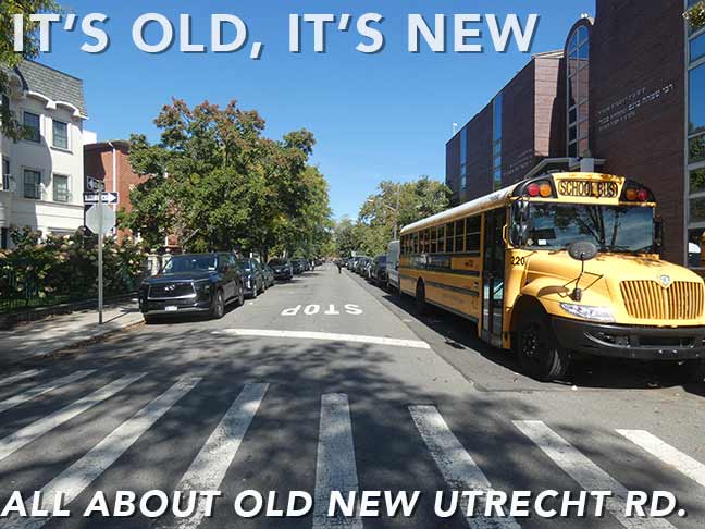

It has been 26 years since I explored a favorite road going way back to when I lived in Brooklyn, Old New Utrecht Road. I don’t know when I first discovered it: it could have been as early as the 1960s, when I visited relatives who lived at 13th Avenue and 50th Street, and the old road crossed 50th Street a few blocks away. It could have been when I began to seriously explore Brooklyn by bicycle in the 70s, or it could have been when I rode past it on the B11 bus going up 50th Street (though I did not use that bus often). What I seem to remember is that it wasn’t paved (that seems to be corroborated by locals who were around decades ago). I was fascinated, also, by the nomenclature of beginning a place name with the juxtaposition of “old new” (Julia Louis-Dreyfus’ comedy vehicle between “Seinfeld” and “Veep,” “The New Adventures of Old Christine” comes to mind.) I can’t think of any other place names called “New Old” or “Old New” anywhere.
The “Old” comes from this being an old road, and the “New” from New Utrecht, one of Kings County’s original five towns going back to the 1600s. The town of New Utrecht was named for Utrecht, Netherlands, the 4th largest city in that country. In Dutch, “Utrecht” is derived from two words that mean “old fort,” so that “New Utrecht” literally means “New Old Fort.” I’ve also been fascinated with New Utrecht Avenue because as a kid I thought it had a funny name and was completely shrouded by an elevated train. A few years ago, I walked its full length. I have covered New Utrecht and its other Brooklyn namesakes fully throughout the years beginning in 2000, but I am still drawn to it; this time, I desired to put it in its modern-day Borough Park context. In 2000, did I ever think I’d still be writing Forgotten New York daily 26 years into the future?
Why, yes. Yes, I did.
GOOGLE MAP: OLD NEW UTRECHT ROAD AND BOROUGH PARK


Add Avenue I on the BMT Culver Line (F train) on McDonald Avenue as transit stations where I begin a walk, since I’m not sure if I have ever gotten off the train here before. Even as a kid I didn’t bicycle much on Avenue I, preferring the business sections in Midwood on Avenues J and M, which had more interesting things to take note of. Infrastructurally, the platforms have lampposts that seem to be peculiar to the Culver, installed when during station renovations in the 2010s. From the south end, a view of the burgeoning towers of the Shining City is vouchsafed, and the view changes year by year as more towers are constructed. Station artwork is “Where the Sky Begins” by Kambui Olujimi.
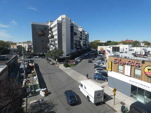
Why take a photo of the slanted parking lot for the Shop Rite supermarket at Avenue I between McDonald Ave and Dahill Road? The parking lot is slanted because it was built atop the old Parkville Junction that once connected the LIRR Bay Ridge Branch (now the NY & Atlantic freight line) with the surface South Brooklyn RR. The tracks once crossed Avenue I on an angle, and when biking here as a teenager and into my 20s, I’d see embedded rails that were a remnant of the junction.
This junction allowed the New York City Transit Authority (NYCTA) to receive deliveries of newly manufactured subway cars (such as the R12 and R46 fleets), which arrived via car floats from New Jersey, traveled over the LIRR Bay Ridge tracks, and transitioned at Parkville down to the Coney Island train yards. The Belcher Hyde 1929 Brooklyn Desk Atlas shows the track setup plainly, but I am enjoined from screen-shotting it by their copyright protection software. Take a look at it here.
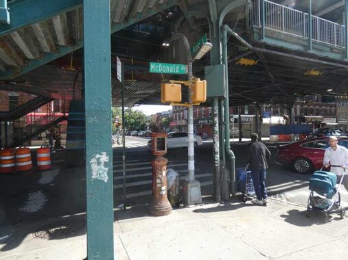
At Avenue I and McDonald Avenue, I found some interesting infrastructure such as the dwarf davit pole with sidewalk lamp addition, as well as a 1910s-vintage fire alarm now used by locals as a waste receptacle.
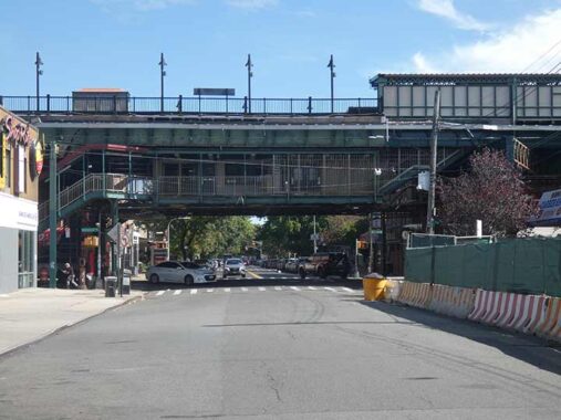
A look at the elevated Ave. I station from Dahill Road.
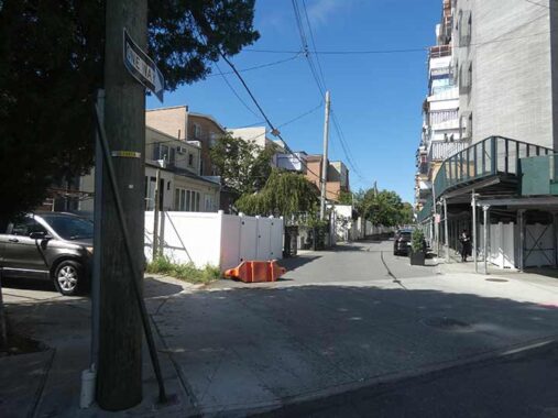
Since at least 2020, there’s been a 49th Road between 49th and 50th Streets between 19th and 20th Avenue in Borough Park. It was constructed as a service alley for a new apartment complex. I explored this new route on this FNY page.
In some cities, when a new numbered avenue is built between two established numbered avenues, it’s given a X 1/2 designation. In the 2000s, a new pedestrian walkway cobbled together by different rights of way in and out of different buildings was established and given the moniker 6 1/2 Avenue. I walked that avenue today and will give an account on a future FNY page. Mitch Waxman of the Newtown Pentacle recently alerted me about a 43 1/2 Street in Pittsburgh; here it is on Street View.
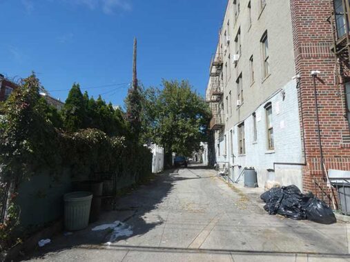
Meanwhile a block away I spotted this service alley that runs through between 19th and 20th Avenues between 51st and 52nd; it’s called “51st Street South Easement” on Google Maps, though unlike 49th Road, the Department of Transportation doesn’t honor it with a green and white street sign.


I’m never around here anymore. I liked this building at the corner of 20th Avenue and 52nd, former home of Carlo’s Grocery. It once had a conical hat, the kind you wear at a kid’s birthday party.
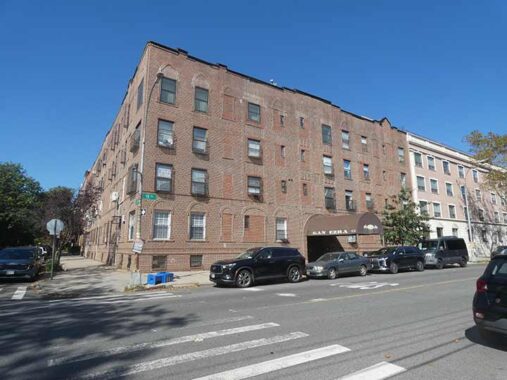
FNY readers know, I’m attracted to brick apartments. I live in a brick garden apartment complex. This one, #5120 19th Avenue, houses a branch of Gan Ezra, a specialized early childhood program and preschool that provides nurturing education and support services for children with learning differences, developmental delays, and special needs.


Between 18th and 19th Avenues, 52nd Street is lined with attached brick buildings that appear to have been designed by the same architect that designed #5120 19th Avenue. They have been subdivided into Boro Park Village and Borough Park Townhouses.
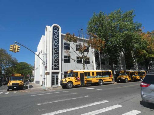
Gerer Yeshiva Machzikei Hadath, 20th Avenue at 52nd Street, is a well-established educational institution specializing in traditional Jewish studies, offering a comprehensive curriculum for students seeking a religious education.
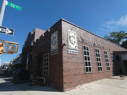
FNY Correspondent Sergey Kadinsky:
On the SE corner of 20th and 52nd is s Glatt A La Carte, a catering service. Glatt is Yiddish for “smooth” referring to the strict kosher standard involving the smoothness of the lungs of the slaughtered animal.
Old New Utrecht Road


The south end of the southern section of Old New Utrecht Road, running four blocks, is at 18th Avenue and 52nd Street. While today much of the road looks like any other Brooklyn side street, as mentioned before, it was formerly unpaved, with sidewalks only an occasional addition. According to Gil Tauber, the street sign honors Rabbi Zvi Florence (1955-2010) who was on Community Board 12 for many years and was dedicated to furthering entertainment and the arts in Borough Park. He helped organize the Annual Purim Parade, the Choel Hamoed Festival and the Succathon in Borough Park.
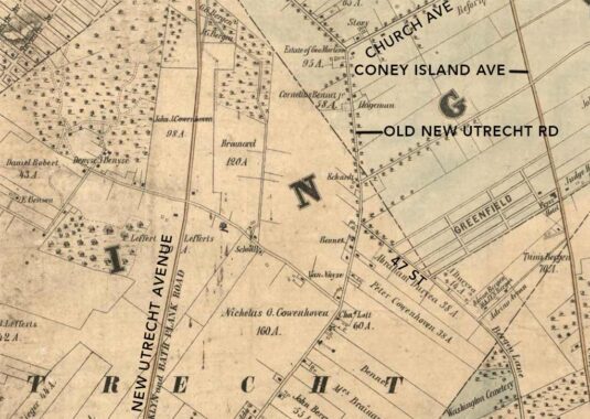
The oldest map showing Old New Utrecht Road I have access to was drawn by cartographer Matthew Dripps in 1852. I have added some modern-day street names. The road once ran continuously from what is now Church Avenue and 36th Street (Martense Lane) directly south to Gowanus Bay. South of where the Nicholas Cowenhoven property is indicated, 18th Avenue now runs in its old road bed. Today, only two blocks of its northern end and 4 blocks between 48th and 52nd Street remain, though as we’ll see, there are other hints about its old route. The roads you see on this 1852 map were likely once Native American trails later adapted for use by the Dutch and then the British. Interestingly the community of Parkville was already established by 1852, and its street layout affects the modern-day layout. The dotted line in the middle of the map marks the boundary between the towns of New Utrecht and Flatbush.
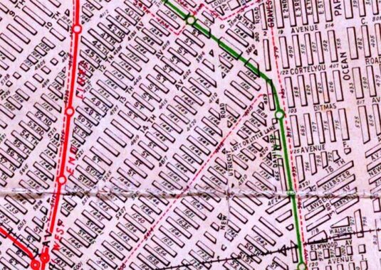
Though much of “ONUR” had been demapped by 1922 and was no longer traveled on, this early (1922) Brooklyn map by Hagstrom dutifully marks the entire original route. A second very old road, Lotts Lane, is also on the map and I will discuss it a bit later.
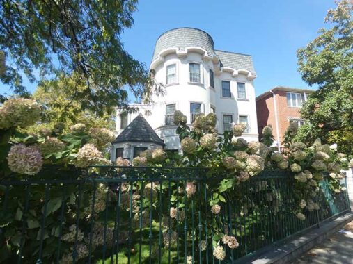
It’s not easy to find relatively buildings constructed in the old school method of physical attractiveness, but here’s one on the NW corner of ONUR and 52nd Street. On these four blocks, ONUR is one-way south for motor traffic.
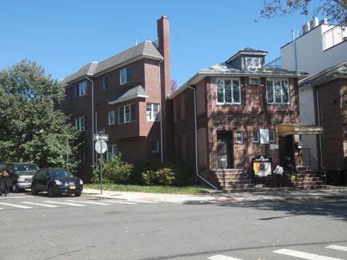
At the northeast corner of ONUR and 51st Street, the angle of the intersection makes for some interestingly-shaped building plots.


This 4-block section of ONUR survived because a number of two-family brick buildings were well-established there. These new buildings replaced them, with little loss of esthetic quality.


I failed to notice how narrow this lengthy building fronting ONUR at 49th Street is. However, a look at the building at a different angle in the 1940 tax photo illustrates the point. It’s not quite as obvious in 2026, as a taller building has been built behind it on 49th.


The block of ONUR between 49th and 50th is my “favorite”. because it remains without a sidewalk, and it’s easy to envision it as it was in a previous era, as a dirt trace through wilderness.
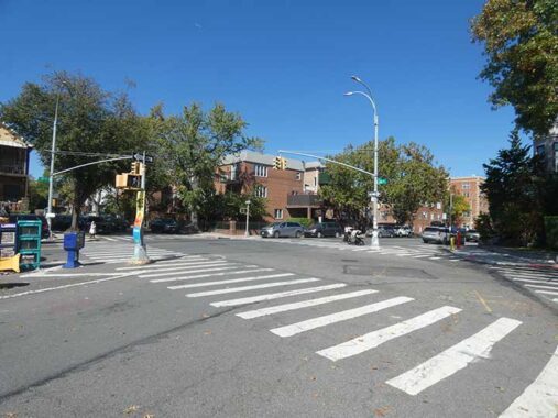
At this section of the ONUR’s northern end at 17th Avenue and 48th Street, there’s no remaining indication it once proceeded further north, but if you know where to look… there are.


I am unsure when it was constructed but this relatively new house sits on a slanted plot where ONUR meets 17th Avenue at 48th Street. My camera aimed at it three times, as it was attracted to its eclectic, or “Queen Anne” characteristics and ornamentation. Maybe architectural quality is making a comeback.
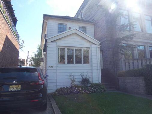
This very small dwelling, a reminder of the former housing stock now largely being replaced, stands alongside it on 17th Avenue.


This neck of Borough Park is overwhelmingly Jewish. Yet, Holy Spirit Church, 17th Avenue and 46th Street, has thrived since 1920 when its first Masses were held. The church sits on a beautiful campus complete with wide, spacious lawns and a grotto. When it was opened it was called Church of the Holy Ghost (for the third Person in God’s Trinity). The term “Holy Ghost” was changed to “Holy Spirit.” This likely came about as “ghost” became more closely identified with “frightening apparition.” Its original building, though modified over the years, is still in use.
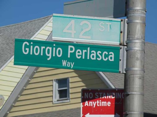
17th Avenue, 42nd Street and Dahill Road form a small traffic triangle that nonetheless has been given a name, Giorgio Perlasca Way, by the Department of Transportation. According to Gil Tauber in Oldstreets:
Giorgio Perlasca (1910-1992) worked for Angel Sanz-Briz during WWII issuing protective passes to Budapest’s Jewish population. He was in charge of safe houses sheltering Jews from deportation and the Arrow Cross militia. He also worked with Raoul Wallenberg; Friedrich Born, of the International Red Cross; and Angelo Rotta, from the Vatican, in issuing protective passes. It is estimated that Giorgio Perlasca saved approximately 3,500 Hungarian Jews.
It’s a shame that his name has largely been lost to history: but it is remembered here.


It’s my bet that these two groups of attached houses, the white-aluminum sided trio at Dahill Road opposite 17th Avenue, and the buff-bricked septuplet further north on Dahill, once appeared the same, but owners decided to place siding on one group and not the other.
Though many streets south of Prospect Park carry British names, Dahill is Irish. Perhaps this road, which separates the street grids of Brooklyn Village (extended south to Bay Ridge) and the lettered avenues and north-south numbered streets of the Town of Flatbush, was named for Irish immigrants or residents.
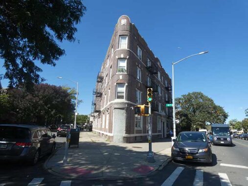
West of Dahill Road, steets meet it at an angle. This makes for triangle-shaped plots, and a couple of mini-Flatiron Buildings. I always wanted to stay in one of these “angle buildings.”
Lotts Lane
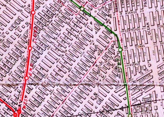


Let’s take another look at the 1922 Hagstrom Brooklyn map selection. in the center you can see what is marked “Lotts or Little Lane” running east from Old New Utrecht Road east to what was then Gravesend, now McDonald Avenue, crossing Dahill Road at 41st Street. Checking my handy copy of “Colonial Highways of Greater New York,” published in 1908:
“The road connected the main road with what was known as the road from Flatbush to New Utrecht [today’s ONUR] in the days of Dutch Sovereignty. A part of the lane is still open and in use as a public highway. In Dutch days this lane provided something of a short cut from Flatbush to New Utrecht and the shores of Gravesend Bay.” The report goes on to say the road was in use as early as 1663, but was closed in sections from 1891 to 1903; other sections became part of Cortelyou Road. This small section shown on the 1922 Hagstrom may have still been in evidence that year, Up until 2000 when it discontinued its hand drawn Brooklyn map, Hagstrom continued to show a short dead end piece of Lotts Lane at Dahill Rd. opposite 41st Street. The 1852 Dripps map (scroll up) also shows a slanted road matching the location of Lotts Lane.
And indeed, you can still see where this ancient road was because the property line here follows it. The north side of an 3-story multifamily house on Dahill slants to match it, as does a driveway for a porched house on Dahill. Unfortunately, 1940s.nyc fails to show this site in 1940.
The Lott name can be found frequently in Brooklyn. In 2020, I visited the early 18th century homestead of Johannes Lott and his son Hendrick in Marine Park, which was being prepared for use as a museum (though progress has been slow). There are streets named Lott in Flatbush and Brownsville.
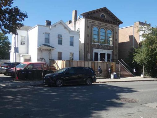
Heading north and west, we are in a heavily Hasidic and Orthodox Jewish section. Yeshiva Zichron Melech, a private Orthodox Jewish rabbinical seminary and high school at #510 Dahill Road, now has clear glass windows instead of the stained multicolored glass windows it sported in 1940. To its right is a very old dwelling from the early 20th century, largely reinforced by aluminum siding.
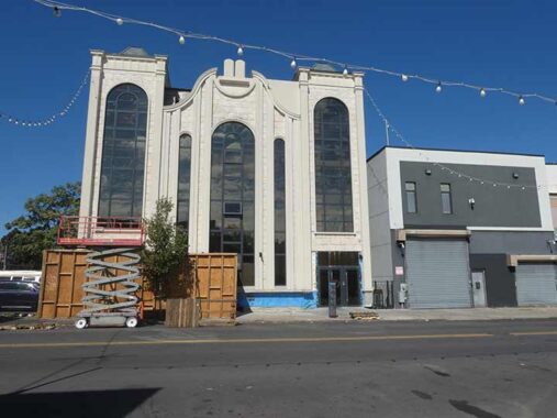
At Ditmas Avenue and Dahill Road is a newly built extension of Palace Hall, a Jewish wedding venue offering spacious, elegant décor and quality catering.


Seeking more ONUR remnants, I headed west on 39th Street. On 16th Avenue are a pair of signs I found interesting one for a pottery studio called Doughdishes, and another for the 39th Street Pharmacy (which sports the traditional mortar and pestle symbol and the Rx abbreviation for recipe), and a “WELLNESS” mural featuring some items available therein on the 39th Street side.
Road Remnants
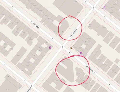


In various locations in Borough Park, the old route of Old New Utrecht Road can be glimpsed by slanted edges on buildings, through which the road passed. Looking at Open Street Map shows building shapes, and I relied on it for this research. At 15th Avenue, two buildings on either side of 15th Avenue and 41st Street bear such a slant.


Some remnants can no longer be seen. At 16th Avenue and 44th Street, Old New Utrecht Road passed through the intersection over a century ago, and there was a private house on the corner that fronted on its old path. The house is no longer there as the Yeshiva Beth Hillel of Krasna was built several years ago on its lot.


Possibly the most prominent of these ONUR remnants was located on 39th Street between 14th and 15th Avenues, where a wide, slanted driveway could be seen where the old road used to pass. the driveway and its accompanying buildings were razed a few years ago, with a large storage facility erected in their place.


However, a second slanted driveway can still be seen on 38th just east of 14th, and its former identity can be discerned by drawing a line south from an existing portion of Old New Utrecht Road to it.


Old New Utrecht Road still runs along the north end of this huge building at 14th Avenue and 38th Street. Now home to a sukkah (a temporary, outdoor hut built for the Jewish festival of Sukkot (the Feast of Booths or Tabernacles) manufacturer, this is the former Phoenix Hermetic Company factory, which manufactured metal caps, jar covers, canning closures, capping machinery, and specialized metal lithography. The company was credited with inventing the modern continuous thread (CT) cap in 1922. It is now known as Phoenix Closures.


A strange two-block section of Old New Utrecht Road survives between Church Avenue and 36th Street and 14th Avenue, and it’s fairly well trafficked as a short cut.
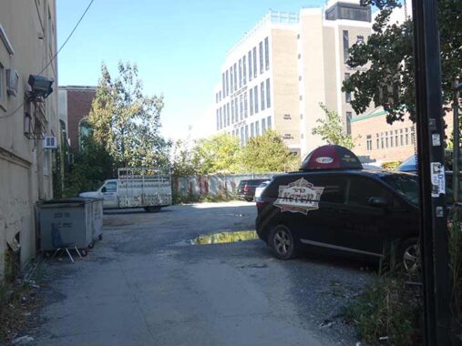
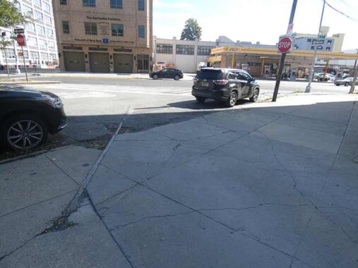
What’s behind that locked gate on 14th Avenue between 37th and 38th Streets? Nothing much of interest these days, but this place marks the former route of two separate railways: a surface freight line called the South Brooklyn Railroad, which extended from the waterfront on a separate right of way along 37th Street and then down the middle of McDonald Avenue to the Coney Island. It was last used in 1978 and the tracks were ripped up over a decade later, though you can still see one here on 14th Avenue.
Above the surface freight line ran the Culver Line elevated, which branched off Brooklyn’s 5th Avenue El (demolished in 1940) and then ran on elevated tracks along 37th Street and then south along McDonald Avenue to the Coney Island terminal. When the 5th Avenue El was razed, this section was orphaned and ran as the Culver Shuttle (as the Culver section on McDonald was connected to the IND Church Avenue station in the 1950s) until 1975. The el structure stood in place until 1985.
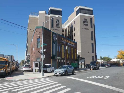
One of the few businesses located on ONUR is Citywide Security and Private Investigation, a security guard service.
Sergey Kadinsky has charitably translated Hebrew lettering on some of the local buildings. Behind CWSP is “is the Bnei Zion yeshiva of the Bobov hasidic community, whose name originates from the village of Bobowa in the Galicia region of Poland. Other Hebrew letters on this building indicate sponsors and their loved ones. It is an honorable thing to give charitably in the memory of a deceased family member.”
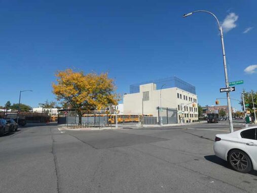
Formerly a dirty, poorly-paved intersection, ONUR, Church Avenue and 36th Street have recently been upgraded by the Department of Transportation, but it’s still a bit of a free for all as there are no stoplights.
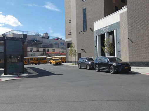
This narrow section of Church Avenue between 36th and 37th Streets has actually been widened and given a sidewalk. It’s actually a former trolley right of way, the precursor of the B35 bus. The upgrades came when the shul was built.
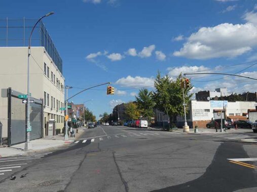
In the 19th and early 20th centuries, Church Avenue was called East Broadway, but it was renamed in honor of the Flatbush Reformed Church found further east on Church and Flatbush Avenues. The road may predate the colonial era.
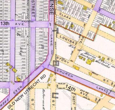
This 1890 plate from a Kings County map shows the original west end of Church Avenue. It was a fork in the road from Martense Lane (today’s 36th Street) and Old New Utrecht Road, two pieces of which still exist. On this map, property and lot lines are indicated, but the only existing roads were shown in purple; the rest were still on the planning boards. Note that 14th Avenue paralleled Church Avenue; today, it intersects Church Avenue at 35th Street. Story Street was lengthier then, and now runs north-south.


This new yeshiva at 36th Street and 13th Avenue was built sometime in the last decade. Sergey: “Yeshiva Torah Veyirah of the Satmar hasidic community. Based in Williamsburg, it has branches in Borough Park and beyond. This is a boys’ school whose name translates as Torah and Fear of God. The subtitle here honors Rabbi Yoel Teitelbaum, who survived the holocaust and reestablished the Satmar community in Brooklyn.”


For those born in Borough Park or have moved there since 1990 or so, it’s hard to imagine this site at 13th Avenue and 37th Street as the site of a busy transit line, but indeed it was where the Culver Elevated once ran, from the demolished 5th Avenue El south to Coney Island. When the IND was extended south of Church Avenue in 1954, the resourceful NYC Transit Authority converted these tracks to a shuttle line connecting the West End BMT at 9th Avenue (see below) to the IND north of Ditmas Avenue. this shuttle was a single-track operation that ran until 1975, with the elevated structure in place until 1985. See FNY’s Culver Shuttle page for visual evidence.
The empty lot seen at the intersection was once the site of the surface freight line, South Brooklyn Railway. It was at this spot that Italian men gathered on the weekends to play bocce, a variety of lawn bowling, under the el. My father and I would sometimes take in the action.


I’ve been through here a lot, on a bus, on a bicycle, walking. But here’s something I hadn’t noticed, at #3816 13th Avenue: an embossment at the roofline, indicating the building’s original owner, Brooklyn Union Cornice and Roofing (Rfg) Company. Credit where credit’s due, Brooks of Sheffield at Lost City discovered it first, and surmises this was where the company’s union workers met.


I was saddened to see the formerly plain-Jane exterior of the Thirteenth Avenue Retail Market sullied by garish ads for a new tenant, Certo Market serving Orthodox Jewish customers. Some of the original lettering can be seen on the side entrance, and FNY has the original entrance appearance on this page.
While open-air markets have mightily multiplied in New York City in the last 20 to 30 years or so (the farmers’ markets in Union Square and Grand Army Plaza in Brooklyn, for two instances, as well as the Brooklyn Flea and other varied “fleas”), there was a time when they were considered unsanitary and undesirable, not just the large ones that fill empty lots but even the lone entrepreneur with his pushcart. Among the reasons for this is that these markets were unregulated and visited rarely by health inspectors. After NYC’s former Department of Markets was established in the 1920s, things improved somewhat but not enough for Mayor Fiorello LaGuardia when he took office in 1933.
The Little Flower spearheaded a Works Progress Administration initiative to build indoor markets throughout the city to improve sanitation and make inspections easier. These markets’ design was very simple, no-frills Machine Age, with no ornamentation whatsoever, and sanserif lettering on signage. There are a few of these left — the original Essex Street Market near Delancey is still standing, though now endangered, and the 1st Avenue Retail Market infrastructure remains in place, though an apartment tower has been built over it and the market space is now Theatre for the New City.
39th Street
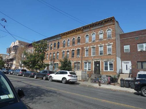
I rejoined 39th Street to attain the D train at 9th Avenue. It’s a major two-way route from Sunset Park, where there was once a ferry at 1st Avenue at Gowanus Bay southeast to Dahill Road in Kensington. It’s a mix of old school attached homes…
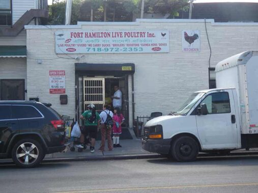
… to the occasional live poultry slaughterhouse.
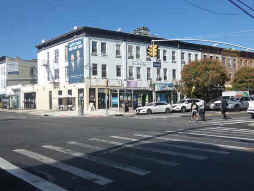
In the 1980s, this whitewashed group of brick houses at Fort Hamilton Parkway and 39th Street was home to the huge Lamp Warehouse. Gradually, though, the lamp store cut back to a smaller and smaller space, till by 2021 it was just the corner store. When I went past in 2026, I saw it was completely gone. That space is now occupied by Aileen La H, a Honduran restaurant featuring pollo con tajadas (fried chicken with green banana slices), carne asada with chorizo, tacos, empanadas, and desayuno típico.


A D train on the West End Elevated tracks at 10th Avenue and 39th Street, which could really use a paint job. What’s unusual about this picture? Well, as a kid, I noticed that every, and I mean every, paper map of Brooklyn I used depicted the elevated line running on New Utrecht Avenue all the way up to 9th Avenue. It doesn’t—it turned onto 10th Avenue, running on a very low headway, and then onto a right of way at 38th Street. It always bugged me. Online maps like Google and Open Street Map correct the error. Of course there’s an entire FNY page devoted to this minutia.
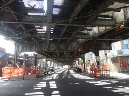
A look a the very low elevated west on 10th Avenue, which is shadowed for just two blocks.
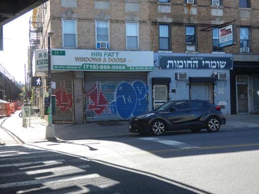
Brooklyn is nothing if not ecumenical. Here’s a Chinese window and doors dealer, next to a Hebrew-lettered storefront. Sergey:
“Shomrei Hakhomos translates as Guardians of the Walls. The laws of the Torah are fortified by ‘walls,’ which are rabbinical stringencies designed to uphold observance of the Torah.”
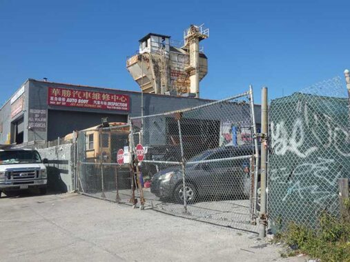
Someone help me out here. I stopped to get a shot of this structure at an auto body shop across the street at 39th near 10th, but I don’t know what it is. One of the guys there asked me why I was taking pictures, but I defused him by presenting him with my card. I should have asked him!


A large Jewish school fronts on 39th Street between 9th and 10th Avenues. Once again, Sergey for the translation: ” ‘Talmud Torah of the Holy Court of Sanz-Klausenburg.’ This hasidic community’s namesake is the Transylvanian city of Cluj-Napoca, known to Hungarians as Kolozsvar, and to German and Yiddish speakers as Klausenburg. The Sanz part of its name originated in Nowy Sacz, in the Galicia region of Poland.”
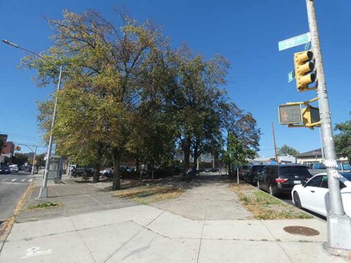
Heffernan Square is actually a triangle formed by 39th Street, 9th Avenue and the unshrouded section of New Utrecht Avenue. I do not have any direct research on the Heffernan for whom the square is named. I gather that the Brooklyn Eagle reported that the triangle was named anywhere from 1932-1934 but the Eagle archives is now behind a paywall, so I’m not sure which year. My suspicion is James J. Heffernan (1888-1967) who was elected as a US Representative for the first of five terms in 1940. However, in 1933 he was serving as the Traffic Commissioner for the borough of Brooklyn.


When I first saw this installation on the outside fencing, I assumed it was a tribute to houseflies, but without color it’s hard to tell one bug from the other. It’s actually Christopher Russell’s “Bees for Sunset Park.” (We’re close to the undefended border of Borough Park and Sunset Park, which to me runs down 9th Avenue or Fort Hamilton Parkway.)
Russell:
“The station is like a kiosk, and it reminded me of beehives — of people coming in and out of it, and doing their jobs. I began to think about the great gates that Gaudí did. He came from a family of ironworkers, and there’s a fantastic dragon gate he did in Barcelona.
Metalwork and gates were definitely an aspect of the Arts and Crafts tradition, and that was very much on my mind. I also thought about Mackintosh and his buildings in Glasgow.” [NY Times]


I’ve often cited original IRT stationhouses at Bowling Green, 72nd Street and Atlantic Avenue in Brooklyn as relics worthy of note, but I haven’t paid nearly enough attention to original BMT stationhouses erected in the 1910s when as part of the Dual Contracts that funded subway construction for both the IRT and Brooklyn Rapid Transit, dozens of such houses were built serving those parts of the line that were in open cuts. The Brighton Line (Q, B) has Prospect Park and Parkside Avenue, and the Sea Beach (N) has a whole series of them between 8th Avenue and 86th Street. There’s only one on the West End here on 9th Avenue and, after renovations in 2012, it’s a gem. For many years, the front entrance was blocked up despite the large “subway entrance” sign. The exteriors of these stations feature terra cotta with diamonds and circles that are frequently used as a BMT motif.
In a 2012 makeover, most of the original BMT (when built in 1916, BRT) decorative elements such as tiling and mosaics were retained, while new overhead lights, again using the original arts and crafts design, were installed. Most of subway design, in the IRT, BMT and beginning in the 1930s, IND, were under the supervision of architectural designer/engineer Squire Vickers. Skylights add some airiness to what could be an otherwise drab experience.
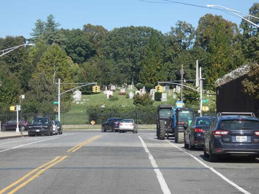
9th Avenue reaches its eastern end at 37th Street and Green-Wood Cemetery. When I was a kid, I thought of 9th Avenue as a somewhat mysterious entity, since it did NOT extend into Bay Ridge. Because of a changing angle of street grid orientation, 10th Avenue follows 7th as you travel southeast on 86th Street, while 8th Avenue begins at 73rd and 9th Avenue at Bay Ridge Parkway, where its eastern path was interrupted as frequently as I perceived that the cartoons were by breaking news reports. 9th Avenue was stopped cold by Leif Ericson Square, and then by the open cut of the N train. Its only continuous stretch runs from the cemetery and 37th Street to 61st Street, where it meets the open cut.
Add to that the fact that in the 1970s, on my bicycling rounds I discovered that the very fence, where the arrow sign is located now, had a diamond shaped sign saying “DEAD END” on it. In front of a cemetery, no less! Never mind that it wasn’t really a dead end and motorists could proceed in either direction. Eventually the sign was removed.
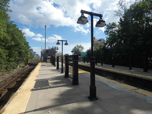
These are relatively new cowled platform lamp stanchions. Over a decade ago (as of 2026) the MTA replaced its original 9th Avenue station lighting with these, which quite resembled the old ones. Trackwork was the rule today, and I waited over 30 minutes for a D train that wouldn’t come, so I blew the fare and walked over to 4th Avenue to catch an N train back to Queens…
Check out the ForgottenBook (HarperCollins, 2006), as well as Forgotten Queens (Arcadia, 2013). I also have a chapter in the anthology “New York Calling: From Blackout to Bloomberg” (Reaktion, 2007). As always, “comment…as you see fit.” I earn a small payment when you click on any ad on the site.
10/11/26
2 comments
Kevin, the Brooklyn Daily Eagle archives, and other Brooklyn papers, have been free ever since BPL partnered with Newspapers.com about 15 years ago. Here’s the link:
https://www.bklynlibrary.org/online-resources/brooklyn-newsstand
Shop Rite is still around?I thought it went the way of Bohack and A&P.
They issued stamps which you could later redeem for “valuable gifts and
prizes”(They always seemed to be out of the particular gift you wanted)
Mad magazine mocked them with a picture of a stamp book dripping with
saliva from people licking the stamps and sticking them in the stamp book.
Gross