

I am old. Impossibly old. Older than you imagine. Older than you can imagine. And I have returned to work fulltime, with Marquis Who’s Who, albeit via my home computer. Thus at the end of the week, I can be a bit tired. Now, the weekend is the only time I have to do FNY camera walks, compose a page and prepare the raw files from my camera. Or just rest. That’s why on occasion, I turn things over to…
BY SERGEY KADINSKY
Forgotten NY correspondent
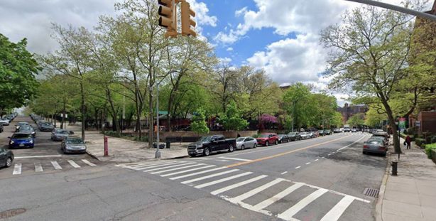
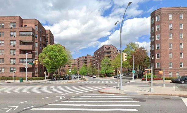
On the street grid of Queens, boulevards were allowed to retain their names either because of their lengthy routes or because they sliced through the grid which prevented them from taking a number. Yellowstone Boulevard travels through two grids in Forest Hills, taking the place of 105th Street on the neighborhood’s north side, and 67th Drive on the south side. In its middle, it travels through a valley that may have inspired its name.
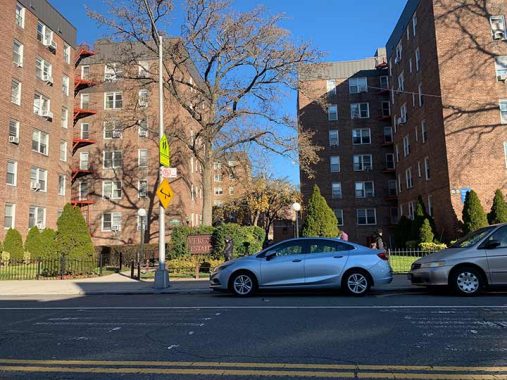
Yellowstone Boulevard begins at the service road of the Long Island Expressway, which divides Rego Park and Forest Hills from Elmhurst and Corona. Its first two blocks are its most recent, paved in the 1950s when apartments were built here on the former marshland of Horse Brook. Playgrounds and small parks are also sprinkled atop the phantom stream.
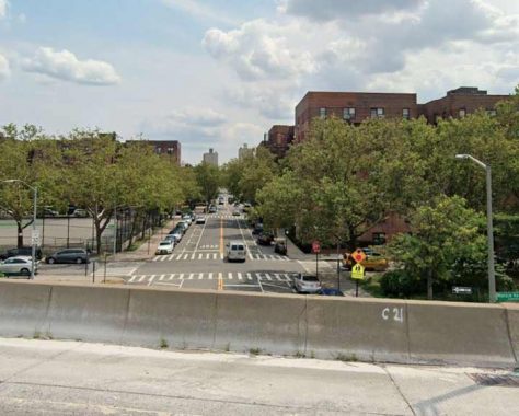
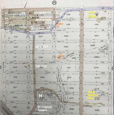
At 62nd Drive the boulevard becomes relatively narrow as it is hemmed in by properties of the Annadale development that spanned three blocks and preceded the surrounding neighborhood by decades.
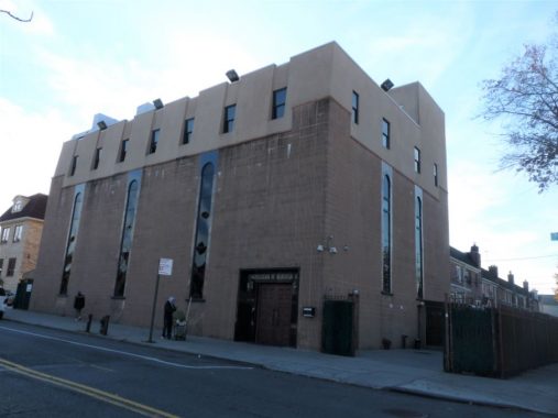
Jewish tradition holds that the preferable location for a synagogue is a hilltop. The Georgian Jewish Congregation has the ideal spot on Yellowstone Boulevard. Its founders are immigrants from the mountainous nation in the Caucasus sandwiched between Russia and Turkey. Don’t say that they are Russian Jews. Although they speak Russian as a result of the Soviet experience, their culture is not Russian.
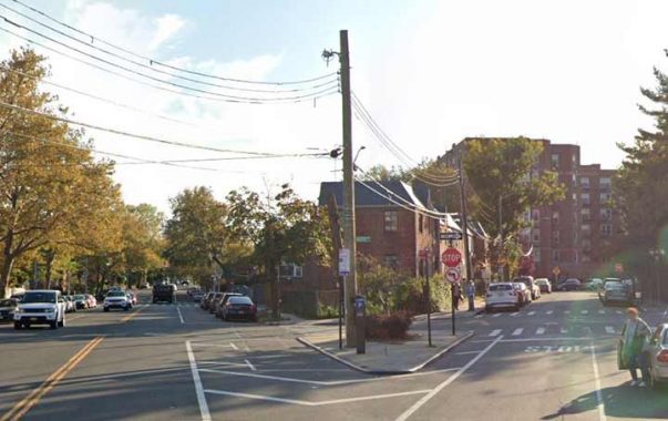
Apex Place meets Yellowstone Boulevard in front of the Georgian synagogue. The two-block grid-breaking diagonal is a remnant of North Hempstead Plank Road that paralleled Horse Brook between Elmhurst and Flushing Meadows.
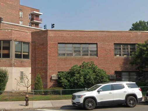
At 63rd Drive, the boulevard faces Stephen A. Halsey Junior High School 157 where the second floor overshadows the schoolyard. The school’s namesake is related to the road on the other side of the school, 102nd Street which was Astoria Road prior to the borough-wide numerization. Halsey was among the founders of Astoria. Among the distinguished alumni of this middle school is Michael H. Perlman, who wrote the book on celebrities who lived in Rego Park and Forest Hills. He is also the founder of the Rego-Forest Preservation Council.
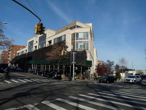
At 64th Road is a triangular curiosity, the Novo64 apartments that were completed in 2006. The property line of this post-millennial residence matches the unbuilt Aero Place, a paper street that dates back to the 1910s. The Aero co-op at 105-24 63rd Drive also preserves the name of this never-built street.
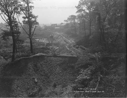
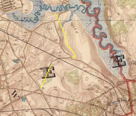
A photo of this road from 1928 shows a primeval landscape untouched since the last ice age. The photographer was surveying a sewer line route that would become Yellowstone Boulevard. Considering the winding route of Yellowstone Boulevard at the bottom of a ravine, perhaps there was a waterway here? None of the old maps show it, but there was an unnamed brook that emerged at the site of Aero Place and 108th Street that flowed into Horse Brook.
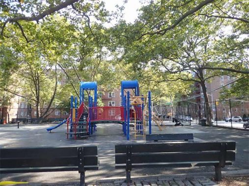
A block south school is its leading source of graduating students, P.S.175, where Annadale Playground serves as the schoolyard. Fitting with local school zoning, Perlman attended this school before advancing to Halsey. His mother Linda also attended both schools. The tables here are occupied all day by older men playing cards, chess, and backgammon. Most of them are Bukharian Jews, having settled here when the Soviet Union collapsed. In 2007, this playground was where Dr. Daniel Malakov was murdered in front of his child, on the order of his ex-wife, a crime that shocked this tight-knit community.
When my family immigrated to this country, we arrived through the iconic TWA Terminal and were then driven to my great-aunt’s apartment on Yellowstone Boulevard, across from this playground. An uncle impressed us with American life by shouting “Open Sesame” at a garage door, which then opened. Behind his back was a remote control. Another uncle on 102nd Street hosted us for two weeks where we practiced English by watching Jeopardy and Wheel of Fortune. That’s how I developed a liking for historical trivia and a childhood crush on Vanna White.
We had three sets of relatives living in the Verona apartments, which have a midblock walkway with benches. That’s where the older generations gathered to reminisce on the past and adjust to their new homes. The building’s name evokes the city of Romeo and Juliet but it actually commemorates the pre-numerization name of 65th Avenue that was originally called Verona Street.
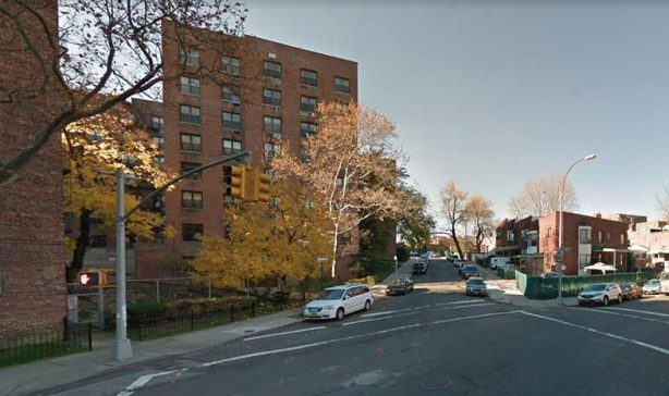
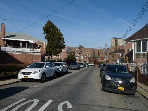
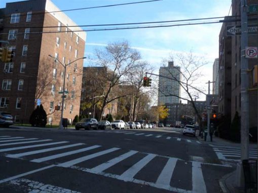
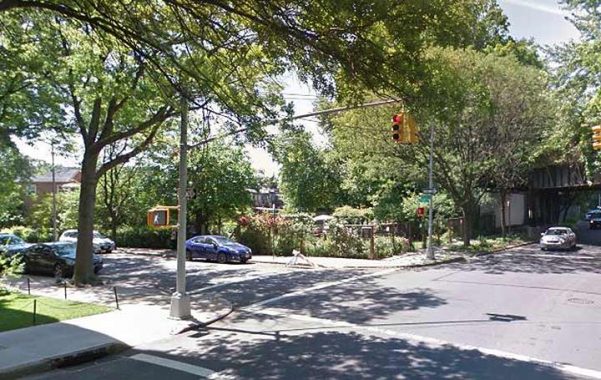
At 66th Avenue, Yellowstone Boulevard enters a ravine with slopes on both sides and its route makes curves that follow the topography. Likely the route was designed by developer Cord Meyer to give the street a bit of whimsy on this rectilinear grid. A block of 66th Avenue that intersects Yellowstone Boulevard also skews from the grid as it predates urbanization. Prior to numerization, it was Jackson Lane, a dead-end that led to a farm owned by its namesake family.
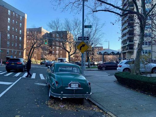


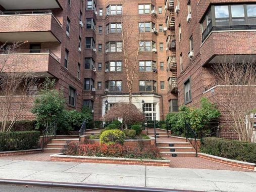
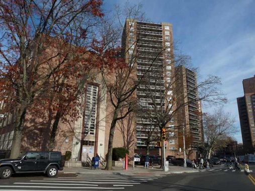
The tallest residential towers on Yellowstone Boulevard are the three Birchwood Towers. Completed in 1964, their modernist style resembles the World’s Fair of that year, and the nearby towers of LeFrak City, Kennedy House, and Park Plaza. Like LeFrak City, each of the Birchwood Towers has a name evoking globalism: Bel Air, Toledo, and Kyoto, with lobby designs relating to these three places. On my Yellowstone Boulevard walk, I spotted a car from 1949. Can anyone name the model and maker?
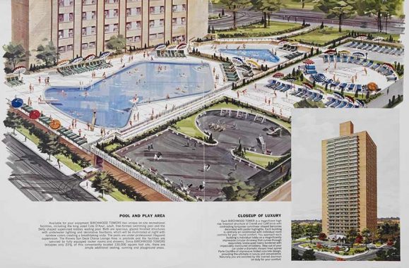
The Birchwood Towers have a private playground and pool atop its garage. Prior to its construction, this block served as an informal park for sledding. But there is a public park a few blocks to the south with slopes for this winter sport. The 1.75-acre Yellowstone Playground occupies most of the block at 68th Avenue, a heavily-used park in this densely-built community.
Jeffrey Hyman lived in the Birchwood as a youth, and his friends Douglas Colvin, John Cummings, and Thomas Erdyeli lived nearby. Music fans know them as Joey, Dee Dee, Johnny and Tommy Ramone.
Initially this park was the private garden of the Lexington House apartments on 108th street, atop the hill facing Yellowstone Boulevard. To prevent it from becoming developed, the city acquired the site in 1963 and it opened as a park four years later. Every park needs a volunteer group to keep it in shape. The Yellowstone Park Alliance is the organization that keeps the flowers blooming here. At the bottom of the slope in Yellowstone Park, the playground is named for Arthur J. Katzman, the Councilman who made this park possible.
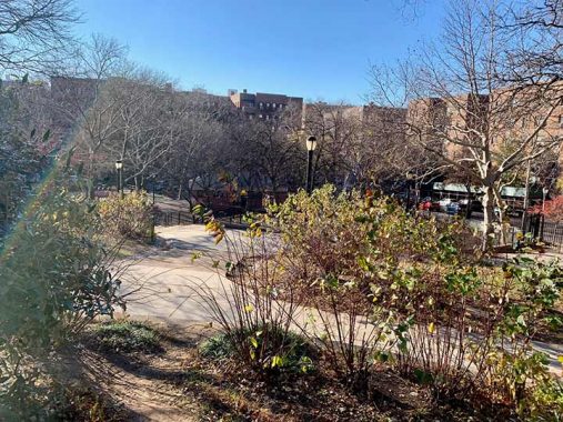
The hill at Yellowstone Park is steep, but like the summits of Fort Greene Park in Brooklyn and Marcus Garvey Park in Manhattan, views are blocked by apartment buildings that now dwarf this hill. Its namesake is the world’s first national park, where the highest peak is 11,358 feet.
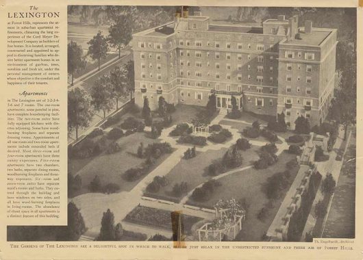
The Lexington apartments were among the earliest to be built north of Queens Boulevard. In this 1931 illustration from Mike Perlman’s collection we see Yellowstone Park as a private park. Its private-to-public story and a layout that covers almost an entire block is similar to Travers Park in Jackson Heights, which is also located amid upscale prewar apartment buildings.
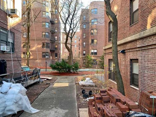
Many of the buildings on Yellowstone Boulevard have private parks hidden from the street that used to have fountains, floral beds, and benches. Some of these became neglected over the decades, seen only from the apartments facing these interior yards. This private park belongs to the James Madison co-op (68-37 Yellowstone), one of a dozen residences in the neighborhood carrying a presidential name, according to Perlman. He notes that many of the nearby buildings also had rooftop gardens, decades before green roofs became a sustainability feature.
The steepest slopes along Yellowstone Boulevard are between 67th Drive and 68th Drive, a single number but really three streets. The sequence here is Avenue, Road, Drive, followed by the next number. As Brownstoner explains, Queens was a collection of some 60 towns, villages, and hamlets. With urbanization, their grids grew and “bumped” into each other. Some communities had long, wide grids, and others had tight blocks. To make a numbered route stretch across the borough, it traveled through multiple former villages that were fused into a borough-wide grid.
On the south side of Queens Boulevard, the blocks are long between 65, 66, and 67 avenues. But here on the north side, they’re narrow. So the filler streets (the former Atom to Zuni sequence) between each numbered avenue were assigned as roads and drives. Does my explanation make sense?
Yellowstone is not a boulevard in the sense of its width, but concerning appearance there is plenty of greenery as most buildings have landscaping, fountains, and benches at their main entrances.
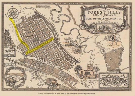
As noted, Yellowstone Boulevard’s name was the product of Cord Meyer’s imagination and the earliest maps of his planned community had an alphabet of named streets. From Atom Street that became 75th Avenue, to Zuni Street that is now 63rd Drive, all were later given repetitive numbers to fit into the bough-wide grid. Only Jewel Street was spared, redesignated as an avenue. Perlman notes that often it is the apartment buildings that keep the old names alive. On Yellowstone Boulevard and along 108th Street, we have buildings named Kelvin, Livingston, Portsmouth, Quality, Ruskin, and Verona. Perlman’s collection of local history includes a map of Cord Meyer’s grid from 1926 by illustrator Ernest Clegg.
At the junction of Queens Boulevard, the Hyde Park apartments (69-39 Yellowstone) form a flatiron corner where Jewel Avenue begins its eastward run towards Fresh Meadows.
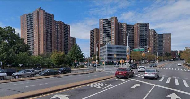
Crossing the massive boulevard, Yellowstone touches the tip of MacDonald Park in the shadow of Parker Towers and Gerard Towers. Continuing south to Dane Place, the boulevard takes the route of Whitepot Road, a colonial-period street. The largest apartment complex in Forest Hills, Parker Towers is a self-contained community of three towers with a circular driveway, fountain, garage, doormen, and dog run, among other amenities.
Across the boulevard from Parker Towers is its contemporary, the 24-story Gerard Towers, numbered 70-25 Yellowstone Blvd. In 2020, Kevin asked if anyone knew the namesake for the one-block Gerard Place that predates this apartment tower. So far, no answers have been found.
The DOT hates bowtie intersections for the difficulties they pose for pedestrians and vehicles. The one at Queens Boulevard was tamed a bit by banning left-hand turns. At Austin Street are the 112th Precinct and Russell Sage JHS 190, my alma mater. Between the school and Parker Towers is an unnamed alley used by cops and teachers for parking. I had few friends in this school, was not a good athlete, and feared going to the local high school with the same crowd. So I took an exam and was accepted as an art major at LaGuardia High School in Manhattan, where my social life blossomed and my creativity was appreciated. Perlman also attended that high school as a vocal major, a couple of years before me.
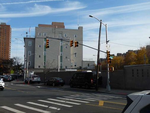
Across the street from the middle school is the 112th precinct. The light fixtures in its parking lot still have the “cobra” head design that had been phased out on the streets in favor of LED lights. If there were interest in a field guide to all of the city’s lampposts by genus and species, Kevin would be the one to write it. The lamppost here is a Donald Deskey with a GE M400 lamp.
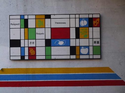
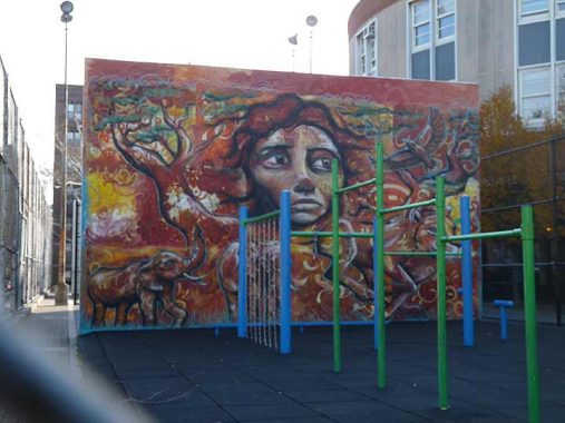
Murals tell the stories of neighborhoods. In Forest Hills and Rego Park, there are railroad underpass murals at Ascan Avenue, Continental Avenue, Fleet Street, 63rd Drive, and Yellowstone Boulevard. The one here was inspired by Dutch modernist Piet Mondrian.
To the south of the Long Island Railroad tracks, Yellowstone Boulevard meets Burns Street, kicking off an alphabetic grid that avoided numerization. Next are Clyde, Dartmouth, Exeter, and other British names. The synagogue here is Young Israel of Forest Hills, built in the 1950s by Holocaust survivors. Over the decades, it hosted commemorative events that preserved the stories of its founders. The traffic lights atop this building signal whether the eruv is in operation, a signal for observant Jews concerning their ability to carry objects on the Sabbath.
At Exeter Street, the off-grid Dane Place splits from the boulevard, carrying the trace of Whitepot Road to the Rego Park Crescents. Before 1910, Forest Hills was known as Whitepot. There is uncertainty on whether the name was derived from white clay pots offered to the local Natives in exchange for the land, or a white stream that flowed through the area.
At Kessel Street is a community garden next to the abandoned LIRR Rockaway Beach Branch. The last train rolled through here on June 8, 1962 and since then there has been a debate on whether to leave it abandoned, revive the rail line, or transform it into a rail-trail. A community garden abuts the tracks at Kessel Street and the boulevard. There are few public gardens in Forest Hills as this section of the neighborhood has plenty of backyards.
The final two blocks of Yellowstone Boulevard run through a panhandle of Rego Park, within a short walk of the tiny Remsen Family Cemetery where veterans of the American Revolution are buried. Alderton Street here is yet another British name given by developers for that historical and distinguished feel. But if you like American soft drinks, raise a toast with Dr. Pepper, invented by Brooklyn-born pharmacist Charles Alderton. At Woodhaven Boulevard, one can continue in a straight direction with Yellowstone Boulevard becoming Cooper Avenue, or turn slightly south where Woodhaven Boulevard continues without interruption until Rockaway Beach.
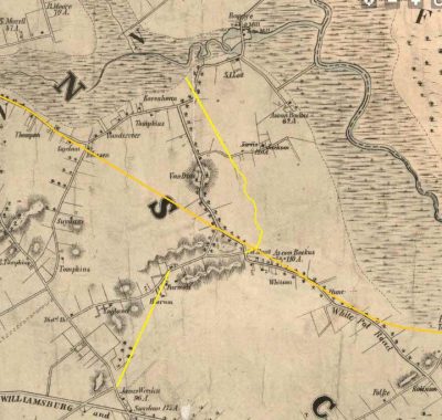
A set of historical maps reveals the context of the boulevard’s route. The 1852 Matthew Dripps map shows Whitepot Road, with the routes of Yellowstone Boulevard and Queens Boulevard here superimposed on the landscape in yellow.
On the Julius Bien map from 1890, we see the topography of Whitepot before it became Forest Hills. The route of Yellowstone Boulevard is highlighted with Whitepot Road later being fused into it. Queens Boulevard appears on this map running parallel to the train tracks. Between the years 1903 and 1909, the map of Forest Hills had its most dramatic change, as farms were sold to Cord Meyer and his proposed street grid, which included Yellowstone Boulevard.
In this 1927 Bromley map, we see only two completed north-south roads: 102nd Street and 108th Street, with Jackson Lane, now part of 66th Avenue, connecting them. The winding route of Yellowstone Boulevard is awaiting completion, along with all the other streets of Forest Hills. By the end of the 1930s, most of them would be completed.
Like a lost brother, Michael Perlman and I were raised in this neighborhood, attended the same high school, and we both write extensively on local history. My thanks to him for the wealth of information on anything pertaining to the past in Rego Park and Forest Hills.
Sergey Kadinsky is the author of Hidden Waters of New York City: A History and Guide to 101 Forgotten Lakes, Ponds, Creeks, and Streams in the Five Boroughs (2016, Countryman Press) and the webmaster of Hidden Waters Blog.
Michael Perlman, Forest Hills native, is the founder of the Rego-Forest Preservation Council and author of Legendary Locals of Forest Hills and Rego Park.
As always, “comment…as you see fit.” I earn a small payment when you click on any ad on the site.
12/19/21
9 comments
Any school boy can tell you that car is a 1949 Plymouth Deluxe Club Coupe.
Love reading your stories. Thanks so much.
Excellent Description of Yellowstone Blvd from LIE _ Woodhaven Blvd . Perfect Route for Forest hills Residents to Rockaway Beach in 1960 . 2Streets and you are on the Beach . A must for the Under 40s.
The old car referenced in the article is a Chrysler.
The old car is a 1949 Chrysler or DeSoto (hard to tell without seeing the front of the car). All that chrome, I’m gonna say it’s most likely the Chrysler version.
That synagogue is definetly of the Brutalist school of architecture.It looks like
they’ll be ready in case of attack
It’s hard to identify what kind of car it is, but I can tell it’s from the Chrysler Corp.
The car is a 1949 CHRYSLER ROYAL COUPE.
Ugh yellow stone and jewel avenue!!! Just trying to cross Queens blvd with my car everyday is utterly the pits
Forest hills is just building and building ugly new buildings
Terribly congested already!!
I miss the days when Austin Street was an actually lovely place to shop!
FOHI, rubbish they are HIGH