with SERGEY KADINSKY
Forgotten NY correspondent
I imagine that you weren’t aware that there’s a neighborhood called Mapleton in Brooklyn. It’s barely there anymore, as the larger neighborhoods of Bensonhurst and Borough Park absorbed it. Today Mapleton can be considered to be confined to the area between 57th and 65th Streets, 17th Avenue and Dahill Road. Today its good citizens say they’re in Borough Park, and the only tangible remnant of Mapleton is the Brooklyn Public Library Mapleton branch at 17th Avenue and 60th Street (which shuttered temporarily in early 2020 for needed repairs).
Mapleton Park was developed beginning in 1908 by William Sugarman of the Alco Building Company near the Sea Beach Railroad, then a steam surface railroad; the railroad was placed in an open cut and electrified in 1915, and the surrounding area developed rapidly. Mapleton first lost the “Park” and then fell out of favor completely.
It’s been quite awhile since I’ve walked around in these parts, but when I lived in Bay Ridge I cycled through fairly frequently. Since much of the area is occupied by Orthodox and Hasidic Jews, I’ve asked Sergey Kadinsky for area insight. I’ll mark his comments with “SK.”
GOOGLE MAP: MAPLETON TO KENSINGTON
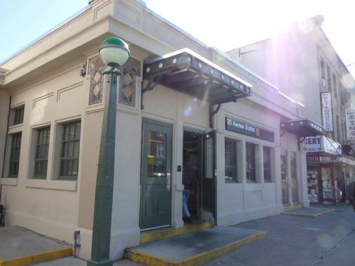
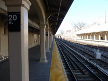
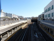
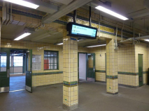
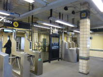
I took the N train to 20th Avenue, a station I’ve never exited from before. Like 8th Avenue, it’s one of a number of Sea Beach Line stations that have been completely overhauled after years of decrepitude and neglect. The work took over three years and lots of service disruptions, but finally, people who ride the N train in these parts have stations they can take pride in.
The MTA left the overall “look and feel” of these stations largely intact. The platforms are weather-protected with arches connected by columns and still look pretty much the same way they did when built in 1915.
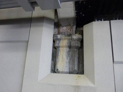
However: the original station walls were apparently deemed to be too far gone to rehabilitate. Therefore the MTA simply built a new wall in front of the old ones, leaving periodic openings for arched columns. The MTA did newly paint the originals in most cases, but they missed a spot here and you can really tell the difference.
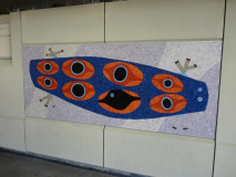
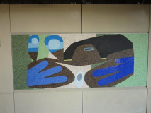
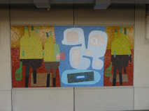
Unlike much of the new art in the rehabbed Sea Beach stations, the new work at 20th Avenue are pretty abstract. They’re by David Storey and are collectively called Sea City Spin. According to MTA Arts and Design, “the pieces create vignettes that weave together references of backyard windows, sidewalk market displays and juxtapose nature with the urban environment.” The artist David Storey, by the way, isn’t the British playwright also called David Storey.
As you know I’m quite a fan of the “just the basics please” tiled interiors of the BMT surface and open cut stations in south Brooklyn. I just don’t think they get their due compared to the Heins and LaFarge IRT exterior station houses. Their protege, Squire Vickers, is less well-known; he designed IRT, BMT and IND stations up to 1940, and came up with the original Machine Age IND streamlined designs.
He also designed the station houses for open cut and grade BMT stations on the Brighton (B,Q) West End (D) and Sea Beach (N) lines, as well, and now that they’re being rehabilitated I’ve come to respect and appreciate their designs with beige tiles and green/gold geometric shapes. To me these stations, most of which are on the Sea Beach, are worthy of NYC Landmarks status.
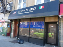
The Society di Amici is definitely not run by Quakers. Mapleton is on the cusp of several ethnic enclaves: remaining Italian-Americans in Bensonhurst, Orthodox and Hasidic Jews in Borough Park, and even fairly recent Chinese and Russian immigrants.
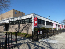
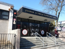
Franklin D. Roosevelt High School, 20th Avenue and 58th Street, was constructed in 1965 and counts among its alumni NBA player Vinny Johnson (who won two championships with the Detroit Pistons) and Liuetenant Colonel Alexander Vindman, who had a prominent role in 2019’s presidential impeachment hearings. The only time I have been inside was in 1976, when I attended a “Senior Sing” my cousin, Michel, was participating in. I remember one of the songs was Alice Cooper’s “Welcome to My Nightmare.”
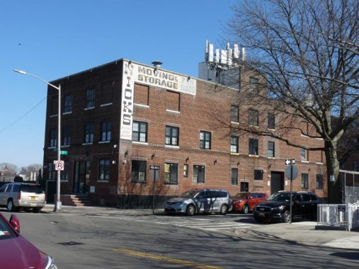
Across 20th Avenue from FDR High, Nick’s Moving & Storage has a prominent painted sign.
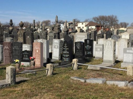
While Green-Wood and perhaps Evergreens get all the Brooklyn cemetery publicity, there’s another one smack in the center of the borough that’s fairly unnoticed, except if you are looking out the window of the F train en route to Coney Island or toward Manhattan. Washington Cemetery has been in Kings County since the mid-1850s, and while it has a primarily Jewish clientele today, that wasn’t always the case; cemetery founder James Arlington Bennett is interred within. He was also an educator and ran for Vice-President in 1840 on a ticket with Joseph Smith, author of the Book of Mormon and founder of the Church of Latter-Day Saints.
The 100-acre cemetery is divided into five separate numbered cemeteries divided by 20th and 21st Avenue, Bay Parkway, McDonald Avenue and Ocean Parkway. Cemetery #1 is east of McDonald Avenue and #2-5 are between McDonald and 19th Avenue. The main entrance is on Bay Parkway near McDonald Avenue. The crowded cemetery sold its last plot in 2008.
The cemetery sprawls on an irregular plot against the Bensonhurst and Midwood street grids, which were built out after the cemetery was already in place.
You won’t find a lot of big names here, but Jerry Sterner (1938-2001), author of the play “Other People’s Money” is here; his headstone reads “Finally, a plot.”
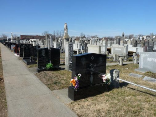
The monument to Daniel Roshal and Ida Volpe is typical of the post-1972 Soviet Jewish immigration wave that followed the custom of engraving images of their loved ones along with poems in their memory written by family members. Notice how the post-Soviet burials are all lined up here. Prior to their deaths, this path was much wider, able to accommodate hearses, but as cemetery space was running out, the roads were narrowed into paths to allow for more burials. –S.K.
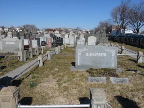
The footstone monuments for Ida and Louis Dorman avoid any imagery, either out of deference to the Orthodox custom of avoiding “graven images” or perhaps for budgetary considerations. The railings here separate plots designated for families and burial societies. –S.K.
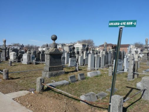
Eva and Morris Frankel died in the early 20th century. Their family plot appears to have a dozen burials within it. Often a tree stump monument symbolizes a young life cut short. Other common symbols at Jewish cemeteries include the lion of Judah, symbol of the largest surviving Israelite tribe. Descendants of Levi are also still with us. Benjamin merged with Judah in antiquity and the rest of the tribes were dispersed by the Assyrians, their whereabouts unknown. Star Trek‘s Mr. Spock’s famous Vulcan salute originates from the priestly blessing bestowed at Jewish services. On monuments they symbolize the kohanim caste, descendants of Aaron. For more on Jewish monuments, visit Kevin’s 2004 page on Mount Zion Cemtery in Queens. –S.K.
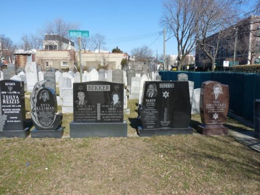
Near 20th Avenue with Public School 121 in the background are the monuments for Grigori and Meri Bekker. It’s a trilingual message with their Hebrew names and remembrances from their family members in Russian. Yakov Gurevich’s wife is alive at the time of Kevin’s visit, but likely her remains will be buried alongside her husband indicated by the blank space on his monument. Immigration divides families as parents and children end up being buried across the ocean from each other. Vera Gorilovskaya’s monument notes her father Misha, who was buried in Kiev, while Enya Kleiman’s stone mentions her father Abram who was killed in combat fighting the Nazis. I can relate to her pain. My maternal great-grandfather Levi Brodsky was shot by the enemy while digging a defensive ditch outside Stalingrad. His burial site is unknown to my family. –S.K.
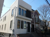
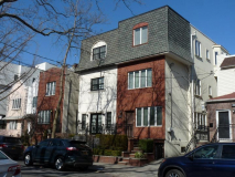
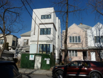
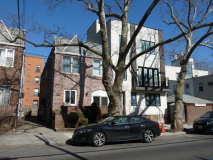
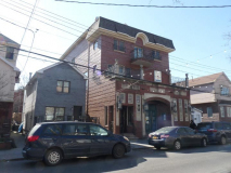
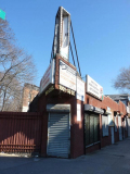
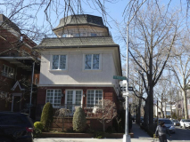
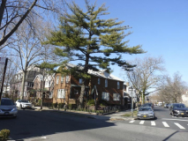
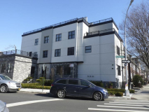
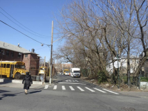
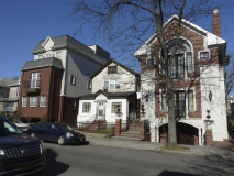
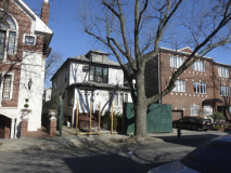
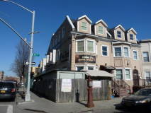
Heading for the F train at Church Avenue, I turned left at 53rd Street. For four decades, since the 1980s at least, Borough Park’s stock of modest two-family-two-floor homes have been replaced with larger houses, as bigger families have moved in. Here’s a sampler of what the new buildings look like.
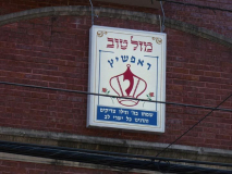
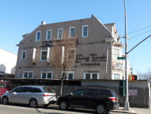
Two blocks to the north of Washington Cemetery is a sizable mansion-synagogue on 53rd Street, Zera Kodesh D’Ropshitz, representing hasidim from the Polish town of Ropczyce. Their rebbe (leading rabbi) Chaim Rubin, the Ropshitzer Rebbe carries a title that goes back to the late 18th century.
The rectangular sign above the entrance was likely installed for the December 2019 wedding in the Rebbe’s family. My friend Yitzchok Shteierman who lives nearby offers the transation: “Rejoice in the Lord and be glad, you righteous; sing, all you who are upright in heart!” from Psalm 32:11. A Hasidic wedding is austere in its devotion and ecstatic in celebration at the same time. Here are a few scenes from that wedding. –S.K.
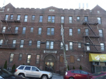
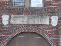
You will find the unusually named Roroc Court at 18th Avenue and 53rd Street. The name is likely a portmanteau word created by combining two of the developers’ names.
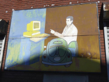
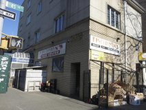
Meanwhile, the auto accessories place on the northeast corner, with a painting featuring what computers looked like around 1990, has an unusual peaked triangular edge. The reason for this is simple…
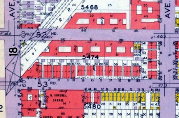
…as the Long Island Rail Road Bay Ridge branch, currently leased for freight to the NY & Atlantic RR, slices through the intersection at an angle; indeed, the entire intersection is bridged across the open cut.
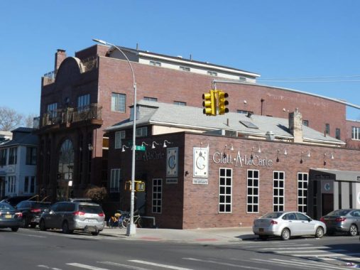
At 52nd Street and 18th Avenue is Glatt A La Carte, a catering service. Glatt is Yiddish for “smooth” referring to the strict kosher standard involving the smoothness of the lungs of the slaughtered animal. We are what we eat, and so the animal’s organs must be clean. Behind the caterer is the Borough Park synagogue of Spinka hasidim, led by Rebbe Meir Eleazer Weisz. His ancestral namesake town is today known as Săpânța in northern Romania. Branches of the Spinka hasidic community also live in Williamsburg, Kiryas Joel, England, Belgium, and Israel. –S.K.
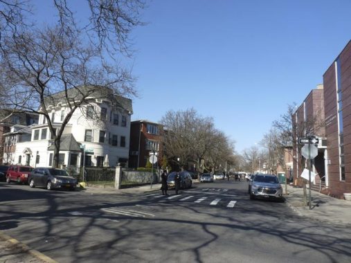
I have always had a fascination with Old New Utrecht Road, not least because of its odd juxtaposition of “old” and “new.” “Old” because it’s very old…it predated the current street grid…and “new” because of New Utrecht, the former Kings County town, which honors Utrecht, Netherlands. This is one of two Brooklyn roads that honor that city. I’ve walked New Utrecht Avenue for FNY, and covered Old New Utrecht Road pretty early on.
The old road currently exists in two pieces, a slanting, four block stretch from 48th to 52nd between 17th and 18th Avenues, and a one-block remnant at 14th Avenue but in the 19th Century it was continuous and together with what became 18th Avenue was one of Brooklyn’s main routes to Gravesend Bay in the colonial era.
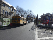
This stretch of the road was maintained likely because existing homes were there when the street grid was laid out and built in the late 1800s and early 1900s. Still, new construction has sprung up on ONUR, some of which pays homage to the past, and some conforming to modern styles.
I could be wrong about this — old timers correct me in Comments — but when I was a kid, riding past in the B11 bus down 50th Street and later riding through on my bicycle, I had the impression that at least some sections of ONUR were unpaved. Its sidewalk-free blocks remain testament to its rural past, though the road is regularly paved these days.
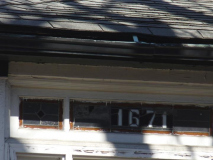
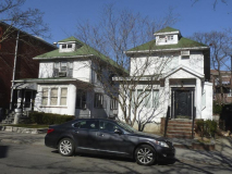
In these photos taken on 48th Street between 16th and 17th Avenues, you can see examples of Borough Park’s former housing stock: modest two-story houses, some with stucco’ed exteriors, and glass panels showing the house numbers. They’re quickly being replaced by much larger, more extravagant dwellings.
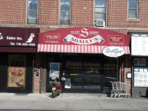
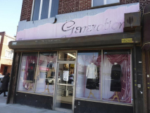
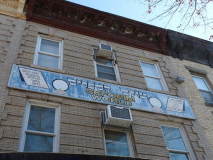
16th Avenue is Hasidic Borough Park’s second main commercial avenue, second only to 13th Avenue. Several businesses have painted signs that have been there for decades and are now fading. However, these businesses have a longstanding clientele that is generational in some cases, and feel no need to replace the signage; people know where they are, and what they can buy there.
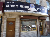
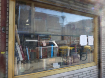
For most of history, the majority of humanity was illiterate, relying on illustrations and the spoken word for information. The People of the Book have this nickname for a reason with nearly universal literacy and a focus on education since the beginning. Seforim is the Hebrew term for holy books, as seen in this shop on 16th Avenue. In an age of smartphones and instant information, the print publishing industry remains strong among Orthodox Jews, who do not use electronic devices on their Sabbath and holidays. On those days, they rely on print media.
Above the awning for Seforim World is a hand-painted sign for this store whose colors have faded over the decades. This shop takes pride in its collection of out-of-print books and antiques. –S.K.
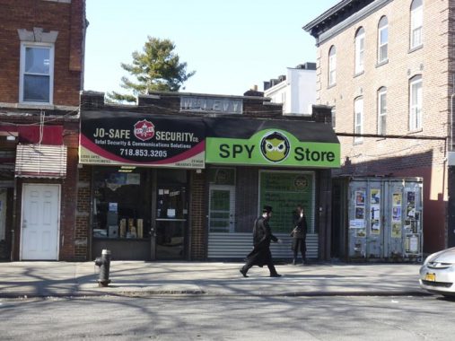
At 4414 16th Avenue, the name Wm. Levy appears in a cartouche at the roofline. It’s possible that Levy owned the plumbing & heating supplies store seen in this 1940 Municipal Archives tax photo.
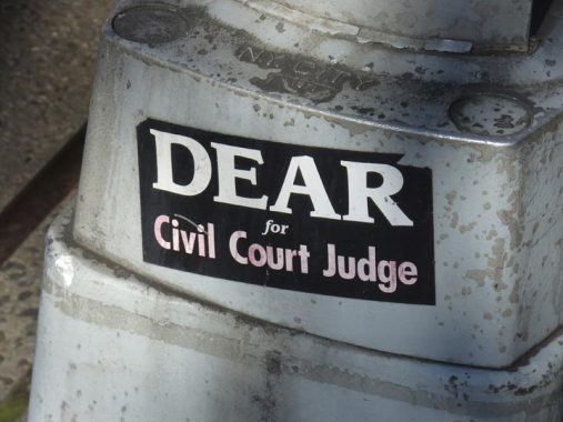
Noach Dear (b. 1953) was elected Civil Court Judge for NYS in 2008, and has served on the NYS Supreme Court since 2015. He was a Democratic NY City Councilman from Borough Park from 1983-2001. He lost to Anthony Weiner in a Democratic primary for Charles Schumer’s House seat after Schumer was elected senator, then ran as a Republican, losing to Weiner in the general election. Dear thereupon narrowly lost a State Senate election to Kevin Parker in 2002.
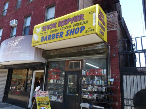
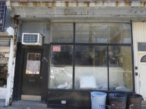
At 4313 16th Avenue you can get your haircut and shoes shined in the same place, though I’m not sure about simultaneously.
I keep meaning to book a tour for Torah Animal World at 16th Avenue and 41st Street. It made the Village Voice list of NYC’s Strangest Museums in 2015. The dream of Rabbi Shaul Shimon Deutsch was to present every beast mentioned in the Torah as a neighborhood learning venue. Operating a zoo was too costly and labor intensive, so he decided to present the beasts in stuffed versions. Elephants, ostriches, rhinos, bisons and lions are in the exhibit; lions, now confined to Africa, could be found in the Holy Land in antiquity. Some now extinct animals are represented: the egg of an elephant bird from Madagascar, as well as a tusked musk deer, now found only in Siberia.
Though over one million pass through the doors annually, admission is still by appointment only. It’s $10 and you can call 877-752-6286 to set one up; groups are welcome. There is also a location in Fallsburg in the Catskills. Open Sunday through Thursday from 9 to 9.
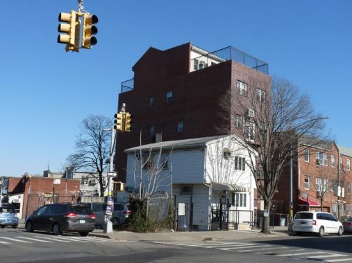
At 40th Street and 16th Avenue, there’s a contrast between old and new Borough Park housing stocks.
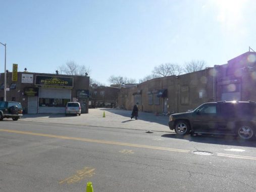
When observing street scenes for Forgotten NY, I have a keen eye about property lines and odd building angles. They often have a story to tell about former roads and rail lines. The slanted building on 39th Street between 14th and 15th Avenues is no exception to this. Pardon the bad image, but the sun was directly above the shot.
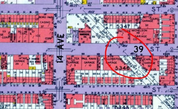
I’ve circled that slanted building in red on this 1929 Belcher Hyde map. You can see that Old New Utrecht Road formerly passed through here. By 1929 it was all but demapped but sections of it were used as driveways as is the frequent case with old Brooklyn roads. You just have to know where to look for them. More on ONUR a bit later.
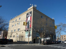
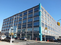
A pair of truly massive former warehouse and factory facilities on 14th Avenue. The first, at 38th Street, is the former home of the Phoenix Hermetic Company, but now serves as the Sukkah Center.
Phoenix-Hermetic is still in business today as Phoenix Closures. According to its website,
Phoenix-Hermetic pioneered in closure design, capping machinery, cap sealing, metal forming and lithography. Innovations included the development of the modern continuous thread (CT) cap in 1922. In an effort to better describe the business, the company changed its name in 1932 to The Phoenix Metal Cap Company.
Meanwhile, Sukkah Center…
For one week each autumn Jews leave the comfort of their homes and eat their meals in sukkahs, booth-like tents that commemorate the Exodus when Jews lived as nomads during their 40 years in the desert. The commandment to dwell in tents originates from Leviticus 23:42. Known to Christian translators as the Feast of Tabernacles. Although Jews are also encouraged to sleep in sukkahs, in colder and rainy climates it is not a requirement. Our health comes first. A sukkah vendor sells the leaf and bamboo covering that proivdes enough covering to be called a roof while still allowing one to see stars and feel the elements. Jewish apartment dwellers use their synagogue sukkah to observe this commandment.–S.K.
The massive loft at 14th Avenue and 37th Street is home to a mini-mall, Brooklyn Square.
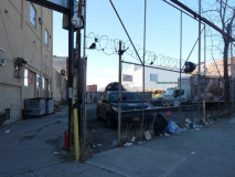
What’s behind that locked gate on 14th Avenue between 37th and 38th Streets? Nothing much of interest these days, but this place marks the former route of two separate railways: a surface freight line called the South Brooklyn Railroad, which extended from the waterfront on a separate right of way along 37th Street and then down the middle of McDonald Avenue to the Coney Island. It was last used in 1978 and the tracks were ripped up over a decade later, though you can still see one here on 14th Avenue.
Above the surface freight line ran the Culver Line elevated, which branched off Brooklyn’s 5th Avenue El (demolished in 1940) and then ran on elevated tracks along 37th Street and then south along McDonald Avenue to the Coney Island terminal. When the 5th Avenue El was razed, this section was orphaned and ran as the Culver Shuttle (as the Culver section on McDonald was connected to the IND Church Avenue station in the 1950s) until 1975. The el structure stood in place until 1985.
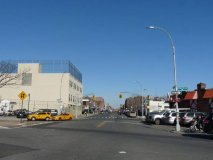
From modest beginnings… Church Avenue, one of the main drags through Kensington, Flatbush and into Brownsville, officially begins at Old New Utrecht Road and 36th Street, though a short paved section runs west to 37th Street to permit B35 buses (and until 1956, trollies) access to it. It’s another colonial-era route named for the Flatbush Reformed Dutch Church at Flatbush Avenue, a congregation that goes back to the 1650s.
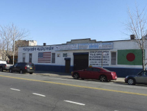
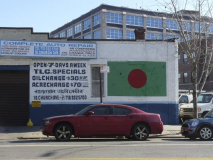
In polyglot Kensington, the flag of Bangladesh, as well as some Bengali script, are shown on this Church Avenue auto repair shop. As a rule, the red dot on the flag is usually off center a bit to the left, so it will center when the flag is fluttering in the wind. The green represents the country’ verdancy, while the dot represents both sunrise and the blood shed during Bangladesh’s war of independence in 1971.
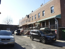
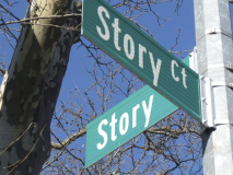
Whenever I’m in this part of Kensington, I duck down one-block Story Street to see if the ancient pair of 1964-era vinyl street signs, shown on FNY’s Church Avenue page, are still surviving. Sorry to say, they’ve finally been replaced by a pair of standard green and whites.
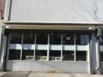
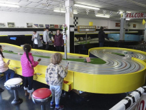
I also ducked into Buzz-a-Rama for a look. Buzz-a-Rama bills itself as the world capital of slot car racing. The mecca has been operated by Frank “Buzz” Perri, now nearing 85, since 1965. For those unaware, slot cars are guided by miniature 12 volt D.C. motors set in the underside of model cars along a central groove in the track in which they run. Racing buffs, young and old, bring in their own cars, or rent them here, and rent space by the hour. It’s open on weekends.
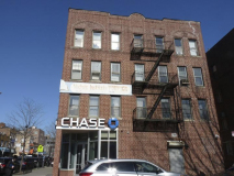
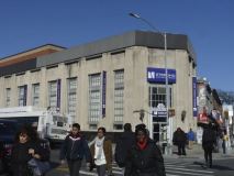
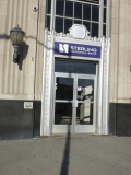
Finishing at the Church Avenue F train at Sterling National Bank, most recently an Astoria Bank branch.
Astoria Federal Savings was chartered as Central Permanent Building & Loan Association in 1888, and became Astoria Federal in 1936, which seems about right for the date this branch at McDonald and Church Avenues was built. This branch was formerly the Greater NY Savings Bank, purchased by Astoria in 1996.
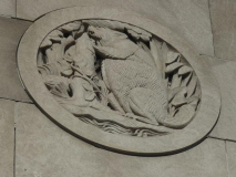
It’s streamlined, as buildings started to be in that era, but architects were still able to add touches like the beaver, a symbol of thrift as well as of New York State (let’s not forget the bank’s namesake, John Jacob Astor, the USA’s first millionaire, made a smash as a fur trader and initially, as a dealer of musical instruments).
Check out the ForgottenBook, take a look at the gift shop, and as always, “comment…as you see fit.”
3/1/20


22 comments
I am 43, and I too have some memory of an unpaved portion of ONUR. But as much as I try I can’t place exactly where it was
I do as well, it was right near where it starts at 17th Ave. Looks like a day care is there now. There were old frame houses by my memory. https://www.google.com/maps/@40.6300117,-73.9824161,3a,75y,192.48h,79.29t/data=!3m6!1e1!3m4!1slAQENRjU9-hEDY0OeV6MTA!2e0!7i16384!8i8192
Astoria Bank is no more–all branches taken over by Sterling Bank.
Great write-up, Sergei. Thanks for sharing. I’ve learned so much about my own City from FNY.
I don’t know why you thought it was necessary to mention Anthony Weiner, but since you did, here’s some background (scroll down to the video, a real must see):
https://www.foxnews.com/politics/anthony-weiner-scandals-from-politics-to-sexting-cases
And in the spirit of “never again” a warning from one of SK’s “paisans”:
https://nypost.com/2020/03/01/imagining-what-a-president-bernie-sanders-would-mean-for-jews/
I just mention the facts and don’t take a political slant. I mentioned Donald Trump without comments on the Little Neck-Forest Hills walk.
Yes, but Weiner is a convicted & registered sex offender who is best ignored, if not forgotten. I doubt Noach Dear would have disgraced himself the way Weiner did.
Gotta love the pathetic “Bath Fitter” station wall coverup. Apparently this is nothing new; in the early 80’s the badly corroded columns of the Brighton Line Church Avenue station were simply sheathed in flexible metal casings, which were then painted a plum color. Talk about lipstick on a pig; I laughed then as I do now.
I can remember that into the late sixties/early seventies there was a section of Old New Utrecht Rd. near 17th Ave. that was still unpaved.
“Glatt” actually means “smooth” in Yiddish (cognate with German!), not “lung.” But yes, the term refers to the Kosher rule that the lungs of a slaughtered animal must be “smooth.”
Great trip down memory lane, Kevin and Sergey. I grew up on 51st Street, between 19th and 20th Avenues. PS 121 was my grade school back in the 50’s when kids walked to school and came home for lunch. We used to ride our bikes and burn Christmas trees in the big empty lot where FDR HS sits now. I went to New Utrecht HS, but my younger brother went to FDR.
The section of Washington Cemetery along 20th Avenue was quite old. I could read some of the headstones while walking my dog. Many were for people born in the mid-1800’s in Eastern European towns and provinces that no longer existed by then. 58th Street, where the Moving and Storage is, was not paved until the 1960’s. The cemetery scene from the 1987 movie The House On Carroll Street was filmed from the Bay Parkway “F” train station.
I spent many a Saturday afternoon at the Mapleton Library. When I wasn’t at the library, we used to ride the Culver Shuttle back and forth just for the joy of looking out the front window. I well remember the freight trains pulling out of the Parkville yard and moving slowly down McDonald Ave., much to the dismay of car drivers.
You’re definitely correct about Old New Utrecht Road not being paved. I used to walk it on my way to Montauk JHS at 42nd Street and 16th Ave. It was part of my World Telegram & Sun newspaper delivery route later. It was unpaved from 52nd Street to 17th Ave.
The four corners of my block, 19th Ave from 51st to 52nd Streets, and both sides of 52nd Street from 18th to 19th Ave were four story tenements like the Roroc Court pictured. It was all Irish and Italian in the 50’s and 60’s. I guess that’s changed now.
Glatt means smooth not lung.
That’s what I wrote.
The portion of ONUR between 17th avenue and 49th street was not paved when I was a kid in Chasan Sofer ~1990 (I think the rest wasn’t paved either but I’m less certain about that) . Additionally the SE corner lot at 44th and 16 ave had a row of houses at an angle, a remnant from when ONUR passed there. (these houses are no longer there and the lot is filled with a yeshiva. However at the corner NW corner of 16th ave and 43rd the building housing matammim catering is angled in the back. this is visible on Google maps (and from the ground on 4rd street looking at the back of the building
thank you for a great column
In all honesty, I’m not too familiar with Mapleton. Then again, that’s probably because it’s not a neighborhood that exists today. Also, the description doesn’t seem to give much of where the origin of the name really came from. My guess it could have been for possible maple trees that were once there or for the developer’s hometown, though either of which could have been true. Nevertheless, NYC has a ton of no longer existing neighborhoods that no longer exist and were changed over time. As a matter of fact, not too far from here there is area that is now Flatbush, Ditmas Park, Prospect Park South, and Midwood that used to be called Pigtown, which my guess could have been for where the pigs either lived at a time or for the farmers who had them.
I know the neighborhood Mapleton (I’m a Bklyn lifer and neighborhood historian myself) I drive/ride to and from work just about everyday through ONUR. My warehouse is actually a house on 54th btwn 19th and 20th. There’s an alley in the middle of the block (super cool,there’s a few in the area- including that walkway alongside the train tracks on 51st or 52nd).
I’d consider that area Mapleton as well. Omw to work I take Ave I under McDonald ave. which turns into 20th ave after Dahill road. That area, I’d definitely consider to be Mapleton or the Mapleton side of borough park. The homes, the landscape, the feel the of that area, feels dark different from borough park. Overall , you can tell the area is old, I like it though.
Big thanks to those who left some great stories in the comments, well appreciated!
It was a good neighborhood to grow up in. Safe enough to be outside all day, but imbuing us with the street smarts to use later in life. There were many empty lots in those days. That section of 20th Ave from McDonald Ave to Dahill Rd was barren on both sides. We used to make our “forts”, hang out, smoke, look at girlie magazines, and pull up weeds with big root clumps of dirt to practice the “hammer throw”. The apartment courts were for Chinese handball, but when we got chased out, there was stickball and punchball on 51st St. There were always baby carriages being thrown out, and we’d use the wheels to make carts. I broke a front tooth riding my cart down the hill at 50th St and 19th Ave. If it was raining, we could hang out by the LIRR underoasses at 50th or 52nd Streets, and throw rocks at passing trains (or hobos) if the chance arose.
Yes, Mapleton was a good place to grow up!
@Bill Tweeddale Awesome, thanks !
My family lived on 55th st between 18th and 19th aves. I went to PS 121 , Edward B Shsllow Jr High School, and graduated from New Utrecht High. Now living in Los Angeles area since 1956, but my old neighborhood still rests in my heart as my real home. Wouldn’t trade my days in the neighborhood for anything. I am not clear as to exactly what that section of the neighborhood falls under, Is it the Mapleton section, Bensonhurst?
The name “Mapleton”, or “Mapleton Park”, to my memory, has always been somewhat flexible. For example, I played little league baseball in the Mapleton Athletic League whose games were played at the Bensonhurst Fields near “Nellie Bly” and at the Coney Island Creek fields from 1961 to 1965. I was Bar Mitzvahed, in 1965, at the Jewish Center of Mapleton Park, located on West Eighth Street between Avenue O and Bay Parkway. Many young adults and young men spent countless hours at Maple Lanes on 60th Street and 16th Avenue. Until FDR’s construction, in 1965, the neighborhood had no identifiable or associated high school. Of course,a large percentage of youngsters went to parochial schools. Practically no one I’ve known for decades refers to the area as Mapleton or Mapleton Park anymore. I relocated, out-of-state, 16 years ago.
Wasn’t that a time?
You’re right. I never heard the name “Mapleton” used to describe the neighborhood. There was the Mapleton Library on 60th St. and 17th Ave. Growing up on 51st St and 20th Ave, we all thought it to be Borough Park, although it might have been considered to be Parkville or Mapleton. Before FDR was built, just about everyone living west of McDonald Ave went to New Utrecht HS.
I’ve lived in Mapleton for my entire life, and I’m one of the remaining Italian-Americans that are still living there. I graduated FDR in 1995. We always were aware of the history of Mapleton or Mapleton Park, but growing up around 20th Avenue we always felt part of Bensonhurst with 54th Street being the boundary to Borough Park. As the years have passed and Borough Park grew, 60th Street became the boundary. Just my two cents