

On the eastern edge of Brooklyn is a lengthy median flanked by service roads for an unbuilt highway. As it cuts through the street grid, Conduit Boulevard has a set of triangular parks and architectural oddities.
The namesake of Conduit Avenue and Boulevard was the Brooklyn Water Works, a conduit that brought water from reservoirs on the south shore of Long Island to the Ridgewood Reservoir atop the glacial terminal moraine. From there, the water flowed to homes and businesses throughout the city of Brooklyn. After Brooklyn voted to be annexed by New York City in 1898, it switched to the Croton aqueduct and its conduit was eventually abandoned. The route of the pipe remained on the map as Conduit Boulevard, which runs from City Line Park to the Queens-Nassau border, where the road continues east as Sunrise Highway, later renamed Shore Parkway (today Sunrise Highway begins in Laurelton where Laurelton Parkway turns northward).
At its starting point, Conduit Boulevard splits off from Atlantic Avenue in an interchange that appears like the start of a highway. Beneath the ramps is the Long Island Railroad, which was routed through a tunnel beneath Atlantic Avenue in 1940. Next to the ramps is City Line Park, whose name denotes this neighborhood as the limit of Brooklyn. Formerly the site of a water pumping station, it was acquired by the Parks Department in 1937. On maps, this neighborhood appears as Cypress Hills, East New York, or City Line.
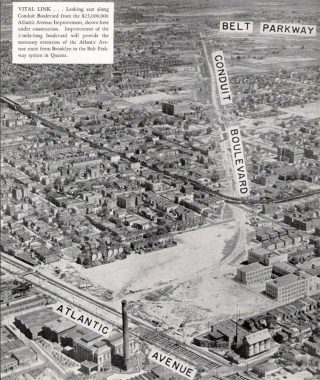
An aerial survey conducted by the city in 1941 shows the railroad going under Atlantic Avenue. Transit Tech High School was completed before City Line Park. The Fulton Street El snaked around Conduit Boulevard, making the turn from Liberty Avenue to Pitkin Avenue. It was demolished in 1956, after an underground line replaced it. Its last seven elevated stations in Queens were linked to the subway line.
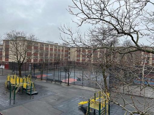
A portion of the park was developed as Transit Tech High School, for students intending to have careers in public transportation. Inside, students can tinker with a retired R42 subway train that was brought here by truck and a crane. The school’s medallion logo shows an anchor with a ship, car with a wrench, motors with thunderbolts, and a propeller in the center.
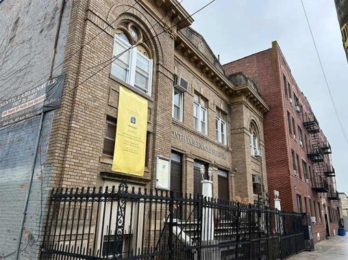
The school faces Fountain Avenue, whose name may also relate to the water works that stood here. Next to the school is Ninth Tabernacle Beth El, affiliated with the Church of God and Saints of Christ, a Black denomination which observes elements of Judaism while recognizing Jesus as the messiah. Prior to its present use, it was an Orthodox Ashkenazi congregation, Talmud Torah Atereth Israel. In the 1960s, Brownsville and East New York underwent white flight as Jews and Italians moved to the suburbs, with Blacks and Puerto Ricans moving in. Within a decade, nearly all synagogues in these neighborhoods became churches.
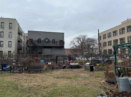
Another Jewish star appears on the back wall of this church, facing the Crystal Wells Community Garden. Its name isn’t derived from a person but from its location, the corner of Wells and Crystal streets.
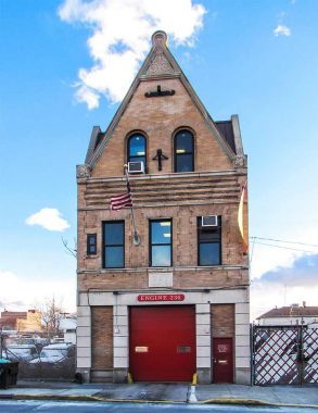
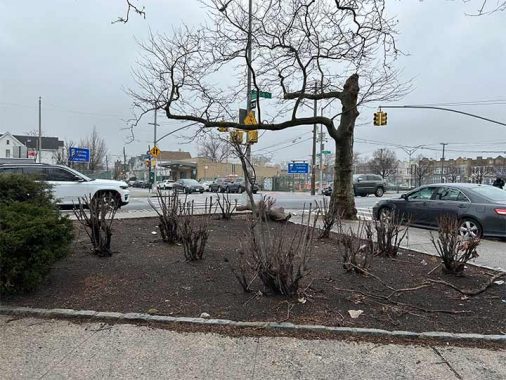
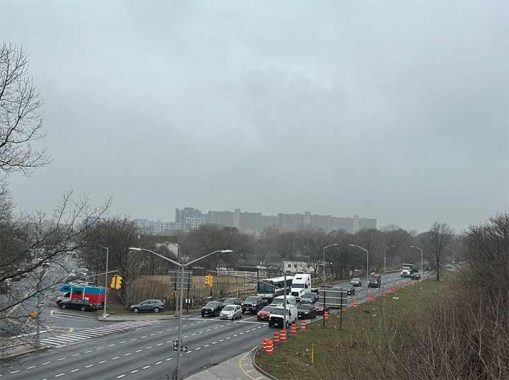
At Liberty Avenue is a FDNY Engine 236 with the initials BFD above its entrance. I thought of the phrase that President Biden used in describing important legislation. Here it stands for Brooklyn Fire Department, having been built when Brooklyn was an independent city. Conduit Boulevard’s median widens here, intended for a highway that was never built. More on that later.
On Hemlock Street, to the north of Conduit Boulevard is a nondescript warehouse that makes carbonated water, open to the public as Brooklyn Seltzer Museum. Founded in 1953, the family-run Brooklyn Seltzer Boys maintain the history of this old-time New York industry. Not far from here is another appointment-only factory/museum dedicated to handpainted commercial signs.
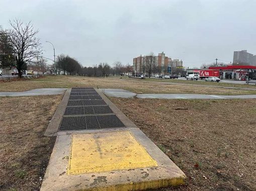
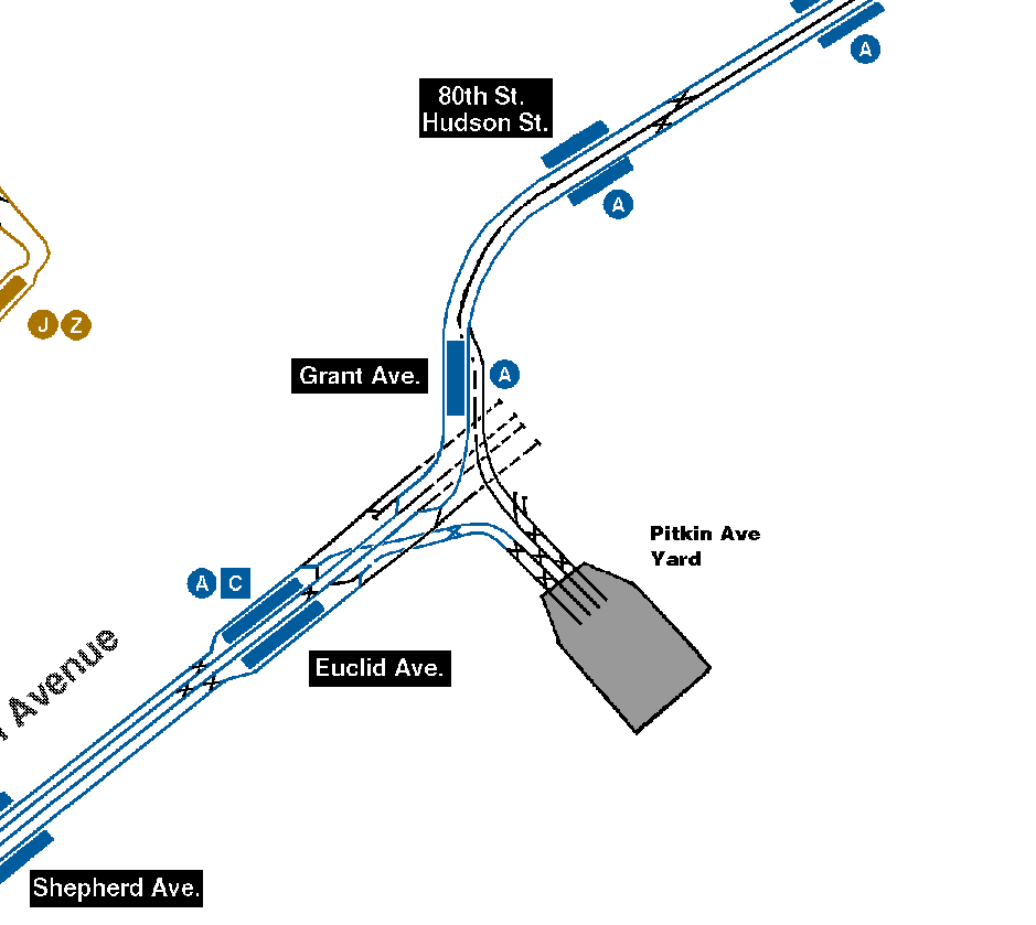
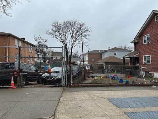
On the median at Pitkin Avenue is a subway ventilation grate that lines up with Conduit Boulevard. Across the street is a commuter parking lot surrounding the Grant Avenue station. Beneath this median, the Fulton Street subway line (A Train) splits in three, with a branch extending into Queens, tracks turning south to the Pitkin Yard, and stub tracks designed to extend the subway further on Pitkin Avenue. Had it been built, the next stop going east would be 76th Street on the Queens border. Was it completed but never used? It is truly the “Area 51” of the subway system.
Grant Avenue has a short segment south of Conduit Boulevard, next to an unnamed triangle. It dead-ends at Robert E. Venable Park. The park was built atop the tracks leading to the Pitkin Yard. Its namesake is a local resident who served as a transit cop. He was killed on the job in 1987 by drug dealers. On the north side of Conduit, Grant Avenue has another unnamed triangle, and a subway station in a commuter parking lot. This station opened in 1956 as the link between the Fulton Street subway and its elevated portion in Queens.
Belmont Avenue has a one-block jog north of Conduit Boulevard, sharing its name with Belmont Playground, honoring the father and son financiers who were both named August Belmont. There is also a Belmont Playground and Avenue in the Bronx. On this block is a house-turned-mosque representing the most recent demographic in eastern Brooklyn and southern Queens, Muslims from Bangladesh. At the end of this block is 75th Street, the unmarked Brooklyn-Queens border, where the named streets of Brooklyn continue in Queens with assigned numbers.
Likewise, Conduit Boulevard in Brooklyn becomes North and South Conduit Avenues in Queens. Why? I don’t know, but it’s similar to how Grand Street becomes Grand Avenue upon crossing this borough border, and Merrick Boulevard in Queens becomes Merrick Road in Nassau County.
Looking south on the borough border, there are two signs for this street that branches from Conduit Avenue: 75th Street for the Queens side and Ruby Street for the Brooklyn side. Some residents describe this borderland as “the hole” because the ground sinks here and often floods (the phantom Spring Creek manifesting itself) It is relatively underdeveloped, a true frontier. It also has a dark past as a dumping ground for mafia victims. Streets named after pricy gems in a swampy area is as misleading a name as ice-covered Greenland.
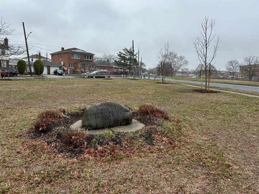
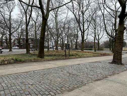
Back to the north side, where a triangular park is formed by Conduit Avenue, Sutter Avenue, and 78th Street. Initially it was named Sutter Green in honor of Peter D. Sutter, a Brooklyn Democratic Party leader in the 19th century whose name also appears on the avenue. Because Sutter already has his name on the map, in 2006 this park was renamed for a local Republican, Angelo Graci, who served as a state assemblyman, judge, and co-founded Our Neighbors Civic Association of Ozone Park. This neighborhood has a sizable Italian community and historically a stronghold for the GOP in this mostly Democratic city. An inscribed rock in this park memorializes Graci, with no further details on this honoree.
A driveway on Sutter Avenue across from Graci Triangle skews from the grid, indicating an ancient road. Another hint of it is a block to the north, where the corner of 78th Street and Belmont Avenue widens a bit.
[Note: this is likely more due to an old farm property line)
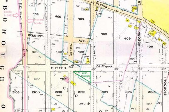
The Belcher-Hyde map from 1913 shows the wide path of the conduit and the unnamed alley north of Graci Triangle. The Brooklyn-Queens border followed Spring Creek and after it was filled, the line between these boroughs was straightened. Only the colored streets on this map were completed at the time.
Verdant streets with brick houses define the Tudor Village section of Ozone Park, with a playground named for these houses. Here, the demographic change is exemplified by the cricket field at Tudor Park, a popular sport among Indo-Caribbean immigrants.
Dumont Avenue enters Queens retaining its name. At its intersection with Conduit Avenue is Dumont Triangle, planted carefully with daffodils. According to the book Brooklyn by Name, the honoree is Swiss political philosopher Pierre Etienne Louis Dumont. No details are given on when the avenue was given its name or what inspired this honor.
On the opposite side of Conduit Avenue is Gemini Fields, a baseball park framed by Linden Boulevard. From its origin in Flatbush to its merge with Conduit Avenue, it carries State Route 27. In its entirety, the set of roads comprising NY-27 run for 120 miles from Gowanus to Montauk Point.
Linden Boulevard was intended to run uninterrupted from Brooklyn to Nassau County but in Ozone Park, homes and the Aqueduct Racetrack stood in the way, so this road appears on the map in three separate segments, and a couple of stubs in between.
South of Linden Boulevard’s merge with Conduit Avenue is a working horse ranch on Parks Department land. The property was assigned to Parks in 1938 when Conduit Avenue was built. At the time it was part of the Brockman radish farm, the last agrarian holdout in Howard Beach. It appeared on some maps as the Cedar Lane farm, for an old road that ran through it. By 1953 it wasn’t profitable to farm here. Parts of the farm became apartment blocks and the rest was an undeveloped park until 1994, when the Federation of Black Cowboys leased the Sunrise Stable from the city. After their lease ended in 2016, it was then leased to GallopNYC, which provides therapeutic horse rides for the public. The site is shared with PEP Mounted Command for its horseback park patrols.
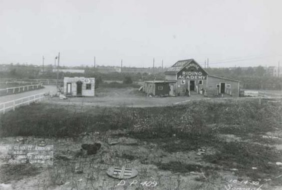
The horse farm here has a long history, as seen here in 1938. Its name is unrelated to Sunrise Highway further east, although both are connected by NY-27. In this century, it is one of the last two horse stables in Queens. The borough has a long history with horses, with long-ago racing tracks, carousels, street names, and public art. In the 19th century, Queens had many horse racing tracks, but as of 2025, only the Aqueduct remains in business.
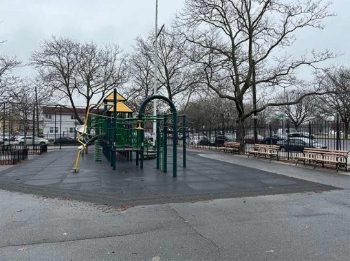
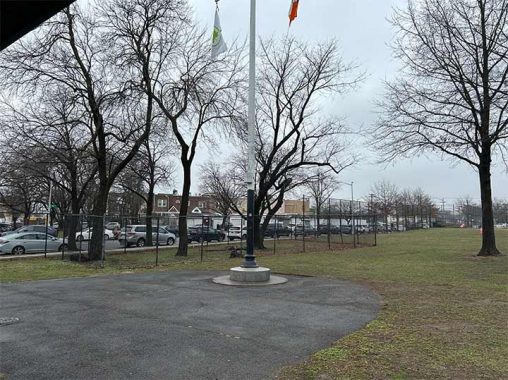
With its considerable width and a highway proposed on its median, the city constructed a footbridge at 88th Street to cross Conduit Avenue. On its north side, the bridge lands in Rocket Playground. Its name honors inventor Robert H. Goddard, who is the co-name of the adjoining J.H.S. 202. Perhaps fitting to celebrate an aerospace pioneer in a neighborhood near JFK Airport.
The final park on my walk here is Vito Locascio Field, bordered by North Conduit Avenue, 149th Avenue and Cross Bay Boulevard. Initially owned by the Brooklyn Water Works, the property then passed to Parks. As 149th Avenue is the Queens continuation of Brooklyn’s Loring Avenue, this park was called Loring Field.
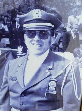
It was renamed for longtime Parks worker and local resident Vito Locascio in 2006. He was the longtime leader of the Columbian Society at NYC Parks, representing its Italian-American workers. In solidarity, I created an online list of every park in the city relating to Italian culture. Hat tip to his son John, also a longtime Parkie, for sharing this photo of the namesake in uniform.
|
|
|
|
|
|
|
|
A small fenced area within this park is a portion of Southside Burial Ground, which Kevin documented in 2018. The cemetery was split by 149th Avenue in the 1930s. A sign on the fence explains the cemetery’s history.
East of Cross Bay Boulevard, Conduit Avenue splits with one lane becoming the service road for Belt Parkway as it carries NY-27, and another lane exiting right becoming the partially completed Nassau Expressway or NY-878.
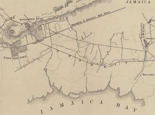
A historical tour using old maps begins with Bernhard Essroger’s 1864 chart of the Brooklyn Water Works, in which “Conduit” appears on the map.
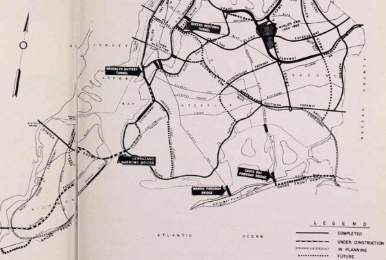
In 1963, the Triborough Bridge and Tunnel Authority published its Future Arterial Program, proposing an interstate highway from the Holland Tunnel through lower Manhattan to Williamsburg Bridge. In Brooklyn it would run as the Bushwick Expressway to Atlantic Avenue, and then on Conduit Avenue to Queens and the Five Towns as Nassau Expressway.
Had Interstate 78 been completed in New York City, it would have meant an uninterrupted drive from Pennsylvania to Atlantic Beach without any traffic lights. These days, city planners are more likely to draw maps for bike routes or public transit rather than expressways that slash through neighborhoods. Conduit Avenue’s future is a green ribbon that mitigates pollution, collects rainwater, and connects parks along its route.
For a similar grid-defiant road with triangular parks, see my essay on nearby Rockaway Boulevard. Prior to Conduit Avenue, the ancient east-west route in this area was Old South Road, which Kevin covered in 2011.
You can learn more about the history of this road by visiting each of the hyperlinks posted in the essay above.
Sergey Kadinsky is the author of Hidden Waters of New York City: A History and Guide to 101 Forgotten Lakes, Ponds, Creeks, and Streams in the Five Boroughs (2016, Countryman Press), adjunct history professor at Touro University and the webmaster of Hidden Waters Blog.
Check out the ForgottenBook, take a look at the gift shop. As always, “comment…as you see fit.” I earn a small payment when you click on any ad on the site.
3/22/25
10 comments
Very thorough, but I can’t believe you didn’t mention Force Tube Avenue.
The driveway across from Graci Triangle does not seem to a remnant of any ancient road but, rather, the result of old farm boundaries.
I wouldn’t be surprised about Conduit Avenue being named for once being by a conduit just like how Canal Street was by a canal and Wall Street being by a wall.
Getting off the Belt eastbound to go to one of the many JFK parking lots on Conduit South is total pain in the ass. Waze has no idea you can’t jump the median to go from the Belt to a lot that’s right there.
Transit High School.That must be where Ralph Kramden learned to drive a bus
https://www.bing.com/videos/riverview/relatedvideo?q=youTube%3fJackie+gleason+Shoe%2f+And+away+we+go!&refig=f448eab894104375f5d73fa338356891&mkt=en-us&ocid=&ru=%2fsearch%3fq%3dyouTube%253FJackie%2bgleason%2bShoe%252F%2bAnd%2baway%2bwe%2bgo%2521%26form%3dMSNSB1%26refig%3df448eab894104375f5d73fa338356891%26mkt%3den-us%26ocid%3d&mmscn=vwrc&mid=C1B3DC30F0591662FCECC1B3DC30F0591662FCEC&FORM=WRVORC&ntb=1&msockid=9ea1f9f9099111f0ae41e4c556ce45ad
wishing I’d thought of that one
Great article. Thank you for posting.
Dumont Avenue was formerly known as Duryea Avenue, named after Michael S. Duryea, through whose land the street was laid out. In January 1887 the New Lots Board of Trade recommended to the Brooklyn Common Council the renaming of 67 streets in the recently annexed former Town of New Lots, with the proposed names having the same initial letter as the original name. The name recommended and chosen for Duryea Avenue was Dumont Avenue. (although Dover Avenue was considered) It appears that Dumont was chosen mainly because (like the original Duryea) it began with a D. Renamed by the Common Council on April 11, 1887, effective April 26, 1887. (Source: The Brooklyn daily Eagle) I’m not sure whether the Queens section had ever been called Duryea or anything else, or whether it was simply extended into Queens after the change to Dumont.
Thank you for the research.
Now I’m curious about Loring Avenue’s namesake.