
I braved the ice floes in the first week of February 2021 and hit the 7 and G trains to the Broadway stop at Union Avenue. I had a desire to walk Grand Street again, which I hadn’t done in a decade, in 2011. Along with Metropolitan Avenue (of which I walked all 14 miles in the spring of 2015) it’s one of Williamsburg’s two major commercial strips, and it combines a lot of old Brooklyn with the hipster esthetic that arrived in the 1990s with some of the upscale Willie of the 2000s, though the latter aspect doesn’t really come into play till you get near the East River. As with my 2011 walk, I paid the closest attention to the sidewalk signs for various businesses, which range from the 1940s to the 2020s.
As an appetizer and to get more exercise in (the Covid Pandemic and icy weather have forced me indoors more than I’d like, and my waistline may have ballooned a bit) I first headed east on Boerum Street from the subway, then up Bushwick then west on Grand.
GOOGLE MAP: BOERUM and GRAND STREETS
Two streets in Brooklyn are named Boerum: Boerum Place, downtown in a small neighborhood called Boerum Hill, and in Williamsburg, running east from Broadway and Union Avenue to Bogart (itself named for a Dutch colonial family; famed actor Humphrey Bogart is a descendant). The Boerum family arrived in New Amsterdam as early as 1649.
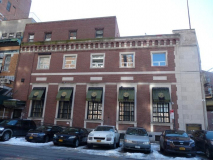
The corner building at Broadway and Boerum Street was originally built as a branch of the Lincoln Savings Bank. The bank was incorporated as the German Bank of Brooklyn in 1866 and then changed to the new name in 1917, no doubt World War I influencing that decision. The building is currently up for lease, but was recently a jewelry store called Broad & Boerum. Its formidable bronze doors are still in place; see I’m Just Walkin’ for a better look.
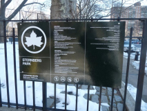
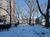
Sternberg Park, between Boerum, Lorimer and Leonard Streets and Montrose Avenue, has been here since 1920; it was built to provide some relief on what was once one of the most congested areas in Brooklyn. It was originally Williamsburg Park, then Lindsay Park (see below) and then Sternberg Park, named for philanthropist Frances Hamburger Sternberg (1920-1990) in the year of her death.
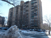
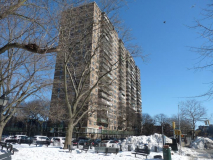
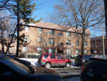
These are the high-rise Lindsay Park Houses, but they’re not named for who you may think. The project, on either side of Sternberg Park between Union, Manhattan and Montrose Avenues, Broadway and Moore Street, was constructed in 1964, a full year before US Representative John Vliet Lindsay ran for mayor. Instead, they were named for a Williamsburg congressman, George H. Lindsay (1837-1916).
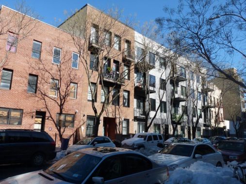
Some newer housing on Boerum between Manhattan and Graham Avenues.
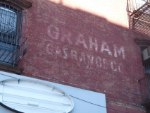
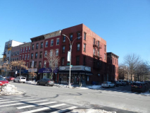
The 4-story walkup on the corner of Boerum and Graham Avenue has a much-faded ad for “Graham Gas Ranges.”
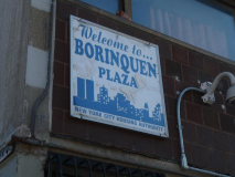
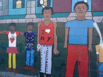
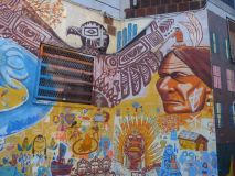
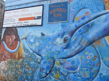
On the two blocks between Graham and Bushwick Avenues, Boerum Street runs through a second project, the Borinquen Houses. The community center on Humboldt Street features some interesting murals. I encountered the term “Borinquen” twice on this walk. The Taino Indians, indigenous on the island of Puerto Rico, called the island Borinquen, “island of great lords.” The name can also be seen in Boricua College, which is in the old St. Francis Prep building on North 6th Street. The Borinquen Houses opened for low-income residents in the late 1960s.
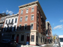
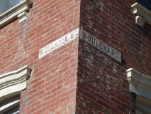
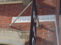
Turning north on Bushwick Avenue, I have a mystery at Meserole Street. A pair of buildings facing each other on the NW and SW corners have chiseled signs with street names. This is the usual way streets were marked before street signs were mounted on poles. However, on both, Bushwick Avenue is referred to simply as “Boulevard.” No map I have checked refers to Bushwick Avenue as Boulevard, even one from 1850, when the street was still a country road. My guess is that in the 1800s, when these buildings went up, Bushwick Avenue was known informally and colloquially as Boulevard. I discuss the situation more in depth on this FNY page.
Update: in the old guidebook “Eastern District of Brooklyn,” the ever-reliable historian/photographer Eugene Armbruster says Bushwick Avenue was once supposed to become “Bushwick Boulevard.” I can add that at one time, Robert Moses wanted to run an expressway down Bushwick Avenue, but fortunately, that didn’t happen. Also see Comments below.
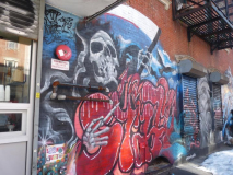
I was arrested by this striking mural on the corner of Bushwick and Meserole. Called “Angels and Demons” it depicts a scythe-wielding Death and a cross-bearing angel.
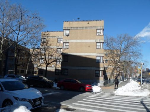
Bushwick Avenue is the eastern border of the Williamsburg Houses, occupying 12 blocks and approximately 23 acres between Maujer Street on the north, Scholes on the south, Leonard on the west and Bushwick Avenue on the east — one of the very first housing projects built in NYC, reaching completion in 1938, before the dismaying Le Corbusier-inspired ‘boxes-in-a-park” pattern took hold. They were built by the Williamsburg Associated Architects, which comprised Shreve, Lamb and Harmon (who designed the Empire State Building) and Swiss architect William Lescaze, in a streamlined “International” style. The Houses were officially made a NYC Landmark in 2003.
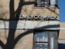
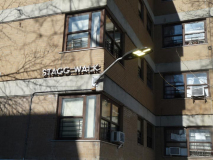
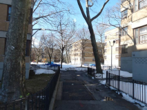
Stagg and Ten Eyck Walk run through the Williamsburg Houses in what would be the roadbeds of those streets, parts of which were eliminated when the project was built. I noted the metallic lettering marking them as well as the new LED lamps.
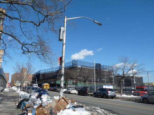
Here Bushwick Avenue features a couple of unusual lampposts, with a thicker shaft usually used with guy-wired stoplights.
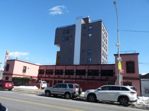
Before East Williamsburg and Bushwick became hipsterfied and later, generally yuppified, there was the Bushwick Hotel, really a motel, on Bushwick and Stagg Street, opposite the Williamsburg Houses.
Offering everything you could possibly desire from a hotel, ranging from extended stay reservations for those brave souls who kneel before the great literary figures found in the myriad works of Hemingway and Steinbeck (who amongst us has not yearned for the freedom of those transient workers following the harvests en route to the the great golden future of Santa Fe?), to very reasonable hourly rates for those looking to take a quick prostitute and crank fueled catnap amidst the pleasant aroma of antiseptic, all while wrapped in the very unique plastic sheets. I lay my head upon the pillow (a very reasonable $6 deposit) and suddenly I am transported to a dangerous sexual re-awakening not seen since Bernardo Bertollucci’s Last Tango in Paris. –-from a hilarious old Tumblr review no longer linked
A new high rise, #236 Stagg Street, sort of spoils the overall effect.
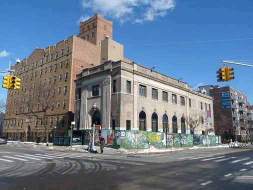
The Chase bank at Bushwick Avenue and Grand Street contains a well-maintained ground floor mural that contains a hidden historic image from East Williamsburg. The mural contains several striking images. Raindrops embazoned with peace symbols drop from the heavens to extinguish sticks of dynamite marked “crime,” violence,” “drugs.” Adam and Eve play in a sandbox. The old Flushing Avenue Pfizer plant and the Maspeth Avenue tanks (demolished July 2001) make an appearance. Scaffolding covers the mural in 2021, but I show them on FNY’s Bushwick Avenue page.
The mural dates to 1994, when this bank was a Chemical branch.
Grand Street
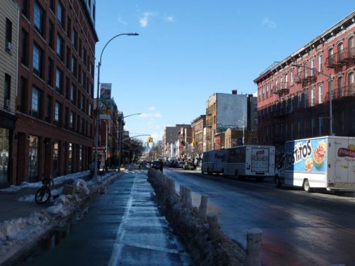
Grand Street is a long road with two distinct sections. The western end of the street in Brooklyn runs east-west through the heart of Williamsburg all the way to the East River, while the east end crosses Newtown Creek and winds its way to the heart of what used to be called Newtown but is now Elmhurst. That section has been called Grand Avenue since the 1920s to differentiate it from Brooklyn, but it evolved out of what used to be the tolled Newtown Plank Road. The two ends of Grand Street were hewn together in 1875 when they were linked by the first Grand Street Bridge over the creek. (The third, built in 1901, is still there.) Grand Street/Avenue became an important farm to market road from the wilds of eastern Queens County to East River shipping.
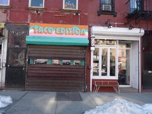
The Taco Edition sign, #800 Grand, appears to be straight out of the 1970s, but it replaced the previous Taco Project in 2019. Note the revolving barber pole next door.
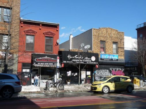
A trio at Grand and Humboldt, #767-771. 771, on the right, may once have resembled 767, which is mostly unchanged through the years.
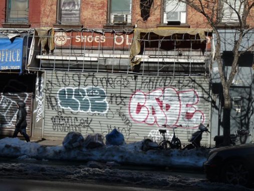
At #753 Grand, there are two ancient signs for the price of one. Here, part of a truly ancient sidewalk sign has been revealed. But what is it?
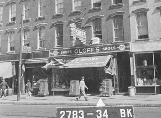
The NYC Municipal Archives from 1940 can help with that; this was once Oloff’s Shoes, which also had a nifty neon sign.
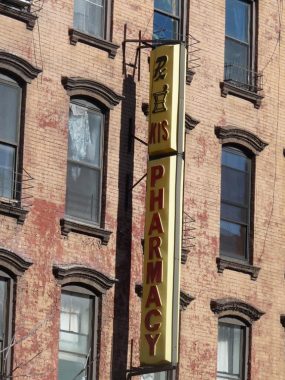
Above the Oloff’s sign is a younger, yet fairly elderly, illuminated plastic sign for a pharmacy. When Street View first recorded the site in 2007, it was a “30 Minutes Photo.” These days, photos can be seen in 30 seconds and less.
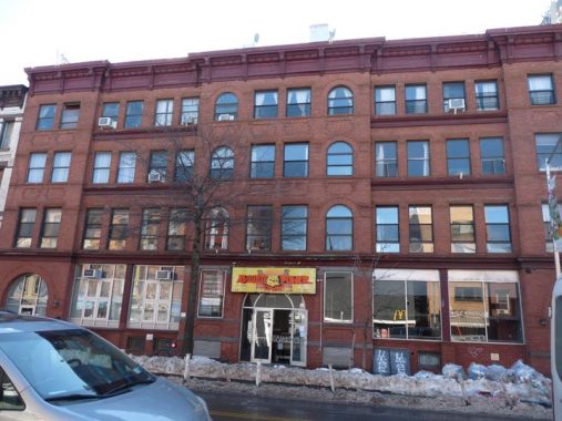
I’d like to know more about the massive 750 Grand Street (formerly 740-750 Grand) but this isn’t a landmarked district and information takes more time than I have to dig around. A Brooklyn Eagle almanac from 1910 indicates it was a carriage factory.
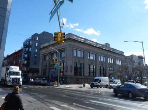
Bushwick Savings Bank, Graham Avenue at Grand Street. Established in 1868 (this building was likely built about 1910-1920) Bushwick merged with Anchor Savings Bank in 1969; this locale is currently home to a JP Morgan Chase branch.
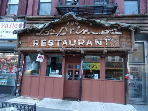
At #704, west of Graham, Los Primos Restaurant has Grand Street’s most unusual sidewalk sign.
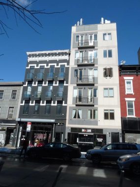
Two visions of residential living, decades apart, at #675 and 677 Grand near Manhattan Avenue. The green and white trim on #675 is relatively recent.
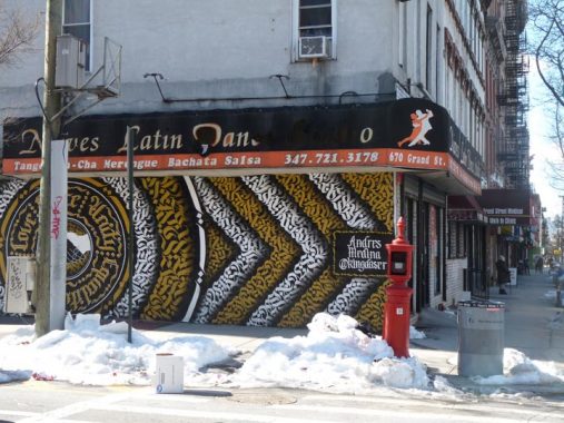
Some relatively new artwork at Nieves Dance Studio, #670 Grand Street at Manhattan Avenue. The older art, seen here on Street View, was a bit more provocative.
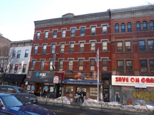
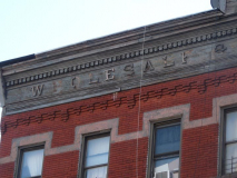
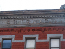
#690-692 Grand is yet another, er, ah, “grand” old brick building. Its original purpose is discernible at the roofline, where the words “wholesale druggist” appear. The druggist was apparently R.C. Knipe and Son.
Away over in Williamsburg, or Eastern District, at 690 and 692 Grand street, stands the handsome and completely fitted store of R. C. Knipe & Son. It was built by Mr. R. C. Knipe in 1870 and has always been a popular store in a thickly populated section. [American Pharmaceutical Association]
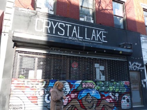
Speaking of drugs, I had thought Crystal Lake, at #647 Grand, was a place where holistic preparations were vended but actually it’s a bar and a handsome-looking one at that.
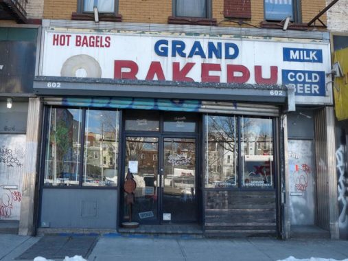
A classic that has been here at #602 Grand between Leonard and Lorimer for donkey’s years, bagel joint Grand Bakery. The sign gets the job done, why change it?
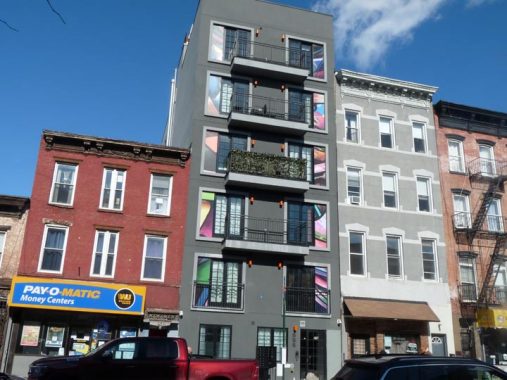
#555 Grand, between Lorimer Street and Union Avenue, is a newcomer wedged between a pair of oldtimers.
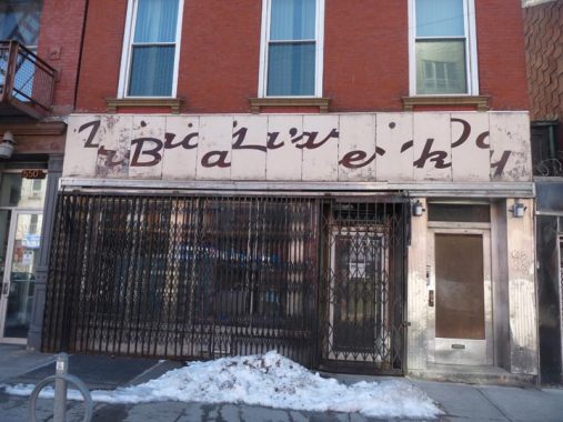
A mystery at #548 Grand. This sign, which looks like a puzzle that has been incorrectly assembled, has been visible only since 2014 or so, according to Street View. It appears to be a bakery. It also looks like this sign…
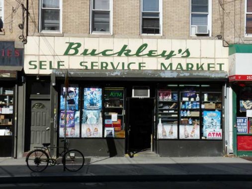
…which can still be found at Nassau and Kingsland Avenues in Greenpoint, a short distance to the north.
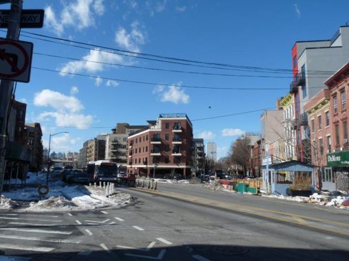
Just west of Union Avenue, I had to leave Grand Street for a few blocks. Here’s why: If you look at the map, Grand Street turns northwest and is interrupted by the Brooklyn-Queens Expressway. Grand Street is on the right here, and I followed the street on the left, Borinquen Place, which gets you past the BQE when on foot.
To me, there’s a bit of mystery about Borinquen Place. (the name “Borinquen” is explained above.) Before the 1970s, the street was simply called “Grand Street Extension,” which made it one of two streets in Brooklyn with an “extension.” The other one is Flatbush Avenue which was extended northwest from Fulton Street in 1909 when the Manhattan Bridge was opened.
The Grand Street Extension shows up on maps after 1903, when the Williamsburg Bridge opened. Apparently it was meant to get traffic (mostly wagons and carts in the 19-ohs) from the new bridge onto Grand Street, which becomes a major commercial route, as we’ve seen, east of Union Avenue. However, the “extension” didn’t plow straight through Washington Plaza and its equestrian statue of George (seen on on this FNY page), and traffic still had to get around that. Grand Street itself was severed by the BQE in the early 1950s.
West of Union Avenue the orientation of Williamsburg’s street grid changes and streets run from NW to SE and from SW to NE. Borinquen Place cuts across the grid and meets South 1st and 2nd Streets at an angle, creating some triangle-shaped plots (as nearby Union Avenue does between Broadway and Flushing Avenue and 7th Avenue South in Greenwich Village).
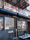
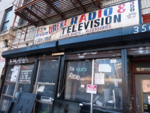
Urena Radio & TV has a handpainted red, white and blie sign at 356 South 1st. The sign looks quite old but in fact, it has been repainted in just the last year as a Street View from 2019 shows.
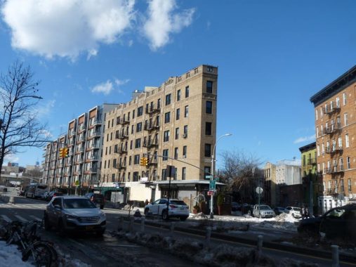
The Flatiron Building in Manhattan’s Madison Square is the best-known NYC building on a triangle-shaped plot but examples of the species can be seen in all five boroughs and present interesting additions to the streetscape such as #145-165 Borinquen Place at Keap and South 1st.
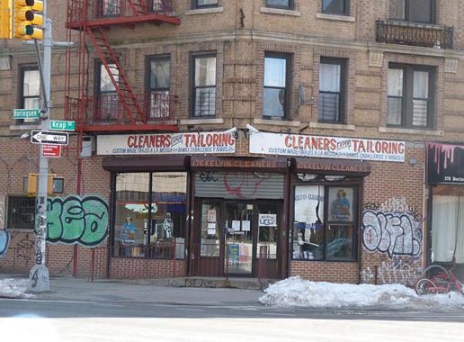
One more handpainted sign at Borinquen Place and Keap Street for a cleaner-tailor service.
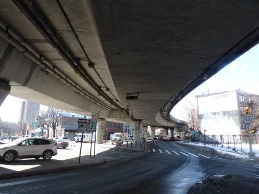
The elevated ramps that connect traffic between the BQE and the Williamsburg Bridge, seen here at Borinquen Place and Marcy Avenue, were rebuilt a decade or two ago, possibly to dampen the traffic noise in this heavily residential part of town.
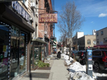
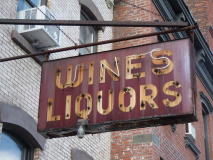
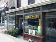
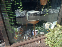
To return to Grand Street and complete today’s walk, I had to scoot up Havemeyer Street after crossing the BQE on Borinquen. This gave me the chance to check out one of the neighborhood artifacts, the ancient “wines & liquors” sign at #142 Havemeyer. Last time I was by, this was a bike shop; now, it’s a film/TV/recording studio called Oscilloscope Laboratories, whose website is even a bit sketchy about its purpose, though a number of movies have apparently been produced here. If you’re involved in this enterprise, the floor is open in Comments.
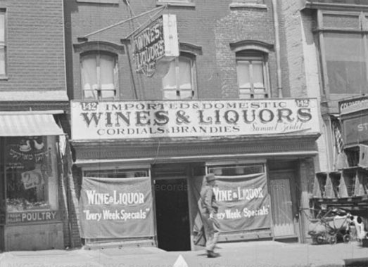
Here’s a look at the liquor store in 1940, when the neon sogn was already in place.
Formerly 7th Street in Williamsburg, Havemeyer Street was renamed for a member of the 19th Century German immigrant Havemeyer family. You can take your pick which one — brothers Frederick C. and William, who opened a sugar refinery in Manhattan; Frederick C. Jr., who opened another sugar factory in Williamsburg; William F., who became a 3-term NYC mayor; F.C. Jr.’s son Henry, who renamed the sugar factory Domino and came to dominate the market.
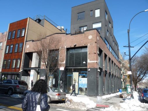
The northwest corner of Havemeyer and Grand Streets is where the City Reliquary got started in 2003, a collection of NYC paraphernalia and ephemera by firefighter Dave Herman. A larger space at 370 Metropolitan Avenue opened up in 2006. It’s a museum and a neighborhoood gathering place. In 2010, King of NYC Lampposts Bob Mulero and I curated an exhibit on NYC lampposts, NYC’s first since 1989 and so far, the last one to date.
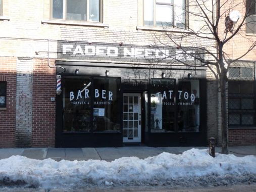
I think what we have here is Peak Williamsburg at Faded Needles tattoo and barber parlor at South 1st off of Havemeyer.
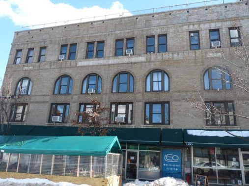
#318 Grand at Havemeyer was once known as the Miller-Grand Ballroom, It was constructed as a ballroom, music venue and catering facility in 1901. The entire place was converted to residential several years ago, but, according to the development’s website, there are several traces of its ballroom days still in evidence. It survived as a music venue until 1975 and over the years played host to such stars as Benny Goodman, Paul Robeson, Celia Cruz and Tito Puente, who lived for a time near the building. The website has several photos of the ballroom building in its glory days.
Back on Grand Street
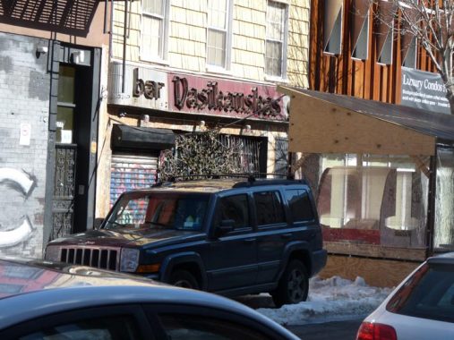
Every time I’m in the area I check on this neon sign for a bar called Vasikauskas, at #279 Grand near Roebling Street. Today, I couldn’t get close for a decent shot because of ice floes and Covid restaurant sheds in the street, but it’s still there. The space is home to Maricuja, a somewhat low-key drinking establishment.
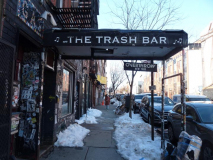
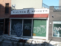
A selection of bars, sports and otherwise, on Grand near Roebling.
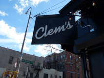
Clem’s, at the SW corner of Grand and Roebling, opts for a black facade with a white-lettered shingle sign. Here is an inside view.
Clem’s opened nine years ago [2002], in a former liquor store that had a bulletproof window where you’d slide your money in and a bottle would come sliding out.
“Back then,” said John Clement, the bar’s owner and a sculptor who lives in Williamsburg with his wife, Jean, and their two young children, “we’d find nine-millimeter shells in the street outside.” NYTimes
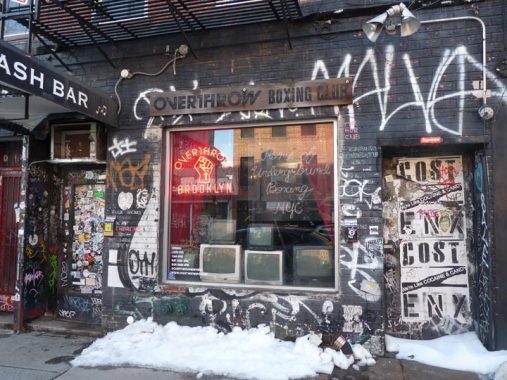
Overthrow Brooklyn at #256 Grand isn’t a revolutionary plot, it’s a boxing trainer. Don’t know why there are TV sets in the window.
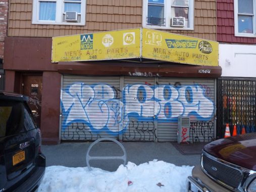
Mer’s Auto Parts at #248 Grand seems to be permanently closed, but its aged vinyl awning sign lives on.
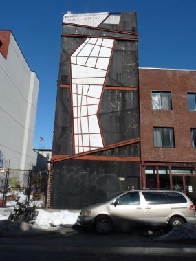
I’m stumped by #241 Grand. It’s covered with construction nets as far back as Street View goes, but when they were remmoved the building had this strange facade with the name “Katherine” at the roofline.
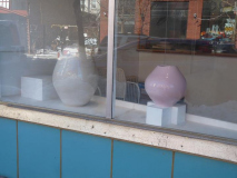
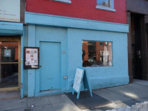
I was intrigued by the robin’s egg blue facade at #238 Grand, which turns out to be a ceramic and pottery studio called Choplet.
Choplet Ceramic School and Studio is home to 2600 square foot dedicated to the art of clay in all its form and welcomes newcomers to pottery and ceramic art as well as professional artists: 23 electric wheels, a kick wheel, hand building tables, 2 extruders, 2 slab roller, a glazing spray booth, a drying closet, 5 kilns and an amazing garden are some of the amenities the studio has to offer. [Choplet]
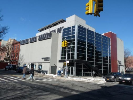
If I asked you to guess what’s the purpose of this building at Grand and Driggs Avenue, “movie theater” wouldn’t come to mind, but this is actually Williamsburg Cinemas. I’ve never watched a flick here, but I do encourage neighborhood movie theaters, which are a dying breed. Nothing playing in early 2021 with the Covid Pandemic.
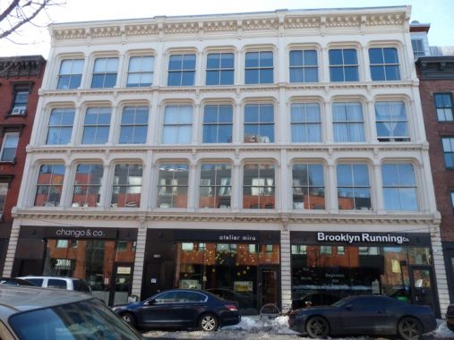
There are a few cast-iron front buildings in Williamsburg, but nowhere near as many as NYC’s capital of castiron, Tribeca. Most of them go back to the 1860-1880 period. One of the largest in Brooklyn is at #224 Grand Street near Driggs.
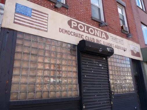
Old-school awning sign for Polonia Democratic Club & Ladies Auxiliary at #140 Grand, just east of Berry Street. The late Bill Reel, a Daily News and Newsday columnist for 38 years, always referred to his wife as “Mrs. Polonia,” referring to her Polish ancestry. The club’s presence here is emblematic of North Brooklyn’s heavily Polish and eastern European demographic.
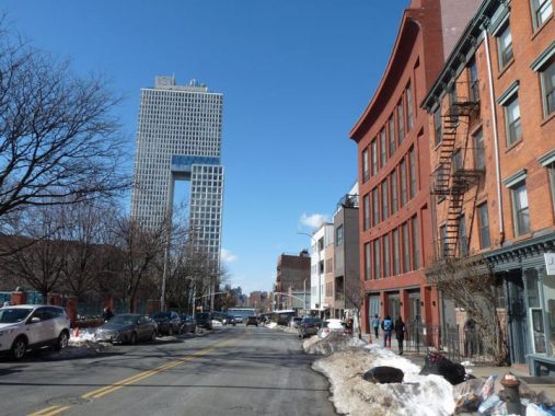
Between Berry and Wythe Avenue, Grand Street takes a slight, almost imperceptible bend. This is shown in the curve of the facade of #89 Grand, a new condo building constructed from 2017-2018.
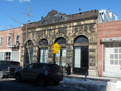
In a part of Williamsburg bristling with new buildings and developments, the old Northside Bank Building at #33 Grand, just off Kent, is still around. The Romanesque Revival structure was designed by Theobald Engelhardt and completed in 1887. Engelhardt also designed the Ulmer brewery complex and Arion Mannerchor Hall, which are on the Bushwick-Williamsburg border a couple of miles to the east. The Northside Bank was acquired by Manufacturers Trust in 1922, which has evolved into today’s JP Morgan Chase. The building isn’t landmarked, but is a survivor.
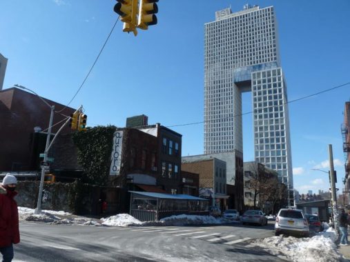
As we approach the East River at Grand and Wythe we can see a gigantic object that looks like a tuning fork, with incredibly large windows on its north “tine.” This is a giant residential building called 1S1, or #1 South 1st Street. It’s the tallest residential building in Brooklyn and ranks among its tallest buildings of any kind. 1S1 is 45 stories tall with 330 apartment units. It’s 435 feet tall, has a rooftop pool, unparalleled views of the East River, Brooklyn, Manhattan and New Jersey, and unless MegaMillions enables it, I will never see the inside of it. Real estate website 6 Sq Ft is aware that most people will never get a good look either, and has artist renderings of the interior.
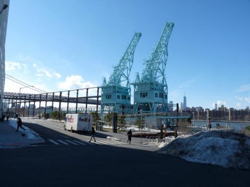
However, the developers of 1S1, the Walentas family, is also aware of that and took pity on the peons by developing a new waterside park named for the sugar refining complex that all this territory once was, Domino Park. I have visited in the warm months and enjoyed takeout tacos. FNY correspondent Sergey Kadinsky has also visited.
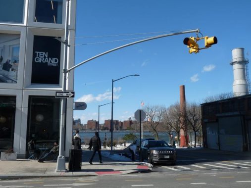
Right now, the Department of Transportation regulates traffic at Kent Avenue and Grand Street with a blinking Cyclops light, but traffic may increase enough to warrant a regulation three-lamper. Kent Avenue also features a busy two-lane bike conduit.
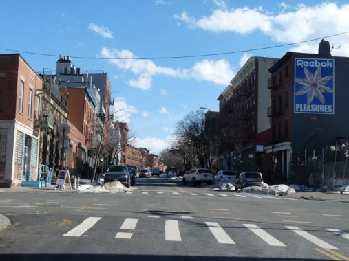
Looking east on Grand Street from Kent. The street goes on and on, as mentioned before, all the way to Queens Boulevard in Elmhurst, and beyond that can even be said to extend northwest into Astoria if you continue northwest on Queens’ Broadway.
Grand Street ends, or begins, at Grand Ferry Park which as you may infer is the site of a former ferry landing to Manhattan. In the past few years, a new ferry service, NYC Ferry, has established East River routes. Today, though, the temperature was 35, it was blowing a gale, we would get 5 inches of snow the next day, and when I got to the ferry landing at North 6th, it was over a half hour wait for the next boat. Off to the L train I went.
Check out the ForgottenBook, take a look at the gift shop, and as always, “comment…as you see fit.”
2/14/21




18 comments
Thank you for the tour. I lived on Lorimer and Ainslie st. You took me on a memory journey.
I think I’ve decoded the bakery sign as “Dara’s Bakery”. “Dara’s” on the top left; “Bakery” on the bottom right.
If you’re referring to the sign on the building at 548 Grand St, then you’re correct. It was the location of Dara’s Bakery. It was owned by the family of a friend who went to St. Angela Hall
Academy elementary school with me from ’64 until ’72. The family lived above the bakery.
Yes. Thanks for the confirmation.
Ephemeral New York suggests an answer to the “Wither Boulevard” mystery: Ephemeral New York – When Bushwick Avenue. The assertion made by Ephemeral New York appears to be confirmed, at least in part, by this map in the Queens Public Library digital archives: QPL William G. DeBevoise Maps Collection
Following up, there is a discussion of how Bushwick (Avenue) Boulevard was to be composed – as well as a description of how Broadway was to be developed – in Eugene L. Armbruster’s The Eastern District of Brooklyn: The Eastern District of Brooklyn – Appendiz XXV – Page 187
Re: 241 Grand Street: Seems that, according to NYC DOF records, Katherine was the first name of the previous owner of the property. The property was sold after her demise. Perhaps including her name on the building or as the name of building was a condition of the sale, or just a request of the executor of the estate, but that’s just my speculation.
No mention of the Grand Street Campus High School on Grand and Bushwick? That was the building with all the scaffolding. Grand Street Campus was formerly Eastern District High School which was moved from its original location on Driggs and South 3rd, then 227 Marcy. Red Auerbach, Mel Brooks, Barry Manilow all went there
There is an Eastern Parkway Extension too
On most DOT signs it’s Eastern Parkway
In olden day many barber shops were combined with a tattoo parlor in the back.Looks like Faded Needle might be trying to revive that practice
Appreciated I been living and raised on South 2nd street between Havemeyer and Marcy Ave since 1970.
Thanks for the memories. I lived in the Williamsburg Houses, first on Ten Eyck Walk ,then on Maujer near Bushwick for the first 8 years of my life .we moved to East New York in 1944. Had my tonsils out at St. Catherine’s Hospital on Bushwick I think. Also had my slight injury from a broken slide sewn up there. We used to walk to and across the Williamsburg Bridge to go to the Chinese restaurant on the other side and take the trolley home.
My ancestral home. My grandparents on both sides were one of the first families that moved into the Williamsburg Houses, Ten Eyck Walk and Scholes St. My mom graduated Eastern District in 1943. My dad worked in a men’s clothing store, Eppy’s on Grand St. We lived at 336 Union Ave. in the 50’s. Thank you for the memories.
The stretch of Grand St. northeast of Metropolitan is one of my favorites. that foot bridge is scary as hell! Also, Urena’s is a great shop and repaired my old Technics turntable for like $30. One of these days i’m gonna haul my betamax over there!
I’m the office manager at Oscilloscope! We are actually located at 140 Havemeyer and we’re an independent film distribution company founded by Adam “MCA” Yauch of the Beastie Boys! The company began as a recording studio and later moved into film. The studio has sadly closed when we left our Canal St office a few years back.
Is the Havemeyer office still open?
I was raised in Williamsburg
South 1St between Havemyer &
Marcy Ave.
As an adult live at Lindsay Park,
then Montrose Ave, between
Leonard and Lorimer.
I relocated to Miami 43 yrs ago,
oh my heart and memories are still are in Williamsburg.
Oh how I enjoyed this trip down mememory lane. Thank you.