PART 1: BROOKLYN and the BRONX
I’m surprised I never thought of this until now, after about fifteen years of doing Forgotten New York. I’ve seen these historic plaques mounted on poles as I travel in Nassau and Suffolk Counties, and a very occasional one in the five boroughs. They’re part of an initiative devised by New York State Education Department in 1928 to mark places of historical significance, and for nearly forty years, almost 2800 such markers were placed all over the State.
The signs themselves are marvels of design, in my opinion. Most of them feature dark blue backgrounds with gold raised block lettering and trim, though there are variations in color and lettering, and very occasionally, shape, just to change it up, I imagine. The State discontinued the series in 1966 after high speed travel on expressways became the norm.
This flickr page that assembles photos of the State markers taken by various photographers illustrates the basic, simple and readable design of these signs.
No study had yet been made of the 92 locations within the five boroughs that these signs delineated, so I decided to do one myself with photographs culled from my own collection; I also used scans from books I had in my collection, and screen captures from Google Street View.
It should be noted that this page doesn’t include the brown and gold markers placed by the Richmond Hill Historical Society and the blue and gold ones placed by the Woodhaven Cultural and Historical Society, which closely resemble the New York State signs. I gave those signs their own page a few years ago, though I didn’t catch them all.
Of the 92 NYS historical signs placed around town beginning in 1928, only a mere handful are still there. Over the decades, the local youth have removed or vandalized them, some have been claimed by new construction or car crashes. Some of the remaining ones are in very poor shape, while others have been restored to better-than-ever construction….
In each case I’ll give the location as shown on the NYS Museum site, as well as the text as originally rendered on the sign, per the Museum listing.
![]()
BROOKLYN
Only four historical markers have been placed in Kings County (Brooklyn) and, as luck would have it, two of the four are still in place.
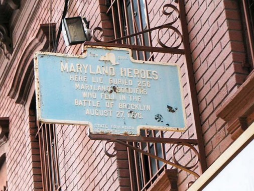
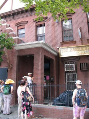
“Maryland Heroes”: Here lie buried 256 Maryland soldiers who fell in the Battle of Brooklyn, August 27, 1776.
This sign formerly stood on 7th Street between 3rd and 4th Avenues. It was moved to and mounted on this American Legion hall at 9th Street and 3rd Avenue a few decades ago.
As stated on my 9th Street page:
A battered tin State Education Department of New York sign, created in 1952, hangs in front of an American Legion hall at 3rd Avenue and 9th Street, stating that remains of the 1st Maryland Regiment, which engaged the British during the battle at the nearby Old Stone House (which is now a museum) in August 1776 and enabled the main line of US troops to escape relatively undecimated, are buried there. The sign is not quite correct, as some say that evidence points to those remains existing beneath an empty lot a block away at 3rd Avenue and 8th Street.
The leader of the find-the-Marylanders group is Bob Furman, a Brooklyn historian and president of the Brooklyn Preservation Council, a nonprofit organization dedicated to maintaining brownstone Brooklyn’s look and feel. “The evidence is quite strong,” Mr. Furman said. “I’m confident enough that I tell everyone I know.”
But Mr. Furman has no way to test his theory. Right now, the site he is targeting is a vacant, concrete-covered lot studded with weeds and surrounded by a chain-link fence. The owners, who say they are interested in developing the property themselves or selling it to someone who will, have rebuffed his inquiries about conducting an archaeological probe on the site. NY Times, 8/26/12
It’s likely that the sign’s original location was chosen because it was close to the burial site.
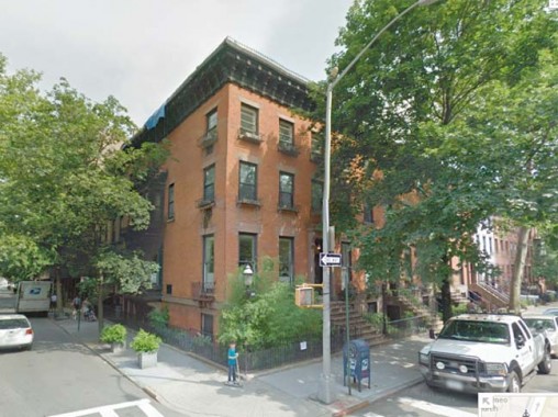
133 Clinton Street at Livingston Street: Property once owned By Philip Livingston – signer Declaration Of Independence. Home – Brooklyn Excelsiors Baseball Champions – 1860
Though the NYS historical sign that once graced this corner is gone, a smaller plaque has been affixed next to the front entrance, which reads:
“This house was the former home of the Brooklyn Excelsiors Baseball Champions of the United States in 1860. Constructed in 1851, the building was once the Jolly Young Bachelor’s Clubhouse. The Bachelors evolved into the Excelsiors B.B. Team. One of it’s pitchers James Creighton, 307 Henry Street, Brooklyn, is said to have tossed the first curveball. During the Civil War, the Excelsiors introduced the game to soldiers from various states. Because of it’s popularity, similar teams were established in other cities. Thus, baseball, as a national sport, can be considered as having it’s origins in Brooklyn.”
Philip Livingston (1716-1778) was one of four signers of the Declaration of Independence from New York, and the only one born in what is now Brooklyn. The Battle of Brooklyn in 1776 was fought partially on his 40-acre estate.
Gravesend
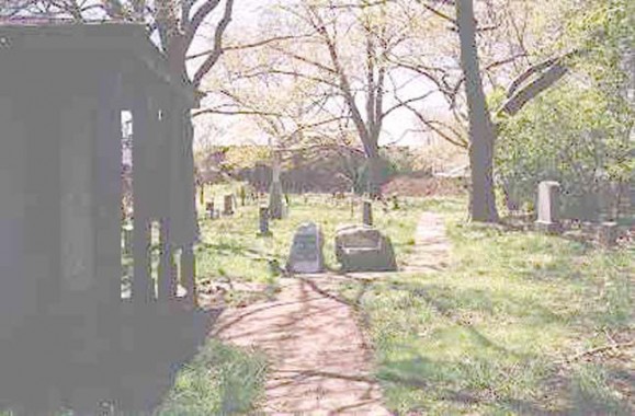
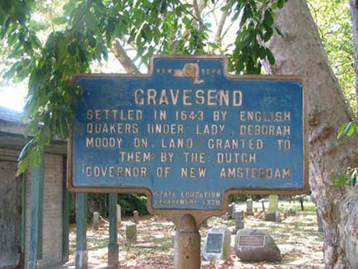
Still standing on the grounds of the Old Gravesend Cemetery at Gravesend Neck Road west of McDonald Avenue is a sign marking the old town of Gravesend: Settled In 1643 by English Quakers under Lady Deborah Moody on land granted to them by the Dutch governor of New Amsterdam.
The Old Gravesend Cemetery dates to 1643, the first year of the settlement. Lady Moody is buried in an unmarked grave somewhere within.
Gravesend Part 1 | Gravesend Part 2 | ForgottenTour 33 in Gravesend
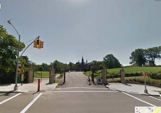
Entrance to Green-Wood Cemetery, 5th Avenue and 25th Street. The NYS Historic sign once mounted in front of the cemetery read:
Lt. Col. Robert Benson 1739-1823, buried here; Clinton In Revolution; Clerk, New York State Senate.
This one is perplexing.
Robert Benson was an older brother of Egbert Benson, the first Attorney General of the State of New York, Chief Justice of the New York Supreme Court, and a US Representative; he served as Clerk of the New York State Senate.
Sometimes, to save space, the markers were worded somewhat confusingly — I don’t know what “Clinton in Revolution” referred to, although DeWitt Clinton, who held most high offices in NYS and New York City is buried here.
Well, someone who may not be buried here is this Robert Benson — the Green-Wood Cemetery online directory doesn’t list him. Egbert Benson is buried in Prospect Cemetery in Jamaica (see below)
FNY has toured Green-Wood four times as of 2013:
ForgottenTour #60: Green-Wood | ForgottenTour #49: Green-Wood | ForgottenTour #29: Green-Wood | ForgottenTour #24: Green-Wood
![]()
BRONX
The Bronx contained 25 NYS historical markers, only one of which remains, to my knowledge.
There are a couple of markers situated where I can’t get at them, such as the Bronx River marker, on the bridge where Boston Road crosses the river. This is now Jungle World Road and is smack in the middle of the Bronx Zoo, so I can’t get at it without paying a large admission fee.
The marker said: “During the Revolution, the British Fleet was ordered to “Proceed up the Bronx and attack the Yankees in hiding above.”
According to the Bronx River Alliance, one of the skirmishes along the Bronx River during the war involved future Vice-President and Hamilton assassin Aaron Burr.
Another hidden in Bronx Park:
Fording Place. Early crossing of Bronx River, nearby was Bear Swamp, haunt of bears. Site of Sewanoe Indian Village up to 1689.
Bronxdale Avenue, which runs from White Plains Road at Bronx Park southeast to East Tremont Avenue at Castle Hill Avenue, was formerly called Bear Swamp Road.
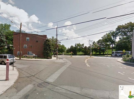
Fort Independence, a Revolution-era fort, stood near here ay Giles Place and Ft. Independence Street. The NYS historical marker in the vicinity read…
One of a chain of forts built in 1776 by Americans to command the valley below. General Richard Montgomery had a farm nearby, in 1772.
As Commander-in-Chief of the Continental Army, General George Washington ordered the construction of outer defenses throughout the Kingsbridge area. Fort Independence was built under the direction of Colonel Rufus Putnam in 1776 to protect the American army and to safeguard the line of the Harlem River. An entrenchment ten feet wide and three and a half feet deep surrounded the austere fort. From its elevated position, the site commanded an extensive prospect of the surrounding countryside. In the fall of 1779, the fort was destroyed by British forces led by Sir Henry Clinton. NYC Parks
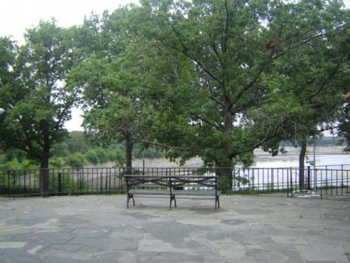
Fort #Four Park, Sedgwick and Reservoir Avenues, is the former home of a NYS historical sign.
Sign text: One of the chain of forts built by the Americans in 1776, to command the valley of the Harlem River; later occupied by the British.
As Commander-in-Chief of the Continental Army, General George Washington ordered the construction of outer defenses throughout the Kingsbridge area. Fort Four was built under the direction of Colonel Rufus Putnam in 1777 to protect the American army and to safeguard the line of the Harlem River. The largest of all fortifications in the neighborhood, Fort Four was admirably situated, commanding a view for miles in all directions. In the fall of 1779, the fort was destroyed by the British forces led by Sir Henry Clinton. NYC Parks
City Island
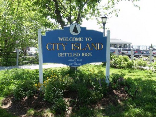
There was once a NYS historical marker in City Island Park, facing Eastchester Bay on City Island between City Island Bridge and Bowne street:
Pearl Of The Sound, was so called, because it was planned to outstrip New York City. Oyster culture first started here.
FNY toured City Island on Tour #9 in 2002, and again on Tour #53 in 2012.
Drake Park
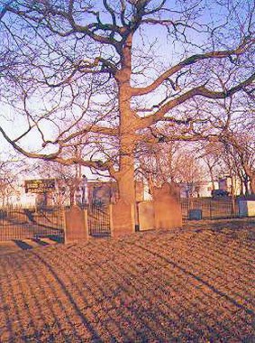
The NYS historical marker at Drake Park/Drake Cemetery, at Hunt’s Point and East Bay Avenues in Hunt’s Point, read:
Contains grave of Joseph Rodman Drake, poet, author of “The Culprit Fay”, “Ode To The American Flag”, and “Bronx.”
The park’s namesake, Joseph Rodman Drake (1795-1820) was a poet whose work has been mostly forgotten by the 2000s but who had made quite a name for himself in his own era, the early 1800s, with his most famous poems “The Culprit Fay” and “Ode to The American Flag.” Drake was born in lower Manhattan, but discovered the then-bucolic fields of Hunts Point as a young man; in fact he would often brave the currents and rowboat here across the East River. While ill with tuberculosis at age 25, he requested to be buried in Hunt’s Point. One of his best friends was Fitz-Greene Halleck, who is likewise little-known today, but was read enough in the 1800s to have a statue in Central Park cast in his likeness.
Featherbed Lane
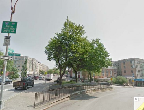
A NYS historical marker was located at the traffic triangle at Featherbed Lane and University Avenue in Morris Heights.
The plaque explained the origin of this unusually-named street: So called from story that farmers’ wives, in 1776, aided Americans to escape British by spreading featherbeds on the lane.
Another story posits that in the 18th Century, this was the red-light district and the featherbeds were used by the working girls. In any case, the marker is long gone.
Glover’s Rock
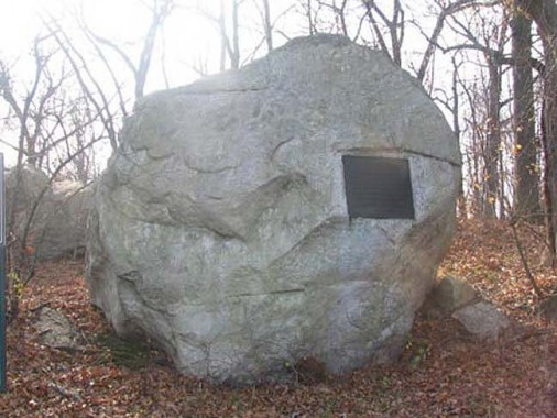
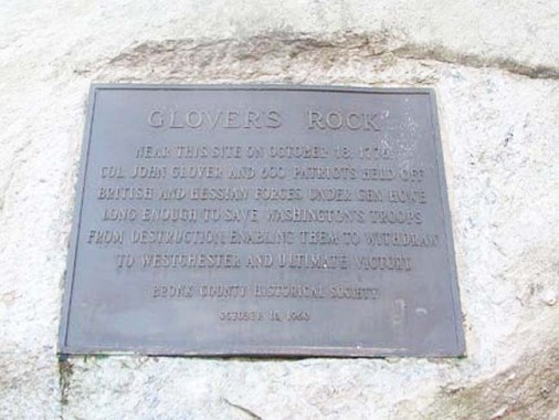
One of the things you discover when researching these historical markers is that sometimes they were placed far out on the city outskirts, where you wouldn’t see them unless you happened to be driving past. That’s the case with Glover’s Rock, which is located way up on the south side of Orchard Beach Road near Park Drive in vast Pelham Bay Park.
From the ForgottenBook:
As much as can be determined, it was used as an Indian lookout; the area had an Indian trail long before Shore Road appeared. The rock’s main claim to fame, though, was that on this spot during the Revolutionary War in October 1776, Colonel John Glover (1732-1797) and his 14th Continental Regiment, largely made up of militia from Marblehead, Mass. engaged the British during the Battle of Pell’s Point and took heavy casualties, allowing a retreating General Washington to escape. The Redcoats had planned to cut off the patriots at Rodman’s Neck, a nearby peninsula jutting into Eastchester Bay. Glover’s men, who numbered just 550, had to deal with as many as 4000 British and Hessians. Glover placed his regiments behind stone walls lining the Pelham Road; Glover’s brigades held their positions as long as they could until the enemy advanced, and then retreated to join the next regiment’s position. Thus the enemy was forced to engage more and more patriots as the battle unfolded. Washington’s forces were able to move north to White Plains due to Glover’s delaying strategy. Glover’s regiment took 12 casualties while claiming nearly 1000 from the Crown. His Marbleheaders later assisted Washington in his famed Delaware crossing.
Glover’s Rock is marked by a tablet erected in 1960 by the Bronx Historical Society, replacing an earlier one placed in 1901 by the Daughters of the American Revolution.
Its NYS historical marker, though, has vanished. It read:
In Battle of Pell’s Point, Col. Glover and 550 men, held British long enough for Washington’s army to escape to White Plains.
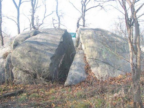
Split Rock, elsewhere in Pelham Bay Park off an exit ramp from the Hutchinson River Parkway to the eastbound New England Thruway, is fairly inaccessible these days on foot because the trail that led to it has overgrown. According to some accounts, this spot is near where British settler Anne Hutchinson and most of her family was killed on a raid ordered by Wampage, a Native American sachem of the Siwanoy tribe, after provocations by New Netherland director-general William Kieft. The natives captured her daughter, Susanna, who lived with the Siwanoy for a few years before being ransomed back to other Hutchinson family members.
William and Anne Hutchinson had espoused religious freedom after arriving in Massachusetts from Anne’s birthplace in Alford, England, but the Puritans had none of it and expelled them. After a brief stay in Rhode Island (Roger Williams’ colony was an early outpost of tolerance) William died and Anne and her family moved to this far-off outpost in what was then rural Westchester.
The historical sign read: Near here was home of Anne Hutchinson, who settled in 1642. She and her family were killed in the Indian Uprising, 1662. The sign was incorrect on the date of the raid.
Hunter Island
There was a NYS historic marker on Hunter’s Island, which was joined to Orchard Beach, along with East and West Twin Islands, by landfill in 1947. The sign read:
Contains the Hunter-Iselin Mansion; Ogden Mansion on Twin Island; Indian Name Laapawachking, – “Place Of Stringing Beads.”
The elaborate Iselin Mansion is a familiar landmark on the lofty crest of beautiful Hunter’s Island. and is one of the sights of the surrounding country. Standing on what has been declared to be the finest location on the whole length of Long Island Sound, it was erected as early as the year 1800…
Long known as Henderson’s Island from one of its early owners, Dr. Henderson, a surgeon in the British navy, its great rooms formerly contained one of the finest collections of oil paintings in the United States. During the summer months this mansion has been used by the Little Mothers’ Association.
A winding roadway leads across Hunter’s Island to the Twin Islands, on the easterly one of which stands the splendid Ogden Mansion, from which may be secured another view of waves and water scarcely equalled in the whole region. As a seat of one of Jacob A. Riis’s many charities, no more beautiful location could possibly be selected. Old Mansions of the Bronx, 1921.
“Old Indian Path”
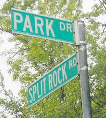
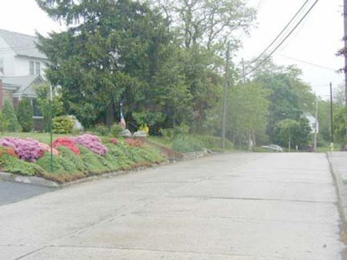
An unusual situation exists in the extreme northeast Bronx. Looking at the map it would seem logical that the Bronx-Westchester city line should run along the northern end of Pelham Bay Park. But it doesn’t. There’s a very small piece of the Bronx running along Park Drive (shown above), and the roads that interesect it are in the Bronx for only a few feet before entering Pelham Manor in Westchester County.
Split Rock Road begins at Boston Post Road and runs a few blocks before ending at Park Drive. Long ago, it ran further south past Split Rock (see above), which gave the road its name.
It was about here that NYS erected a historical marker, headlined “Old Indian Path” :
Later known as the Split Rock Road. Erected by the Park Dept, City Of New York, October 18, 1938.
Pell Estate
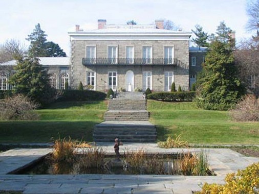
Englishman Thomas Pell, a physician, purchased a vast tract of over 9000 acres of land (most of what is now eastern Bronx) from the local Siwanoy Indians in 1654. Descendants of the Pells occupied the tract for nearly 150 years. By 1813 the acreage was sold out of the Pell-Bartow family (Ann Pell had married John Bartow), but in 1836 John’s grandson Robert reacquired the property and in 1842 built the mansion that is there today. A small cemetery is also on the property in which is interred Pell family members going back well into the 18th Century.
NYC bought the house from the Bartows in 1888; in 1915 the Pell Mansion underwent a complete restoration by the International Garden Club organization, which continues to maintain the grounds, now numbering nine acres, as a public garden to this day. In 1946 the Mansion opened as a museum exhibiting furniture and painting from the 19th Century.
The NYS historic marker that used to stand near the mansion read:
Thomas Pell of Fairfield, Conn., under tree known as Treaty Oak, bought Pelham Manor from the sachems Annhoock and Maminepoe.
Jonas Bronck
Many countries claim Jonas Bronck, the first European settler in what is now The Bronx. Was he Norwegian? Swedish? Danish? German? Most scholarship now agrees he was Swedish but had moved to Holland before emigrating to the New World in 1639, building a house by a promontory at the juncture of the Harlem River and the Bronx Kill across from Randalls Island, constructed like “a miniature fort with stone walls and a tile roof”.
Bronck died just four years later, in 1643; his death may or may not have been related to the Siwanoy raids described previously. His land, which consisted of about 680 acres (or most of everything west of the Bronx river and south of today’s East 150th Street), passed through a number of Dutch landowners before it was sold to Captain Richard Morris and Colonel Lewis Morris; the land stayed with the Morrises for several generations. The Dutch had signed a peace treaty with the Weckquaeskeek Indians at Bronck’s home in april 1642.
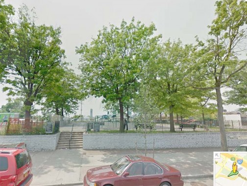
A NYS historical marker commemorating Bronck formerly stood in Pulaski Park, at Bruckner Boulevard and Willis Avenue in Mott Haven. The plaque read:
First settler in the Bronx, 1639, built house east of this park, where was signed treaty between Dutch and Weckquaeskeek Indians, 1642.
Lydig’s Mills
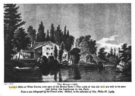
According to the late Bronx Historian John McNamara, Philip Lydig was a ship’s baker who emigrated to America in 1750 and supplied sea biscuits to the merchant marine. His son, David, expanded into the milling of flour and in 1830 bought mills that had previously belonged to Colonel DeLancey, a Tory who had fled to Canada after the colonies became independent. The mills were located on the Bronx River north of East 180th Street.
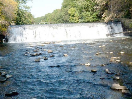
The Bronx River falls, seen from East 180th near Boston Road in Bronx Park. The NYS historical sign, headlined “Lydig’s Mill,” was located on Boston Road near the zoo entrance, and read:
Built in 18th century, stood here. North was Johnson’s Tavern, where stage coaches, New York To Boston, stopped to change horses.
Johnson’s Tavern, later known as Planters Inn, was where stagecoaches bound for New England stopped to allow the horses to be watered or changed, and allowed travelers to rest and get a meal.
Macomb’s Dam
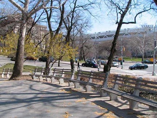
Macomb’s Dam Park, in the shadow of Yankee Stadium, at East 161st street and the approach road to the Macomb’s Dam Bridge, once had a NYS historic marker, which read:
Bridge is on site of old dam which made pond of Harlem River. Dam became nuisance and was torn down by citizens in 1840.
…which is a rather concise history of the Macomb’s Dam Bridge, built in 1814 by Robert Macomb, who was given permission to build a drawbridge across the Harlem River, but instead dammed the river at where West 160th would be. Angry area farmers tore down the dam in 1836, reopening the river to boat traffic. A wooden swing drawbridge replaced the dam, and the current steel bridge designed by Alfred Pancoast Boller replacedthat bridge in 1898.
For a person who angered and inconvenienced so many, Macomb is remembered by Macombs Place in Harlem, the bridge itself, and Macombs Road in Morris Heights.
Parade Ground
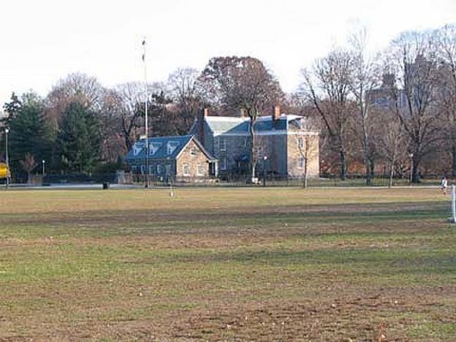
At Broadway and Manhattan College Parkway in Van Cortlandt Park, there’s a vast area of open space between the street and Van Cortlandt Mansion itself. This is the parade grounds where military bands used to practice.
The National Guard used the field for drills, mock battles, and polo matches until World War I (1914-1918), when the Army used the entire park as a training facility and spectators gathered to watch training exercises. In 1907, the Parade Ground became a temporary home to 15 bison who were awaiting relocation to Oklahoma. NYC Parks
The Parade Ground was converted into athletic fields beginning in 1938 and currently features 6 baseball diamonds, 5 soccer fields, 2 football fields, 12 cricket pitches, a Gaelic football field and numerous track and field courses.
The former NYS historical sign that used to stand on Broadway read:
Here was the bouwerie or farm of Adrian Van Der Donck, secured by purchase from Indians and grant by Governor Kieft, 1650.
The Weekquaeskeek Indians occupied the land for centuries before selling it to the Dutch West India Company in 1639. Van Der Donck obtained possession in 1640, and after conflicts with the Indians, Jacobus Van Cortlandt bought the property in 1699 and his son Frederick built the mansion in 1748, which still stands.
Van Cortlandt Mansion
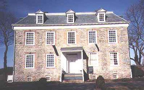
As you might expect, the State also installed a historic sign at Van Cortlandt Mansion in the park nearby, which read:
Built in 1748 by Frederick Van Cortlandt. Hessian headquarters in Revolution. Washington and Rochambeau were here.
This Georgian-style country house made in the fieldstone style was built in 1748 for Frederick Van Cortlandt. The vast athletic field north of the mansion was at one time the Van Cortlandt farm, and had large planting fields, livestock, and a grist mill.
George Washington, as well as French generals Lafayette and Rochambeau used Van Cortlandt Mansion as a headquarters and meeting offices during the Revolution. The house is maintained by the National Society of Colonial Dames as a museum appointed with period Colonial and Federal collections. It is open to the public: call (718) 543-3344 for hours.
Nearby, the Van Cortlandt mills also claimed a NYS marker:
Site of grist and saw mill of Van Cortlandt family. Used over 200 years, burned in 1901. One of the millstones is west of the mansion.
During the American Revolution (1775-1783), Van Cortlandt’s mills ground grain and cut lumber for both the Americans and the British, depending on who controlled the region. In the early 1800s, new mills were built here, and local corn farmers continued to use them through the end of the century. NYC Parks
A third NYS historical marker here cited the old Van Der Donck mansion, which the Van Cortlandt Mansion replaced:
Adrian Van Der Donck, first settler here, 1650 built house, later burned by Indians. Original site of Van Cortlandt House.
Vault Hill
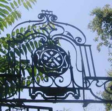
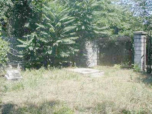
Roaming in Van Cortlandt Park east of the Parade Grounds and athletic fields (including NYC’s premier cross country running course) that line the park’s western edge at Broadway and just south of the Henry Hudson Parkway, you can find the original burial plot of the Van Cortlandt family, Vault Hill. NYC municipal records were hidden from the British here in 1776 by NYC clerk Augustus Van Cortlandt (Frederick’s son), and in 1781 George Washington lit campfires here to deceive the Brits while he marched to Yorktown to face Cornwallis in a decisive battle of the Revolution. By 1917, the region in view of the cemetery was being used as a training ground for World War I troops: doughboys dug trenches and hiked the surrounding hills. Most of the Van Cortlandt family remains are now in Woodlawn Cemetery.
There was once a NYS historical marker here, which read…
Burial vault of the Van Cortlandt family, where Augustus Van Cortlandt, City Clerk, hid New York records during Revolution.
Poe Cottage
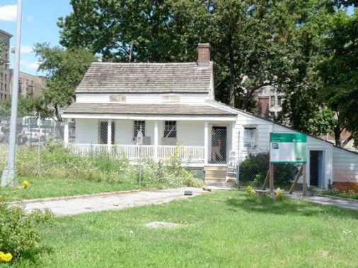
From my latest Grand Concourse page:
When Poe lived in this small farmhouse at the Concourse and East Kingsbridge Road with his wife Virginia (a first cousin) and her mother; between 1846 and 1849, there was no Grand Concourse, and the house stood far out in the country. That’s what Poe was seeking in a dwelling, believing the clear country air would invigorate his ailing young wife, who had tuberculosis. Tragically, it did not work and Virginia died; one of his best-known poems, “Annabel Lee”, is thought to memorialize her.
Poe and his family were destitute while living in the farmhouse. He was a literary success but had lost his savings in a failed magazine venture. The author and his mother-in-law had to forage in nearby fields for the family’s sustenance. The cottage itself was built in 1812 by farmer John Wheeler and stood on Kingsbridge Road until it was moved to its present location in 1913.
The house is one of four Poe museums in the USA; it is sparsely furnished in the fashion Poe must have had while here. It is thought that the bed, gold-framed mirror and rocking chair belonged to Poe himself.
The NYS historic marker that used to be on site read: Edgar Allan Poe lived here 1846-49 and wrote many of his poems, Annabel Lee, Ulalume, and others. His wife, Virginia, died here.
Screven’s Point
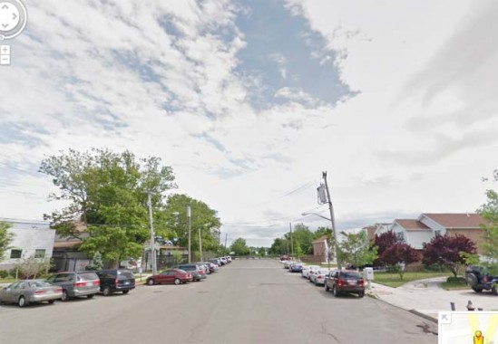
Above: the south end of Castle Hill Avenue at Hart Street at Pugsley’s Creek and the East River
While spots you’d think would be marked have none, NYS historic markers pop up in several out-of-the-way places. There was a marker at what used to be called Screvin’s Point, at the southern end of Castle Hill Avenue.
Sewanoe Indians had castle here, seen by Adrian Block on his voyage, 1614. Loyalist clergymen, including Samuel Seabury, hid in farmhouse.
Seabury was a rector of St. Peter’s Church, the newest building of which can still be found at Westchester Square. After the Revolutionary War he was consecrated a bishop in Scotland in 1784, the first American bishop in the Anglican Church. Though he was a loyalist during the war, after independence was secured he pledged allegiance to the USA.
The Screvin family owned the land at what was originally known as Castle Hill Point. A short street nearby is called Screvin Avenue.
“Site of Westchester Town”
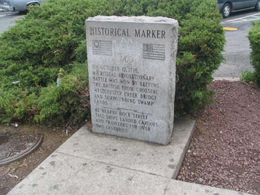
Though the NYS historical marker at Westchester Creek has gone, there is this small marker on East Tremont Avenue near where it crosses the creek.
Westchester Square, even to the present day, appears to be a small town hub, clustering around the triangle formed by Westchester, East Tremont and Lane Avenues. The “town” has recently celebrated its 350th anniversary, having been settled here, as Oostdorp (‘east village’) by the Dutch in 1654 and taken over by the British with the rest of New Amsterdam in 1664. It became a busy port along Westchester Creek, which hastened its development; by 1693 St. Peter’s Episcopal Church was founded. The parish is still in existence. During the Revolution, patriots dismantled a bridge over the creek, delaying British advancement (the present-day bridge carries East Tremont Avenue over the creek).
The NYS historic markers are occasionally worded confusingly, as they were written to fit the plaque. The one here said:
Prescott Bryant repulsed British at causeway over West Chester Creek Westchester “Lexington.”
My internet searches have drawn a blank on Prescott Bryant, so help me out here.
“Throgg’s Neck”
This one is a harder nut to crack. From the ForgottenBook:
Throgs Neck, mainland Bronx’ most southeastern redoubt, was named for a very early British settler, John Throckmorton, who arrived in the peninsula now capped by Fort Schuyler in 1642. The peninsula, or “neck” (cf. Little Neck in Queens) was bestowed an abbreviation of his lengthy name and Throgmorton Avenue, also a tribute, is a variant spelling. Throgs Neck is also occasionally spelled with a double g. The explanation for all this may lie in the fact that in the early days of printing (which in Throckmorton’s day had been an industry for only about a century and a half) spellings were hardly standardized. However Throgs Neck is spelled, it is a peaceful, tranquil area with a couple of private communities that enjoy terrific views of the water-filled surroundings.
The NYS historical marker that was in Throgs Neck has its location given at “Throgg’s Point Park”said:
Named For Throckmorton, who settled here in 1642. One of his companions was Roger Williams, founder of Rhode Island.
No current map shows a “Throgg’s Point Park,” though there is a Bicentennial Veterans Memorial Park facing Throgs Neck Boulevard between the Throgs Neck Expressway and Weir Creek, an inlet of Eastchester Bay. That’s my guess where the sign could have been.
St. Ann’s Shrine
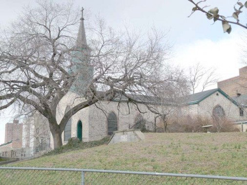
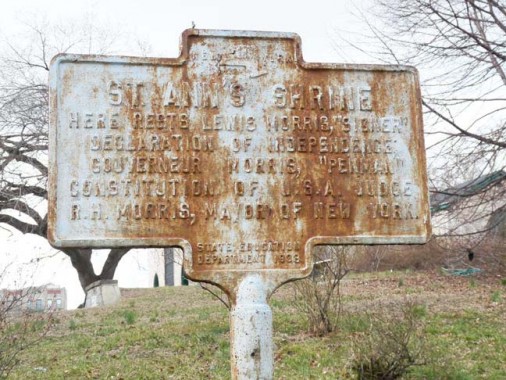
The one and only extant NYS historical marker in the Bronx stands in front of St. Ann’s Church at St. Ann’s Avenue and East 139th Street in Mott Haven.
St. Ann’s is The Bronx’ oldest church, having been built in 1841 and dedicated to Gouverneur Morris’ mother, named, naturally, Ann. Several members of the Bronx’ most noted families of the colonial era and beyond are buried in the church’s graveyard, including Gouverneur and Lewis Morris.
Before much of Mott Haven was purchased by Jordan Mott for his iron works in the 1840s, Mott Haven was owned by the Morris family.
Lewis Morris (1726-1798) was an ardent supporter of American independence and served in the Continental Congress from 1775-1777, and in the NY state legislature between 1777 and 1790. He signed the Declaration of Independence in 1776. His great grandfather (Richard, died 1672) had immigrated to New York through Barbados after being part of Oliver Cromwell‘s army in the English Civil War of 1648. He purchased the first tract of land in The Bronx that became the basis for the Morrisania manor.
Gouverneur Morris (1752-1816) half-brother of Lewis Morris, was a political leader, diplomat, U.S. Senator, and American ambassador to France. He was an outspoken opponent to what he termed ‘unchecked popular democracy’. His son, G. Morris II, sold the estate to Jordan Mott, who built the famed Mott Iron Works on the Harlem River.
After the Constitutional Convention completed the US Constitution in 1787, it was Gouverneur Morris who was assigned the task of editing the text and making it readable and streamlined. Thus, the NYS historical marker reads:
Here rests Lewis Morris, “Signer” Declaration of Independence;Gouverneur Morris, “Penman” Constitution Of U.S.A.; Judge R.H. Morris, Mayor Of New York
Unfortunately, nothing at all has been done to preserve or upkeep the sign, so it has been rusting almost since it was placed in 1938.
More New York State historical markers in Manhattan, Queens and Staten Island coming soon
3/10/13

25 comments
Joseph Ditta: The Gravesend marker is not quite correct: the town was not settled by English Quakers. Rather, Lady Moody and some of her followers were Anabaptists. The Quakers came a bit later to Gravesend, but still before the British takeover of 1664.
Fascinating! As a former Bronxite, I loved reading it. As a current Queens resident, I can’t wait to see the Queens markers.
You found some great and interesting stuff. Perhaps someone could get permission to restore the sign at St. Annes.
Please know that the historic marker on the grounds of St. Ann’s Shrine has been scraped and repainted, a task undertaken by the Increase Carpenter Chapter of the Daughters of the American Revolution located here in New York City.
There a January 2015 image on line if you wish to take a look at flickr.com/groups/thebronx/
“Englishman Thomas Pell, a physicist…” would have been a man ahead of his time. Well ahead of his time. Most of the references say that he was a physician.
Same thing, WAY back in the day.
Re: “During the Revolution, the British Fleet was ordered to “Proceed up the Bronx and attack the Yankees in hiding above.”
Too bad the British successful; otherwise, the Dodgers woudn’t have to have dealt with them later on.
Make that, “Too bad the British WEREN’T successful.”
Actually, no such attempt was made. Due to mill dams the Bronx River was unnavigable north of West Farms, and the British knew it.
Have you looked at the “Historical Marker Data Base? http://www.hmdb.org/
You say that Fort #Four Park is at Sedgwick and Roosevelt Avenues, but there is no Roosevelt Ave. in the area. I didn’t know that the Bronx had a Roosevelt Ave. at all, but apparently there is a one-block street by that name in Throgs Neck.
Regarding the Boston Road bridge over the Bronx River, it can be reached without paying admission to the Bronx Zoo. Walk into the park from Bronx Park East and Boston Road. You can pass the gate where cars pay for parking without having to pay as a pedestrian. Keep going straight and you will wind up on the bridge. Admission to the zoo is not collected until after the bridge.
I am also wondering about the distinction between a “soccer field” and a “soccer pitch”. Are they different enough that the Van Cortlandt Park Parade Ground can have 5 of one but 12 of the other?
Got my R avenues mixed up, I meant Reservoir. Fixed.
I meant cricket pitch; also fixed.
You can sneak in that way without paying admission at all. Take the pedestrian path to he left of and parallel to Jungle Road. Walk till it ends at the Monorail fence. Then just cross Jungle Road and walk into the exhibit area passing the bears. Act cool and no one will stop you.
The monument across from Prospect Park along Parkside Ave in Brooklyn had a marker to commemorate The Battle of Long Island……still there?
Great work Kevin.
Never heard about the Maryland Regiment. Thought Washington got away by stealth without many loses, what really happened sent a chill down my spine.
Thanks for the post.
“Those who forget the past are not necessarily doomed to repeat it,just doomed to being ignorant”
–Hollywood Squares contestant Chares Nelson Reilly
I would be surprised if any of these signs still remain in Manhattan, but we will have to wait for that set to come to find out.
Kevin, thanks so much for your outstanding series on historical markers. I’m very much looking forward to the ones on Staten Island. from your Forgotten fan, Renee
This is an utterly delightful tour! Thank you so much!
Coming up empty on Prescott Bryant as well; has anyone found anything? Could this forgotten and lost marker be wrong?
I must also say that it is a shame that the overwhelming majority of these markers are gone.
Couldn’t the city scrape together a little scratch to promote local history? If they could plant a million trees, surely 20 something markers wouldn’t dent the wallet too much. I’ve seen plenty of these markers north of the city, and it’s always a pleasure to see that past people and events are not forgotten. It reminds one to crack open a book or newspaper, and do some research on our rich history.
[…] of historical markers that are lost or incorrect, focusing on famous people and events. Check out ForgottenNY for his quest of the handful of State Historical Markers that still exist in New York […]
The NY State Historical marker concerning Thomas Pell and the Treaty Oak is still there on the Shore Road, just before the driveway to the Bartow-Pell Mansion… you can only see it coming from The Bronx, heading north. It is in very good condition.. Tom Vasti, vice president. East Bronx History Forum…
Good to know!
I must object to the characterization of Aaron Burr as the “assassin” of Alexander Hamilton. Hamilton’s unfortunate death was the result of a formal, agreed-upon duel, which Hamilton did not have to accept and could have easily avoided.
Wonderful info! Would you know the approximate site of Lewis Morris’ manor house Morrisania, burned the Brits during the War Of Independence?
Thanks in advance –
Bob Selig