
I still have grand dreams and ambitions. Publish a book and own my own place? Done years ago. Marriage? Make millions? Let’s not get crazy. However, it popped into my head a week ago that I haven’t listed every street in Manhattan that runs for one and only one block. My criteria for this project were simple. The one-block street should intersect only the two streets where it begins and ends (or one street, if it’s a crescent and begins and ends at the same street) and should not be a section of an interrupted numbered street. And, they cannot be honorific street names slapped onto already existing streets. If I listed those it would entail a separate website.
Before the nitpickers strike, I’m not considering Manhattan’s “slips” for this page, as they are merely extensions of their parent streets. Fear not, though, I covered them here.
There are more of these”one and dones” than you think, and with the limited time I have over a weekend, I’ll have to do multiple parts. And this is just Manhattan–there are potentially four other projects to be done for the other four boroughs. Staten Island should be daunting. But I have my extensive photo library and Google Street View/screen capture for those streets I haven’t photographed. I think this is going to be fun.

Moore Street
One of the shortest streets in a part of town that has a number of them, Moore Street runs for one block between Water and Pearl north of Whitehall near Battery Park. There was no obvious “Moore” in the area in area records in the colonial era it could have been named for, so tradition holds that it was named for the many ship moorings along Queen Street (now Pearl). All Manhattan territory east of Pearl Street is built on landfill. An extra block of Moore Street east to South Street was wiped out by the New York Plaza complex in the early 1970s.
At left, and seen in photos above, a reverse L-shaped lamppost installed by the Downtown Alliance. The posts appear frequently in southern Manhattan and a group have also found their way to Jackson Avenue in Long Island City.
Coenties Slip and Coenties Alley
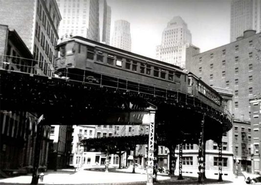
A set of subway cars runs on the S-curve at Coenties Slip, which remains a wide, though short, thoroughfare today. A tight turn from Water via Coenties Slip onto Pearl Street necessitated this S-curve.
Coenties Slip was one of the largest of lower Manhattan’s colonial-era boat slips. It has pretty much kept its old slanted shape, too. The slip was filled in around 1870. The name “Coenties” is old Dutch as Dutch can be since it recalls an early landowner from New Netherlands era, Conraet Ten Eyck, a tanner and shoemaker. He was nicknamed Coentje, or “Coonchy” to the British, and over time settled into this spelling. Ten Eyck Street in Brooklyn’s East Williamsburg was also named for him. Another story has it that the name is a contraction of “Conraet’s and Antje’s”: Conraet Ten Eyck and his wife Antje.
To this day I have never heard “Coenties” pronounced, but I imagine area denizens pronounce it as spelled: “ko-ENT-ees.” Am I right?
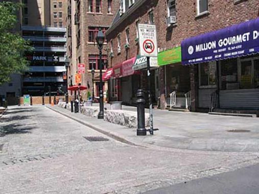
Coenties Alley, formerly Coenties Lane, is a short lane connecting Pearl Street with the rump section of Stone Street cut off by 85 Broad Street. Here there’s a brief break from the towering skyscrapers, allowing a view of 54-story 20 Exchange Place, the Canadian Imperial Bank of Commerce Building (originally the City Bank Farmers Trust Building), completed in 1931, a feverish era for skyscraper building. Within 2 years, this building, 40 Wall (the Trump Building), the Chrysler Building, and the Empire State Building all rose.

Mill Lane
Mill Lane, a short path between Stone and South William, honoring a long-vanished mill, is one of the shortest streets in Manhattan (Edgar, between Trinity Place and Greenwich Street just north of the Brooklyn Battery Tunnel exit, takes the title according to the people who measure these things; see below). Mill Lane is much narrower and less trafficked than Edgar, though, and may well be the least-noticed of any street in Manhattan. In recent years it has been compeletely obscured by ubiquitous building scaffolding, which is mostly there to avoid lawsuits.
Marketfield Street
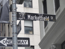
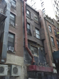
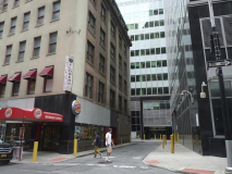
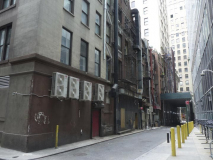
Marketfield Street is one of the city’s few L-shaped routes, proceeding from Broad Street opposite #75 and then doglegging west and north to Beaver and New Streets. I’m showing it from both access points at Broad and Beaver. Nothing to write home to Mother much about here; Marketfield is mainly home to service entrances. I did check to see if there were some remaining window shutters on the back walls of some Beaver Street-facing structures and indeed a couple are still there.
“Marketfield” is an English transliteration of the Dutch term “marktveldt” or “field market” — it once led to the Battery Park area, which was a livestock and produce market in the Dutch days. Marketfield Street was once called “Petticoat Lane”, a name I wish had been kept (you will find discarded bras at Jeremy’s Ale House on nearby Front Street in the Seaport area).
Edgar Street
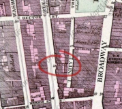
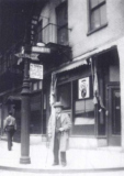
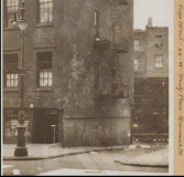
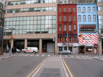
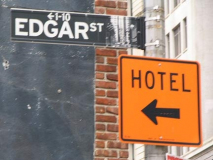
Edgar Street, circled, 1867 Manhattan Dripps atlas; New York Public Library archive view of Edgar Street, seen from Trinity Place in the foreground and Greenwich Street, with its elevated train, in the background; and an Edgar Street corner — not sure if this is Trinity or Greenwich. At this time Edgar Street was 55 feet in length.
Throughout the years, several streets have competed for Shortest Street in New York City supremacy. There are many streets in New York, such as Mosco Street in Chinatown, that have been carved up, paved over, renamed, and shortened; some, such as Chestnut, that have been shortened repeatedly and as a final ignominy, eliminated completely (by the Al Smith Houses, the terminator of Chestnut, Oak, Batavia, New Chambers, and most of James and Oliver); and then there’s Edgar, which has been paved over and revived.
Edgar Street, which is presently 63 feet in length, was named for shipping merchant William Edgar, who at one point in his career owned the biggest shipping operation in the city.
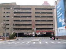
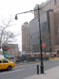
LEFT: Edgar Street recently, looking toward Greenwich. The old elevated, in existence between 1868-1940, has long vanished and the Brooklyn Battery Tunnel Trinity Place exit was completed here in 1953, with the massive parking lot on Greenwich showing up soon after.
2nd from LEFT: Edgar Street, looking toward Trinity Place. While Edgar remains, officially, the shortest through street in Manhattan at 63 feet in length, it’s actually rather busy these days, with two-way traffic and a center median. The red and blue buildings center right are likely the only structures that predate the construction of the tunnel in 1951. Edgar Street was transformed from the tiny alley seen in the photo on top to a traffic conduit between Greenwich and Trinity; the old Edgar was paved over, while the new Edgar was constructed.
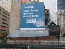
Though no property has ever fronted on Edgar Street, the old version or the new version, the black and white Downtown Alliance signs yet grant it a 1-10 numbering, quite generously. Seen from the tunnel ramp, Edgar Street’s chief function is to act as a giant billboard.

Joseph P. Ward Street
In an era when streets don’t get renamed for local heroes anymore…just subnamed, with additional street signs installed next to the original name. Joseph P. Ward stands out as this short connector between Washington and West Streets beneath a parking garage and next to the Brooklyn-Battery (Hugh Carey) Tunnel on/off ramp has always been plain Joseph. P. Ward Street since 1967. According to Sanna Feirstein in Naming New York, Ward was a naval navigator during WWII; he was awarded with a Silver Star for conspicuous gallantry and intrepidity in action against the enemy while serving with the 1st Armored Division during World War II.
BTW I hadn’t seen much info about Sanna Feirstein, whose book I consult often, but she’s interviewed on this video.
Exchange Alley

I took a comprehensive look at Exchange Alley…quite possibly NYC’s narrowest road…on this FNY page in 2017.
First Place
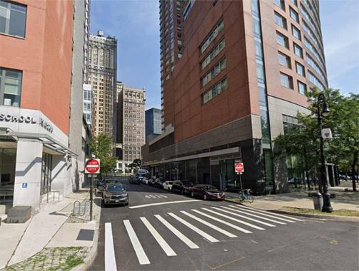
I haven’t paid a lot of attention to Battery Park City in FNY, as I find its luxury apartment buildings a bit samey and uninteresting. However, its street layout bears mentioning. It features western extensions of Financial District streets such as Thames (which becomes “West Thames”), Albany, Liberty, Vesey, Murray etc. Battery Place is extended west but then turns north. North and South End Avenues were added, joining the preexisting East and West End Avenues. And, BPC was bequeathed a new set of numbered streets, 1st, 2nd and 3rd Places. Of the three, only one, 1st Place, runs exactly one block as the other two are dead ended west of Battery Place.

Liberty Place
Formerly known as Little Green Street, Liberty Place is a short lane that connects Liberty Street and Maiden Lane just west of Nassau Street. It used to be on a steep hill until the 19th Century. NYC’s Quaker Meeting House and graveyard used to be on the corner of Liberty and Little Green Streets way back in the 18th Century.
Although there are a couple of addresses on Liberty Place, the lane is more interestin g for the buildings that border it. I went into this on this FNY page from 2013.

Dutch Street
It’s hard to get photos of some of NYC’s downtown alleys because of everlasting scaffolding; so imagine my surprise when Dutch Street was finally revealed to (partial) sun in 2019. Dutch Street, a one-block path from John north to Fulton east of Nassau, has been nearly completely shrouded by construction sheds for the better part of a decade. On a downtown foray, lo and behold, there it was in the sunshine, or what little sunshine the behemoth buildings of Lo-Man permit.
According to Sanna Feirstein in Naming New York (she’s right about more streets than the late Henry Moscow is in The Street Book) Dutch Street was named for the Old North Dutch Church, which was at the corner of William and Fulton from 1769 to 1875; the name shows up on maps as early as 1789. (Moscow merely says it was named for the Dutch colonizers of New Amsterdam.)
I have info and photos of Dutch Street, old and new, on this FNY page from 2019.

Cortlandt Street
“Cortlandt” is a common name in the various NYC street directories and gazetteers, either with a “Van” or without. The street is named for the family of Oloff Stevensen Van Cortlandt, who arrived from Holland in 1637 and became a brewer, with the family eventually amassing a great deal of property and influence. His sons Stephanus and Jacobus became NYC colonial-era mayors. Jacobus purchased the vast estate in the northern Bronx where he built a mansion that stands to this day, and much of the estate became Van Cortlandt Park. Several roads bordering the park or near it were also named Van Cortlandt.
Since 1970 or so, Cortlandt Street has extended for only one block, between Church Street and Broadway. However, two subway stations, one BMT, one IRT, have stations located on Cortlandt Street. Why was Cortlandt Street considered important? The answer lies in its transportation connections. Since 1908, both stations have featured a connection to the Hudson Tubes that connect Lower Manhattan with Jersey City, Hoboken, and Newark. And, until mid-century, there was also a ferry that connected Cortlandt Street with the Jersey City waterfront.
In 2018, I expounded on Cortlandt Street in detail.
Dey Street
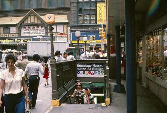
Like its one-block long brother to the south, Cortlandt Street, Dey Street was once much longer, but today runs only for a block, between Broadway and Church Street. It was named for colonial-era Dutch farmer, Dirck Teunis Dey; the road was built through his former property en route to the ferry on West Street. Today, a look west down Dey Street gives glimpses of the spiky exterior of the new PATH train terminal, referred to as The Oculus, and the glass dome of the World Financial Center, which has a climate-controlled lobby area in which you have been able to find several palm trees for the past few decades.
A closer look at Dey Street, FNY in 2018

Theatre Alley
Like Dutch Street, Theatre Alley has lost its near-permanent scaffolding…at least when I last saw it in 2021. Theatre Alley, running from Ann to Beekman just east of Park Row, at one time was the back entrance to the old Park Theatre (originally the New Theatre), which fronted on Park Row. It stood from 1798 to 1820; after a fire the theater was rebuilt the next year, and stood till 1848, when it once again burned down. At that time the Park Theatre was beginning to lose out to other theaters springing up along the Bowery uptown. The Astors, who owned it then, elected to not rebuild it. The Park opened in 1798 with a performance of Shakespeare’s As You Like It. The alley served as the service lane for carriages bringing theatergoers to Park Theatre. But the carriages approaching each other from both sides of the narrow lane created NYC’s first traffic jams causing Theatre Alley to become NYC’s first one way street!

Trimble Place
Trimble Place, a very short, one-block lane in Tribeca, between Duane and Thomas just east of Church, is the only remnant of New York Hospital’s former downtown location. Now New York-Presbyterian, located in Washington Heights near the George Washington Bridge, NYH was chartered by King George III in 1771 and opened in 1791, after US independence had been won. The hospital pioneered the treatment, by surgeon Wright Post, of aneurysms and other arterial problems in its early days. Post’s work in vascular ailments was carried on by Valentine Mott. NYH outgrew its original location by the early 1870s and then moved uptown, but one of its carriage lanes was left over and became a mapped public street in 1874. It was named for George Trimble, director of New York Hospital at the time, and an officer of the Public School Society and local merchant.
Oddly enough I remember the name Trimble because a tenant in one of the apartment buildings my father took care of as a custodian had a realtor on the ground floor named Joe Trimble; and for many years the NY Daily News had a sportswriter with the same name.

Catherine Lane
Imagine my surprise when I was researching the page and came across a Tribeca Citizen piece from December 2023 about the “unwrapping” of Catherine Lane, a narrow passageway between Broadway and Lafayette north of Worth Street. Scaffolding has covered the street almost since I began FNY in 1998 and I had never been able to get a photo of it! I may have to make a pilgrimage over there. Till then I am relying on the photos accompanying the piece.
I do remember a wall bracket lamp way back when the street had been uncovered, but that has since been removed.
Catherine Lane, Street and Slip are named for Catherine Rutgers, a member of the prominent Rutgers family who owned large swaths of territory in Revolutionary-era Manhattan. Oddly, Catherine Lane is not quite parallel to neighboring Worth and Leonard Streets.

Mosco Street
Mosco Street runs for a block between Mulberry and Mott, a block north of Worth. I have long been fascinated with it as I am with all of Manhattan’s short streets, which are often remnants of something much bigger. Mosco was once Park Street and before that, in the mid-1800s, it was Cross Street; it cleaved through the heart of Five Points, once one of Manhattan’s worst corners; old Hell’s Kitchen or the Bowery has nothing on its street gangs, cold-water tenements, thieves’ dens. See the link, or read Lucy Sante’s Low-Life or Tyler Anbinder’s Five Points to get the flavor of it. Much of its was razed to build courthouses and the new NYPD headquarters as well as Columbus Park, and most of it was eradicated by the mid-20th Century. But little Mosco Street is still there as a reminder.
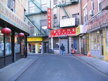
Doyers Street
For a one-block street, Doyers Street is quite unusual in Manhattan, where curved streets are rare: it makes two changes of direction, meaning it goes in three different headings as it meanders from Pell Street to the Bowery. By some chance, the zig-zagging cart path that led to Dutch distiller Henderick Doyer’s tavern has been preserved in situ. The street is the site of the long-running Nom Wah Tea Parlor. Recently cars have been barred as it is now open only to walkers, cyclists and scooters.
Doyers has been called the “bloody angle” from Chinese gang wars that have erupted along its length over the years.

Benson Street
20 or so years ago, Benson Street would have been disqualified from this page because it was a dead end, not a “one and done.” However, a narrow section was opened north to Franklin Street. According to both Henry Moscow and Sanna Feirstein in their Manhattan street name chronicles, Benson Street is named for Egbert Benson (1746-1833), NYC’s first attorney general, a delegate to the Continental Congress, and a founder of the New-York Historical Society. Though the name appears to be English, the Bensons were among the first Dutch immigrant families to settle in Manhattan; a Brooklyn branch of the family settled in what is now Bensonhurst in Brooklyn. ( Feirstein erroneously has the street name as “Benson Place.”)
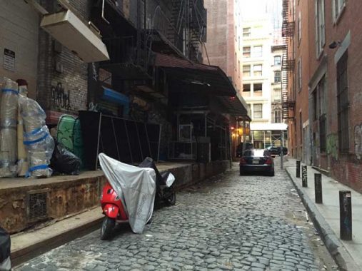
Franklin Place
Franklin Street, and the Place named for it between Franklin and White Streets west of Broadway, have been there a long time. This Dripps atlas from about 1867 shows it already in place, and every street on this excerpt also remains in place. Before the street was named for the Philadelphia polymath who proved the usability of electricity, stove inventor, editor, political activist and ambassador to France, it was, mystifyingly called Sugarloaf, or Sugar Loaf, Street. The name likely had to do with Sugar Loaf, both a town and a mountain in Orange County, New York. According to legend, in winter the mountain resembled “sugar loaves” sold before cubes or granulated sugar became the norm.
FNY profiled Franklin Place in 2015 and 2022.

Hogan Place
In 1980, the easternmost section of Leonard Street between Centre and Baxter Streets was renamed (not subnamed) for Frank Hogan, Manhattan district attorney who died in 1974 after 34 years in office. The street is located between the Louis J. Lefkowitz State Office Building and the Manhattan Criminal Courts Building.

Cannon Street
One of the ghost streets of the Lower East Side. A short piece of Cannon Street, between the Broome Street walkway and the south side of Delancey, has been allowed to remain as it borders PS 110, now known as the New Explorations into Science, Technology and Math, which has a #111 Columbia Street address. It is the only K-12 public school in Manhattan, serving young people in the Gifted and Talented program.
Cannon Street was named for Abraham Cannon, an 18th Century baker and tavernkeeper who had purchased land formerly owned the local bigwig, James de Lancey.

Ericsson Place
From the LES we’ll swing all the way west to Tribeca. I’m not sure Ericsson Place should count, as it’s a renamed one-block section of Beach Street between Hudson and Varick, facing the Holland Tunnel approach ramps. However, it gets its own signs and doesn’t have to appear next to Beach Street signs. It was named for John Ericsson, the Swedish-born designer of the first ironclad U.S. Navy warship, the Monitor. Statues in his honor can be seen in Battery Park and McGolrick Park in Greenpoint, where the ship was built. Ericsson resided on this block of Beach and till recently the outline of his house could be seen next to a torn-down building.
Though there are still some downtown “one and dones” to cover before I move uptown with the survey, I’m going to “call a lid” as they say at the White House, and pick things up again next Sunday, here at your Forgotten NY.
Next: SoHo, Tribeca, Greenwich Village
As always, “comment…as you see fit.” I earn a small payment when you click on any ad on the site. Take a look at the new JOBS link in the red toolbar at the top of the page on the desktop version, as I also get a small payment when you view a job via that link.

22 comments
I wonder if you can do a piece on one story buildings in NYC. I am always intrigued by them when you see them around the city.
You need to check out Henshaw and Staff Streets in Inwood. They both go one block between Riverside Drive and Dyckman Street and are the two streets (not counting the West Side Highway) farthest to the west in Manhattan north of the Cloisters. No residential addresses on either, though several buildings are on them with Riverside Drive addresses. Nothing the least bit noteworthy or architecturally interesting, but they are definitely only a block long and always have been.
I should also add another couple in Inwood that are at the very northern extremity. 217th Street between Park Terrace East and Park Terrace West in one. This block actually has single family brick homes on the north side. The other only semi-qualifies. Indian Road runs down from 218th Street before dog-legging and turning into 214th Street (street numbers up here do not like to behave like they do elsewhere. I live at the intersection of Seaman Avenue and 204th; the next corner north is 207th. There are no 203rd, 202nd, 201st or 200th streets, at least not on this side of the island). Technically, it is two blocks long because 215th Street terminates at Indian Road mid way between 218th & 214th, but there are no intersecting streets on the other side. Close, but maybe a cigar?
201st, 202nd and 203rd Streets certainly do exist in Inwood,all on the east side of 10th Avenue!
“at least not on this side of the island”
I am aware that these streets do exist. Just nowhere near the area I am talking about.
And then there’s the infamous cross streets of Seamen and Cummings..i live a few blocks just south on Broadway.
Meant what I wrote below to be a reply to Wyatt, above, but mis-placed it there instead of here.
Kevin,
I just noticed that this is Part 1, so my apologies if you already had them on your list for the upcoming installments
To be precise, Seaman Av & Cumming.St. I have lived a block and a half away for over 50 years. I have had a postcard titled “Only in New York” with a montage of images of street signs from this intersection, Broadway & Beaver St. and also Christopher Street & Gay St. This was from a much less PC era when there was less uproar over this sort of humor. Not say that is good or bad, just that it is what it is
A hundred years from now, people will make the erroneous claim that Benson Street was named for the detective in the Law and Order: SVU television series which took place in New York. 🙂
Great page, Kevin. Moore Street, the reason for the name N. Moore Street further north… or is it?
Coenties Slip: That’s an elevated train not subway. Wooden car bodies were forbidden in the subway.
For what it’s worth, Dutch OE is pronounced like ooh in English, but the three-syllable CO EN TEES is probably more common in New York than COON TEES. Just please not like a ahort U, all right everyone? Let’s be proper.
I would count the fairly long U-shaped Catherine Slip. Although it appears to intersect with another street halfway through the latter is actually a driveway into the Smith Houses rather than a public road.
Them streets public property for now,but I wouldnt be surprised if some of the smaller ones get “privatized”
Kevin,
Am loving your series on one-block streets,
especially the ones I used to tread in lower Manhattan
and its financial district.
When you get to Staten Island:
An easy place to find one-block streets
is in Westerleigh and Meiers Corners,
especially between Kingsley Ave.
(I grew up in the house at #169)
and College Ave.
cheers, from your longtime reader
Thanks for the memories . I worked at 67 Broad St and One Whitehall from 1978 to 1984 and I roamed around many of these streets on my lunch hours.
Would York Street count? St. Johns Lane to 6th Avenue.
Patience. Part 2.
Can’t wait until you hit the West Villiage. There are a number of one blocks streets there: Minetta Lane, Minetta Alley, Gay St.. Commerce St and Jones St are a few I can think of.
Only Minetta St counts
What about Chittenden Ave In Hudson Heights near 1’87th street? I lived there for almost 10 years.
“There are more of these”one and dones” than you think, and with the limited time I have over a weekend, I’ll have to do multiple parts. And this is just Manhattan–there are potentially four other projects to be done for the other four boroughs.”
Under consideration
https://forgotten-ny.com/2023/01/chittenden-avenue-washington-heights/
Re: Doyers Street, I wonder if anyone here might recall a museum or cultural center very near, and I’d say even on the same side of the street as the location of the Nom Wah? I would further say that it had a downstairs, i.e., subterranean level, among its many rooms and cubbyholes.
I went there on a field trip during junior high — easy to conjure the memory of the exterior, because of the crooked street — but can truly only recall two things from inside. One was a display of incredibly meticulous match-stick (or similar) miniature constructions, including a temple-like structure, and a wheeled carriage. The other was a classmate, who shall remain nameless, getting into big trouble for, and being physically pulled out of (by a female teacher / chaperone at least four times our ages) a coin-operated, sidewalk-type ride that resembled the lunar return capsule. Why that thing was inside that place I’ll never know.
My parents’ retail appliance store was at 27 Trinity Place, facing Edgar Street, and three doors down from Exchange Alley from 1948 to 1969. When I wasn’t in school, I was working in the store, so I have a clear recollection of those streets and the whole neighborhood, I retain a great love for the city to this day.