

GIVEN that I last walked in Canarsie for any length in 2019 (much of those photos remain unused as I seek a context) I thought I would get the BMT Canarsie L train all the way to its southern limit in June 2026 and check on a few things. There are still a few ancient streetlighting remains in Canarsie and many of its old alleys and farm-to-market roads are still in evidence. While residing in Bay Ridge until 1993, I found Canarsie fairly easy to reach on bicycle, just a few miles each back and forth. Perhaps my most unusual Canarsie ride was one of my first. On my birthday in August 1974, I headed out there. I was still in school at the time and had very little money, and at times foolishly carried none at all on my rides. Wouldn’t you know it, genius here got a flat tire and had no money for repair. So, I walked the bike all the way back home in Bay Ridge, or rode on the rim at times, which took a good 3 hours to get back home, worrying my parents in the era prior to cell phones. When I first began biking there Canarsie was Jewish and Italian; today, it is mainly Black and Caribbean. “Canarsie” is derived from the Canarsee Native American group that once populated the area, and the word itself in the Algonquian language group means “enclosed space” or “fenced area.”
1974 was also not propitious for me to ride to Canarsie because the very year before that, 1973, was the last year for the old-fashioned BMT grade crossing at East 105th Street. I don’t know if I was aware of it then, though, as my true subway fandom didn’t kick in till years later when I read Stan Fischler‘s “Uptown, Downtown.” Known best as a hockey commentator and writer, Stan, still with us in his 90s, has also written volumes on the trolleys and subways he rode growing up in the 40s, which influenced my own writing.
Canarsie has precisely zero locations cited by the NYC Landmarks Preservation Commission.
As the map indicates my route was compact, as my back gets sore and tired much more readily in recent years: I will be 69 in a few weeks. Canarsie is much bigger than it appears on street maps, and I’ll have to return for additional highlights. I was lucky to choose a weekend when the L was running to Canarsie, as the MTA has been unable to provide consistent service there for a number of years.


photo: NYC Subway
Kicking things off at the 8th Avenue station on the Canarsie L train, the western end of the line. It’s far below street level and requires three flights of steps to get topside at 14th Street. 6th Avenue was the original west end of the L train in 1924, and this western extension opened in 1931. That year, construction materials on hand required this BMT station to be assigned the IND design for express stations: white tile with a color band along the wall, punctuated by small black and white station ID signs. When the station was overhauled in 1999, it was given the multicolored, multi-shaped tile work that subway designer Squire Vickers gave Canarsie Line local stations. Unfortunately, relentless leakage has compromised the design with water damage.


The last two stations of the Canarsie Line, East 105th and here at Rockaway Parkway, are at grade (on ground level, neither subway nor elevated). The southernmost six stations on the Canarsie were part of a grade-level steam line and opened in 1906; following their electrification and placement on an elevated trestle, they were annexed by the BMT Canarsie Line.
Subway historian Andy Sparberg: “The last two stations of the Canarsie Line, East 105th and here at Rockaway Parkway, are at grade (on ground level, neither subway nor elevated). The southernmost six stations on the Canarsie Line (Atlantic Ave., Sutter Ave., Livonia Ave., New Lots Ave., East 105th, and Rockaway Parkway) were originally part of a grade-level steam line opened in 1865 to connect the Long Island Rail Road (LIRR) East New York Station with a pier at Canarsie Landing, where ferries continued across Jamaica Bay to Rockaway.
“Brooklyn Rapid Transit Company (BRT) acquired the line in 1906, after which it was electrified, connected to the already vast BRT train network, and placed on an elevated trestle between Broadway Junction and New Lots Avenue. Ever since, the line has been part of the Canarsie subway route, under BRT, BMT (after 1923), and public sector ownership (ever since 1940).
“South of New Lots Avenue, this line remains at street grade, very unusual in New York. It is virtually unchanged from the early 20th century, except for the 1973 elimination of a New York’s last subway street grade crossing at the East 105th Street Station. Rockaway Parkway has been the end of the Canarsie subway line only since 1920; before then trains continued via a private grade level right of way between East 95th and 96th Streets to the Golden City amusement park located near the modern Canarsie Pier location. In 1920, the section south of Rockaway Parkway was converted to a streetcar shuttle that continued to use the private right of way until 1942, after which streetcars shifted to parallel Rockaway Parkway (equivalent of East 97th Street) until 1951, when the NYC Board of Transportation instituted a large scale streetcar-to-bus conversion on many important Brooklyn routes, including this one, the B42. Buses continue to serve the route to this day.
“An interesting historical tidbit is that after the 1951 bus conversion, B42 bus passengers received a free, barrier-free transfer to and from the L train subway at Rockaway Parkway, a legacy of the former through train service to and from the Canarsie Pier. It was the only such free transfer in New York, prior to Metrocard. Buses, only on that route, looped in and out of the station, via a short private right of way at Glenwood Road and East 98th Street, and still use it today.
“Today, a bus transfer is available at Rockaway Parkway in a right of way formerly served by streetcars.”


I check on them every time I am on Rockaway Parkway and around the corner on Glenwood Road and East 96th Street. this is the last concentration of leftover iron poles that carried power lines for Canarsie’s Rockaway Parkway trolley lines, the #9 and #14, which, as mentioned earlier, continued south to Skidmore Avenue near the present Canarsie Pier, and the continuation of the Canarsie subway that traveled in its own right of way between East 95th and 96th Streets. Surf Avenue’s collection of leftover trolley poles were removed in 2019: service had ended there in 1946.
I worry that every time I feature these poles, the closer they are to extinction. It’ll happen someday.
The Jerry Building
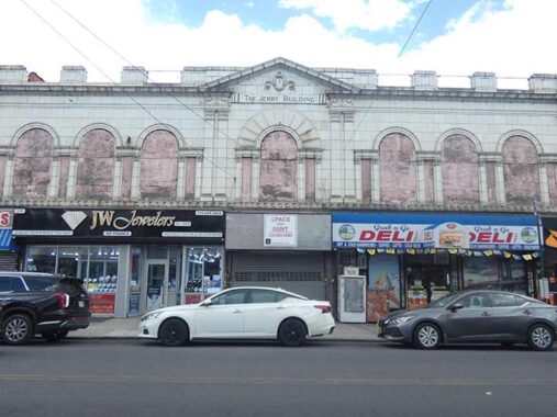
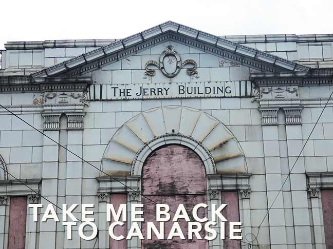
There is a handsome building on the east side of Rockaway Parkway next to the subway entrance with terra cotta arches, Corinthian pilasters, and pediment that has clearly seen better days, identified as “The Jerry Building.” Forgotten Fan Joe Enright has also been curious about it over the years, as well. Who was Jerry? The building was constructed in 1927, too early for Lewis, Mahoney or Seinfeld.
“After digging through Building Department records, I was able to determine that the entire structure was designed in 1927 by a small but notable architectural firm, the Cohn Brothers, who created the imprint for over a hundred large apartment buildings and many commercial strips all over Brooklyn in the two decades prior to the Second World War. In fact, many of their buildings have been gushed over by architectural critics for the past fifty years…
|
“By the way, back in 1927-1930, when that row on Rockaway Parkway was built, a ‘Jerry Building’ was a term used to describe the shoddy workmanship prevalent during the Roaring Twenties. Indeed, construction in Brooklyn had then reached epic levels that would never be seen again. In 1925 alone, over 40,000 new building permits were issued for Brooklyn by the Department of Buildings. Compare that with less than four thousand in 2022. ‘Jerry Building’ is rarely heard today but its origin dates back a couple of hundred years to England. Some say ‘Jerry’ was derived from the word Jericho, as in the biblical story that ended with ‘the Walls of Jericho came tumbling down.’ However, given the pedigree of the Cohens and Goldberg, and the longevity of the Rockaway Parkway edifice, it seems safe to conclude that The Jerry Building was not chiseled as a warning to Canarsie residents to watch their heads as they went shopping…
|
“But could it have been a memorial to a recently deceased ‘Jerry’? The architects and builder had no Jerry next-of-kin, and scouring the ranks of nearby fire houses and precincts, no line-of-duty deaths by a Jerry could be found. However, expanding my search citywide, I did find one possibility. On September 13, 1928, Jeremiah C. Brosnan was a 52 year old patrolman with 24 years on the job.” [Joe Enright in Red Hook Star-Revue]
Joe concludes that “Jerry” Brosnan or the Walls of Jericho are unlikely namesakes, and his is the only scholarship available at present on the internet. The true namesake of the Jerry Building is likely lost to the Mists of Time.


Of course I was also in Canarsie to see about its wealth of old lanes and alleys. Smith’s Lane is one of these, crossing Rockaway Parkway north of the subway terminal. It becomes one of the driveways leading into a municipal parking lot, and has another section running west to East 96th Street.
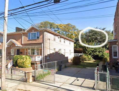
Smith’s Lane formerly extended westward from East 96th. On East 95th, south of Farragut, what appears to be a driveway possesses a telephone pole streetlamp mast. If we look at Open Street Map, one remaining private dwelling remains on this short section, #9514 Smith’s Lane.
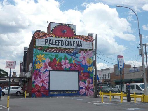
If you meander into the parking lot, a brilliantly painted mural for “PaleFO Cinema” “Canarsie’s First Cinema Mural” appears on the north side of The Jerry Building. “Palefo” is a contraction for Creole words meaning “talk loudly.” The cinema was founded by area resident Eileen Baptistin Level to provide outdoor movie screenings to residents of the Breukelen Houses (located between East 105th Street, Williams, Stanley and Flatlands Avenues) east of this location.
Engine 157
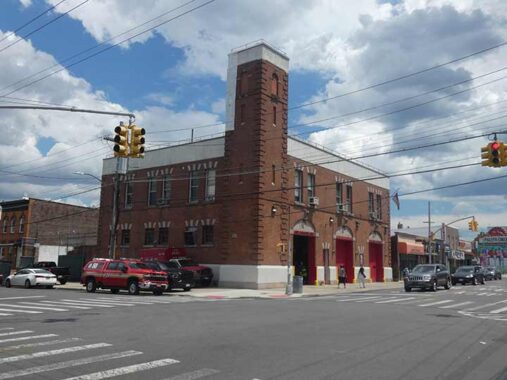


FDNY Engine 257/Battalion 58/Hook & Ladder 170 was founded as Engine 57 in 1897, a couple of years before Brooklyn consolidated with Greater New York. To my surprise, fdny.com provides a detailed history of the fire company and the firehouse at the corner of Rockaway Parkway and Farragut Road:
Engine 57 had a very large area to respond and protect. They ran in with Engine 31 (now 231) to the north, to the east was Engine 25 (now 225), then on Liberty Avenue & Cleveland Street, southwest was Engine 46 (now 246) and to the west was Engine 55 (now 255). Today they respond with Engines 283, 290, 309, 310, and 323; all put in service between 1913 and 1932.
|
The firemen of Canarsie had been requesting new quarters to replace the temporary one they were occupying for some time. They had the help of the Brooklyn Eagle newspaper, which reported on the current condition of the house in the October 26, 1906 edition. The building was in such a dilapidated condition that it was ready to collapse. The outside left wall was bulging out, and the stalls for the horses were rotting and decaying away. The hayloft was broken on one end and, at any time, it could fall into the stalls. The second floor sleeping rooms were poorly ventilated, with four of the six rooms having no windows. The apparatus floor was cramped for the three pieces of apparatus. The house was unfit for man or beast.
|
The City of New York, knowing the poor conditions of some of the Brooklyn houses, went on a building program. They started building new brick houses to replace the many wood frame houses that Brooklyn had been leasing as fire stations. The Fire Department bought a lot measuring 80 feet by 100 feet deep on October 9, 1903, for the future home of Engine 157. New York paid the estate of Leonard Eppig $1,500 for the corner lot at Rockaway Parkway and Avenue “F” (now Farragut Road).
|
Because of the large building program the Department had undertaken it would take time to get funds to build all the houses that were being needed. The busier companies had their station built first, and with the slower ones to be built later. Engine 157 responded to only nine alarms during the year 1898 and only 35 runs in 1903. By the time they would move into the new building the company would be responding to 62 runs a year. Today, Engine 257 responds to over 4,000 runs a year.
|
The new fire station has three bays for the exit of the apparatus onto Rockaway Parkway, and is two stories in height. Peter Guthy was the contractor, and it cost $49,668 to build. The firehouse opened on February 1, 1908 with the three pieces of apparatus. Sometime during the year an 1898 Holloway Chemical Engine was added from Ladder 23.
|
The apparatus floor had room for a ladder truck on the south side of the building. The center bay housed the engine and hose wagon, and the north bay had room for the chemical engine and another hose wagon. Between each apparatus were the stalls for twelve horses, with the feed room for the horses in the center rear of the building. The house watch was located on a platform between the engine and ladder truck. The second floor was divided into three rooms The first room on the left as you walked up the stairs was the recreation room, with six wall lockers, bathrooms and the door for the hose tower. The middle room was the dormitory and eighteen lockers. The officers occupied the smaller third room in the front corner.
|
The big house on Rockaway Parkway has been home for several other companies over the years. One of the first was the chemical engine. Not a separate company, it was assigned to Engine 157 in 1908 and probably was used by them until receiving the first motorized hose wagon in 1916. On October 18, 1929, Engine 257 was disbanded as a Combination company and reorganized as a single engine company. The members assigned to the 1921 White Pirsch ladder truck, then in use by Engine 257, were organized into Ladder 170. With the area still being rural, Ladder 170 would not have received an aerial ladder truck until May 4, 1932.
|
Due to the size of the building, it was always used for storage of apparatus. On June 9, 1956, a brush fire unit was added to the house. Brush Fire 56 would respond with men detailed during the brush season. The unit proved its usefulness during the brush season. Ten more such units were requested in the next budget. The rigs were not purchased and Brush Fire 56 was disbanded on April 12, 1963. Ambulance 2 moved in next on September 2, 1967, from Engine 247’s quarters on 60th Street and 13th Avenue. The Ambulance would be relocated to Engine 280’s house on December 14, 1968.
|
Division 15 responded from here from August 5, 1968 to September 5, 1975. They had been located at Engine 233 and returned back to 233. Today Battalion 58 has been responding from here since December 14, 1995. They had been located at Engine 310.
|
In one hundred years Engine 257 has responded to thousands of runs during its career.
That, of course, explains why the Battalion 58 signage is newer and rendered in Times Roman Bold.
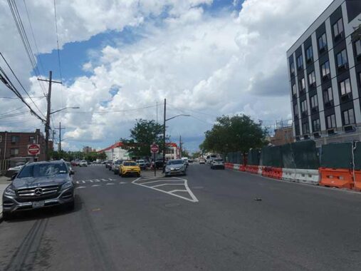
This fork is where Rockaway Parkway (left) meets Rockaway Avenue (right). The parkway is much wider, so you would be forgiven if you thought it was a direct route north. However, the parkway is cut off by the NY & Atlantic RR, running on the LIRR Bay Ridge division tracks. Instead, Rockaway Avenue is the route of choice to get to Brownsville, Bedford-Stuyvesant and other locales to the north.
Both Rockaway Parkway and Avenue are so named because they ran toward ferries at the present location of Canarsie Beach Park to the Rockaway peninsula. The Canarsie Beach Park area has a weird street naming scheme; there used to be a second Rockaway Avenue (as seen on this 1949 map). In the 1960s, the extra Rockaway Avenue was renamed St. Jude Place for a local Catholic church (the present building was consecrated in 1989), and the rest of it became the south end of Canarsie Road.
Jude, the Saint of Impossible Causes and one of the twelve apostles of New Testament fame, is my middle namesake. Sadly, the St. Jude parish school closed at the end of the 2026 school year.
Last Nolan SLECO
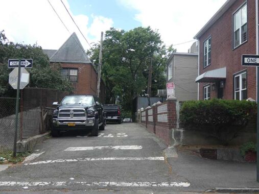


I was sure to visit Nolan’s Lane, an alley west of East 96th Street north of Foster Avenue. I explain why on this FNY page: it’s one of the few mercury vapor lamps still in use on a public NYC street, and it’s been day burning for years. I’m taking a big risk showing it on FNY, as the Department of Transportation relentlessly removes older utilities.


When FNY first profiled Nolan’s Lane back in 2011, the entire alley between East 93rd and East 96th was open to the public: but only one block between East 95th and 96th makes that claim nowadays. One of the property owners along the road in the 1890s was a J.H. Nolan, whose name has survived on the alley (see the map on the linked page).
“The road was named for John H. Nolan, who was known as the Little Drummer Boy in the Civil War Battle of Cedar Creek. He later became an undertaker and managed Canarsie’s first funeral establishment, a branch of L. Ruoff and Sons. He is buried in Canarsie Cemetery, where an elaborate monument recounts his role in the skirmish.” Linda Steinmuller, Canarsie Courier
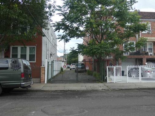
West of East 95th, Nolan’s Lane has been privatized as a driveway. The same fate befell the eastern half of Lake Place in Gravesend several years ago.


Going back to my biking from Bay Ridge days, I always admired and was curious about this attached row on the north side of Foster Avenue between East 92nd and 93rd, as it its so unlike other Canarsie housing stock and resembles construction further west and north in Brooklyn.
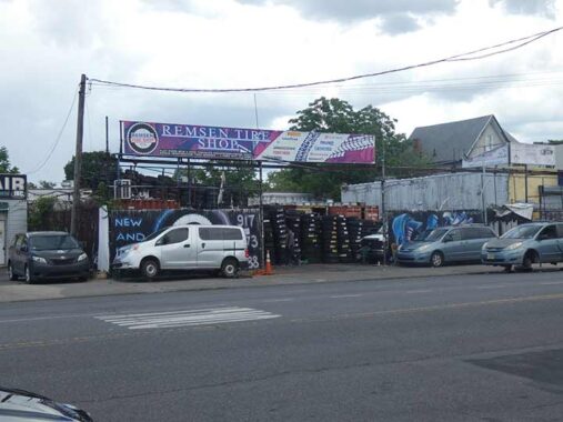


Continuing my effort to hit all of Canarsie’s short Places and alleys, I entered Krier Place (Canarsians help me out here, is it pronounced CRY-er or KREER?) which contains a mixed bag of small residences and auto repair shops (which pop up with more regularity on Remsen Avenue, where it ends just north of Foster Avenue). To illustrate, here’s one of the Remsen Avenue tire joints—that’s a lot of rubber. I have Krier Place on a 1949 Hagstrom atlas, but not from 1922. If we look at an 1890 atlas, a William Krier owned property here.
Remsen is one of those Dutch family names found frequently around town, with Remsen Avenue in Brownsville and Canarsie, and Remsen Street, where my alma mater St. Francis College had been located in Brooklyn Heights. The Remsen Avenue in Canarsie is likely named for James S. Remsen, who purchased and developed property in Canarsie with Henry Conklin (see below).


A sampler of storefronts and ads on Remsen and Foster Avenues.


Would you believe that Bedell Lane, encountered on Remsen Avenue south of Foster, is one of Canarsie’s oldest roads? This 1890 map excerpt, on which established paved roads are shown in purple, proves it. On the map, only Bedell Lane and East 92nd Street are in existence today. At its west end, Bedell Lane met the intersection of the Road from Flatlands to Canarsie Road (or Lane) and Varkens Hook Road. The former is an interesting case. Pieces of it still exist in East Flatbush, running from Holy Cross Cemetery southeast, past the Pieter Claesen Wyckoff House, through where the Brooklyn Terminal Market is now, and ending at this wye. Nothing of it remains in Canarsie, however; there is a separate Canarsie Road south of Avenue M. A careful look at the map reveals a property owner named Bedell.
More on Bedell Lane on this FNY page.


Some of the residential houses along Remsen Avenue south of Bedell Lane. No real surprises though an older Italianate dwelling can be seen here and there.


Bay View Place also straddles Remsen Avenue, this time south of Farragut Road. I didn’t have the opportunity to walk its entire length, but it “devolves” as you walk west on it. What do I mean? There’s a paved section, with sidewalks, between East 92nd Street and Remsen Avenue; paved, without sidewalks, with some small bungalow-like housing, from Remsen to East 89th; and finally, two disconnected partially dirt paths on East 88th and 89th Streets. The short road survives because of some private dewllings along its length. At one time, there must have been a view south to Jamaica Bay from here.
Ryder Elementary
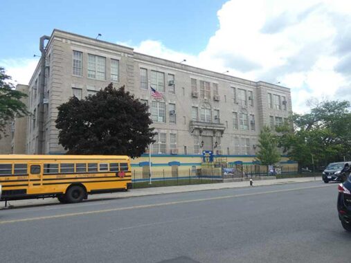
PS 114 (Ryder Elementary), #1077 Remsen, between Bayview Place and Glenwood Road, a recognized pre-K to grade 5 public school likely built from 1915-1925; as usual, architectural details of many public schools are hard to find.
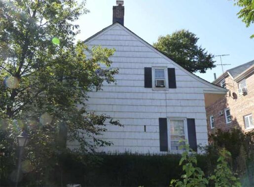
Not sure which Ryder the school is named for, but the Ryders are an old founding Dutch family in Kings County. Ryder Avenue (Midwood) and Ryder Street (Marine Park) carry the name. The landmarked Elias Hubbard Ryder House, located at #1926 East 28th Street in Marine Park, was built around 1827, is described in more detail on this FNY page. Additionally, the historic Ryder-Van Cleef house, #28 Village Road North in Gravesend, and the Charles M. Ryder House, #32 Village Road North (seen on this FNY page) were demolished in recent years.
Many ancient Dutch properties from colonial Kings County can be seen in the artwork of Gertrude Ryder Bennett, who lived for many years at the historic Wyckoff-Bennett House on East 22nd Street at Kings Highway.
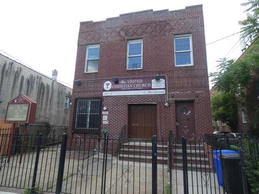
The United Christian Church, part of the Disciples of Christ movement, occupies what I took to be a former residential building at #1116 Remsen near Glenwood Road; however…
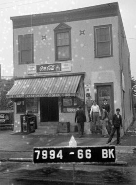
… a look at its 1940 tax photo from the Municipal Archives reveals it one had a newsstand on the ground floor. Note the ‘word “stationery” on the awning; it sold writing paper in addition to its other products. There’s a short alley on the building’s right side…
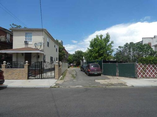
…that is more obvious if you go around the corner onto East 89th Street. It’s unmarked by a modern Department of Transportation street sign but the alley is known as School Lane on Street View and other maps. If you check the 1890 map above, it’s likely named for what was then called “School #3” on the present-day Bay View Place (and not the present PS 114).
“Before Remsen Avenue existed, children walked to P.S. 114, a wooden schoolhouse, through School Lane, which ran alongside of “Pop” James’ Grocery and Candy Store. School Lane was originally known as Cobb’s Lane – a corruption of Kopf’s Lane, named for Peter Kopf, who owned a grocery store on East 92nd Street, and was known locally as ‘Honest Peter.’
|
“The schoolhouse was destroyed by fire in 1907, and temporarily moved to Harms’ Hall – a place where minstrel and Punch & Judy shows performed – on Rockaway Parkway and Smith’s Lane. P.S. 114, which recently celebrated its centennial anniversary ( see June 21 issue at canarsiecourier.com ) was built in 1912 on Remsen Avenue and Glenwood Road.” Linda Steinmuller, Canarsie Courier
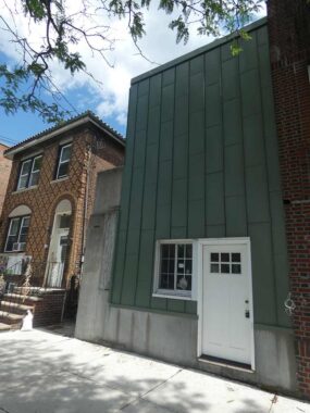
I returned to Remsen Avenue via Glenwood Road and found this curiosity at #8904, which appears to be recently renovated but first appears this way on Street View in 2011. There’s only a pair of paned windows at the entrance. What goes on in that building?


At #1186 Remsen we find another church that apparently inhabits another former residential building, Canarsie Full Gospel Chapel. 1940s.nyc can be maddening as it sometimes leaves out some addresses, and #1186 is one of these; perhaps it was not there in 1940.
Conklin Avenue


I was really here in Canarsie today to walk the length of Conklin Avenue, which was once the est-west spine of Canarsie but has lessened in importance over the years. It runs exactly ten blocks from Remsen avenue (which subs for East 90th) east to East 100th Street. I felt the name was oddly familiar when I first saw it on maps and bicycled past it beginning in 1974. The reason for that was a Bay Ridge politician when I was a boy, William T. Conklin (1908-1990) served in the New York State Senate from 1957 to 1978. Conklin advocated for developmentally disabled persons, as his son was one.
Canarsie’s Conklin Avenue was not named for the Bay Ridge politician, of course, but for developer Henry Conklin.As we see on this 1890 map, it was one of the first east-west routes in the town to receive pavement. When the lettered avenues were later built, it decreased in importance but did not gradually disappear as Canarsie’s other laneways did.


Durland Place is another one of Canarsie’s one-block lanes, running between Glenwood Road and Conklin Ave. east of Remsen Avenue. It’s rather nondescript except for a pair of quirkily built houses.


At the SW corner of Conklin Avenue and East 92nd Street is the American Legion Memorial, constructed, as its cornerstone says, in 1929. On the front lawn is Canarsie’s war memorial, dedicated in 1970. The Hall serves as a community center and catering hall.


East 92nd Street is one of the older roads in Canarsie; while it’s called Canarsie Road south of Avenue M, its full length north of that used to be called Canarsie Road as well. And there are times when Canarsie resembles the small town in southeast Kings County it used to be. I wasn’t heading further south to reach the spire of old Grace Methodist Church (now called Church At The Rock), the tallest building in Canarsie until the campanile of Holy Family Church on Rockaway Parkway surpassed it, which looms on East 92nd Street south of Avenue J, but couldn’t resist some zoom shots. The church was established in 1839 (the first church in the area) and the present building was dedicated in 1895, incorporating a previous 1871 building, according to a generous history on its website.
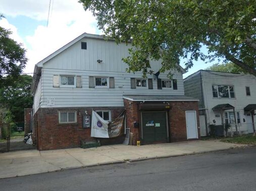
Presently this gambrel-roofed building at #77 Conklin Avenue and East 93rd Street serves as the Glorious Church International, but was formerly the Thomas Jefferson Democratic Club:
Consider the Thomas Jefferson Democratic Club, which still maintains its clubhouse on a quiet, tree-lined street in the Canarsie section of Brooklyn. The clubhouse was the nerve center from which Meade H. Esposito, the once-powerful Brooklyn Democratic chief, oversaw his borough.
|
But even this storied club is bending to the times. Once largely white, it has been seeking new blood among some predominantly black and Hispanic civic groups.
|
John L. Sampson, a first-term State Senator and the club’s most prominent black member, said it had added new black homeowners and Caribbean natives to its roster. The club ”understood the changing demographics of the area,” Mr. Sampson said, ”and wanted to make sure everyone knew there was room for them.”
Such efforts may help secure the group’s future. ”I think the club will continue to be a power force in Brooklyn politics,” Mr. Sampson said. [NY Times, October 17, 1999]
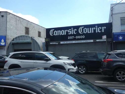
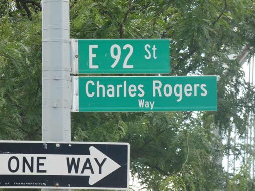
Canarsie’s lively local newspaper is the Canarsie Courier, which claims to have a 100+ year history. Many of its older issues are preserved online. Its managing editor for over 30 years, the late Charles Rogers, has been honored on a street sign since 2023, suggested by the Canarsie Historical Society (which, oddly, doesn’t seem to have an online presence).


The Canarsie Community Reformed Church, Conklin Avenue and East 93rd, can trace its roots back to 1876 when the Rev. John Conrad Dickhaut founded the Flatlands German Evangelical Church. Over time, the German language was discontinued and the group became known as Canarsie Reformed Church. American Guild of Organists


I wanted to check on a couple of things on Flatlands Avenue, a block away. There’s some new construction, or relatively new, like the Guarino Funeral Home of Canarsie, at Flatlands and East 92nd. Information on funeral homes, as with some churches, is sketchy on the world wide web, and Guarino is vague about its opening date.


To my surprise and disappointment, Canarsie’s longtime log cabin, which has hosted an ice cream vendor and various real estate offices, has been remodeled to lose the obvious exterior logs. FNY has the story here.


Yet another midblock church, St. Matthew’s Lutheran Church was originally constructed on Canarsie Road, now East 92nd Street, south of Flatlands Avenue in 1879, as indicated on the cornerstone and has, I gather, survived a relatively recent damaging fire. Just south of it is the forgotten (except by me) Lane to Tyler Davis. “Tyler” and Davis” were two separate property holders.


Walking this route in early October 2011, I spotted at Flatlands Avenue and East 93rd a house on the corner with a storeroom full of Christmas decorations and moving figures. Christmas music blasted through a loudspeaker. A passerby mentioned that the owner does a large Christmas display every year.
The spread was owned by a former Brooklyn assemblyman named Frank Seddio:
A 48-year-old Canarsie holiday tradition is going blue this year when the Smurfs make their dazzling debut in front of Frank Seddio’s holiday-decorated home.
|
The magical, mushroom-inhabiting critters will spend the days skating in front the home on Flatlands Avenue — a heartwarming, $300,000 slice of Yuletide kitsch that promises to brighten the block and beyond when it’s illuminated with 50,000 twinkling lights on Sunday…
|
The former assemblyman and surrogate court judge — and his elves — have decked the halls since 1986, continuing a tradition started in 1963 by the home’s previous owner, Frank Guarino.
|
This year, the cast of 100 animated characters includes a new, singing-talking-joke-cracking parrot, and Stumpy, the fan-favorite talking Christmas tree. Eight wondrous displays feature vignettes depicting Hanukkah and Kwanza, and there’s a 12-foot wreath crowning the roof that “can be seen by airplanes landing at Kennedy Airport,” Seddio said. [Brooklyn Daily]


In May 2026 I found the Seddio house gone, and the new #9306 Flatlands in its place, apparently home to health offices. I don’t know if Seddio has moved the display elsewhere; he was facing legal trouble in the spring of 2026.


Back to Conklin Avenue. I was curious about these three houses with separate heights on the NW corner of East 94th Street. Looking at the 1940 tax photo from the Municipal Archives, it’s interesting that the one-story building used to be a candy store.


The church referred to above isn’t the only area building named for St. Jude. The St. Jude Medical Center, Flatlands Avenue between East 94th and 95th, offers a wide variety of medical services, including dentistry and podiatry.
Once again, St. Jude is traditionally the Patron Saint of Impossible Causes.
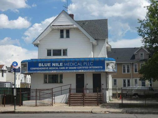
A rather smaller complex, Blue Nile Medical PLLC, is across Flatlands Avenue.


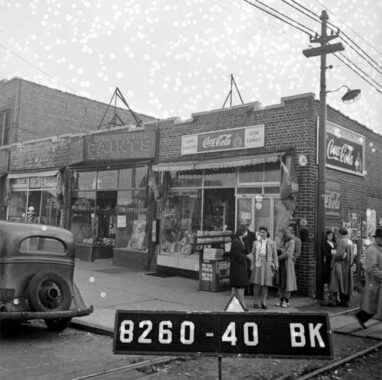
At the top of the page, I mentioned the “backyard trolley” extension of the BMT Canarsie Line that ran in its own right of way between East 95th and 96th until 1942. As you can see from the aerial view, the right of the way of that line is still discernible. A slanted parking lot on the south side of Conklin at East 95th is one of the few tangible remains of that line (except for a couple of other driveways and an orphaned iron trolley pole on East 95th). That driveway is also visible from Flatlands Avenue.
|
|
|
|
|
|
|
|
|
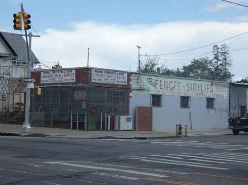
You don’t see a chain link fence dealer every day, but here’s one, at Flatlands and East 95th, complete with painted ad on the side.
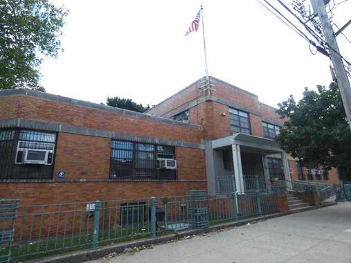
I was stumped by #1106 East 95th Street at the corner of Conklin. It looks like a school, but has no identifying marks whatever. The reliable AI robot says it’s the headquarters and satellite office for New York City Geographic District #18 and serves as a central administrative and operational hub for local community schools.
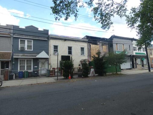
Since Conklin Avenue is one of the oldest paved roads in Canarsie, it’s appropriate that its housing stock is very old, too, like these attached wooden houses at East 95th that are fortified with siding.


A neighborhood anchor is Holy Family Roman Catholic Church at Rockaway Parkway and Flatlands Avenue, which was constructed in 1950-1951. The carillon chimed for a good ten minutes between 11:50 and noon while I was here. The first Holy Family church in Canarsie goes back to 1880, also at this site. The parish school, built in 1955, is now the Canarsie Ascend Lower School.
The Holy Family, of course, was Jesus, the Blessed Virgin Mary and St. Joseph the Carpenter.


Some of the houses along eastern Conklin Avenue are built low to the ground, bungalow style. Here, there must be swampy ground and a high water table.
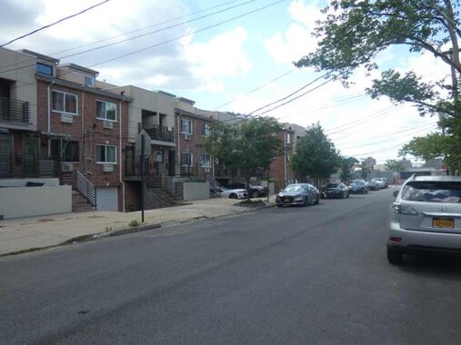
Conklin Avenue’s east end is at East 100th Street. When I fisrt began visiting Canarsie in 1974, this section between Conklin and Glenwood Road was little better than a deep, pebbly ditch, also a sign of swampy land. It has since been built up to its present appearance.


I figured these oddly shaped roofs on Glenwood Road and East 99th were something special in their original appearance, so here’s a look at the building on the right in a 1940 tax photo.


Time to get back on the Canarsie Line to Manhattan. I entered via the bus entrance on Glenwood that was once a streetcar loop. The MTA has plans to build a new trainyard alongside the station.
Check out the ForgottenBook. As always, “comment…as you see fit.” I earn a small payment when you click on any ad on the site.
6/27/26
7 comments
But the greatest Jerry of them all was the Springer
There’s a Conklin St. (NY Route 24) in Farmingdale, LI. Any connection to Conklin Ave by name ?
Keep an eye on that Nolan’s Lane sleco streetight.
About 20 years ago, I sat next to Jerry Springer and his wife in Florida at a spring training game, Reds VS. Yankees. Most people don’t know he grew up in New York in the Kew Gardens/Forest Hills area and graduated from Forest Hills HS. He was a big-time Yankee fan. His wife’s name was Micki…..Jerry told me the only reason he married her, was that he couldn’t find a woman named Babe.
Krier is pronounced cry-er. William Krier was my great-great-grandfather. I believe he is buried in Canarsie Cemetery.
In the sixties I had two sets of cousins with pools living in Canarsie, so I spent a lot of time there in the summers. They attended St. Jude school; I’m not surprised it’s gone now considering the huge demographic change. It had a semi-rural feel in those days. One of the cousins had his wedding reception at one of the wood frame churches back in the eighties, but I’m not sure which.
The Jerry Building terra cotta looks very similar to that on the facade of the Stillwell Avenue station on Surf Avenue. They were built right about the same time so there could be some connection, be it builder or designer.
The route of the trolley from the Rockaway Parkway L station is clearly visible from above on GoogleEarth.
This brought back some old memories, thanks for posting.
1106 E 95 St used to be a NYC Dept of Health facility. Everything south of Flatlands Ave was called Canarsie, extending to Seaview Village where a lot of “new” construction was. North of Flatlands Ave was called “Old Canarsie”. I used to go to Bedell Ln. to cop.
I would stand well away of a jerry-built structure !